Pinto Valley Wilderness

Rock formations found in Pinto Valley Wilderness

Pinto Valley Wilderness is a 39,173-acre property wholly contained within Lake Mead National Recreation Area. A large part of Pinto Valley Wilderness is composed of scenic valleys surrounded by rugged hills and ridges. The southern edge of Pinto Valley Wilderness is quite dramatic with barren rock and steep cliffs that drop straight into the waters of Lake Mead. Down the centers of the valleys are major washes as the area is a drainage for the Muddy Mountains, Gale Hills and Bowl of Fire region to the north. Sandstone and Cottonwood Springs (at either end of Pinto Valley itself) are virtually perennial water sources.
The landscape is a mix of colors: gray, brown, yellow and red sandstone with spatters of green vegetation. Elevations vary from a low around 2,700 feet at the water's edge to a high around 4,700 feet near the northern edge of the property.
This is Mohave Desert country: cholla, yucca, other cactus and scattered creosotebush scrub. The habitat of Pinto Valley Wilderness is also favored by the rare Las Vegas bear poppy plant.
From the summit of Guardian Peak (directly above the waters of Lake Mead), it's possible to see into Iceberg Canyon and the lower end of the Grand Canyon.
Pinto Valley Wilderness is separated from Jimbilnan Wilderness to the east by a 4WD road corridor. Almost the entire northern edge of Pinto Valley Wilderness is just off the side of North Shore Drive (Nevada State Road 167), making for reasonably easy access. There are a couple of old 4WD roads on the property but not a single established trail otherwise.

Upper photo courtesy of James Sippel, NWPS, via Wilderness.net
Upper left photo courtesy of Michelle Zuro-Kreimer, National Park Service
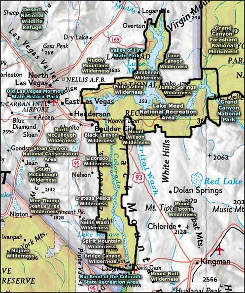
Map courtesy of National Geographic Topo!
Upper left photo courtesy of Michelle Zuro-Kreimer, National Park Service
Map courtesy of National Geographic Topo!
Related Pages
Big Bend of the Colorado State Recreation Area
Bitter Springs Backcountry Byway
Black Canyon Wilderness
Bridge Canyon Wilderness
Desert National Wildlife Refuge
Eldorado Wilderness
Gold Butte Backcountry Byway
Grand Canyon National Park
Grand Canyon Parashant National Monument
Ireteba Peaks Wilderness
Bitter Springs Backcountry Byway
Black Canyon Wilderness
Bridge Canyon Wilderness
Desert National Wildlife Refuge
Eldorado Wilderness
Gold Butte Backcountry Byway
Grand Canyon National Park
Grand Canyon Parashant National Monument
Ireteba Peaks Wilderness
Map courtesy of National Geographic Topo!