The Cenozoic Era
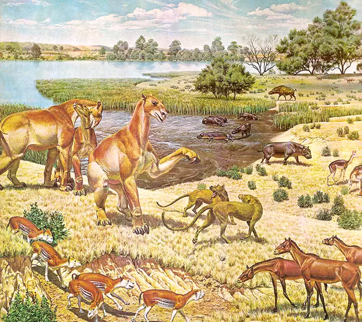
Rendering of possible scene during the Miocene Epoch
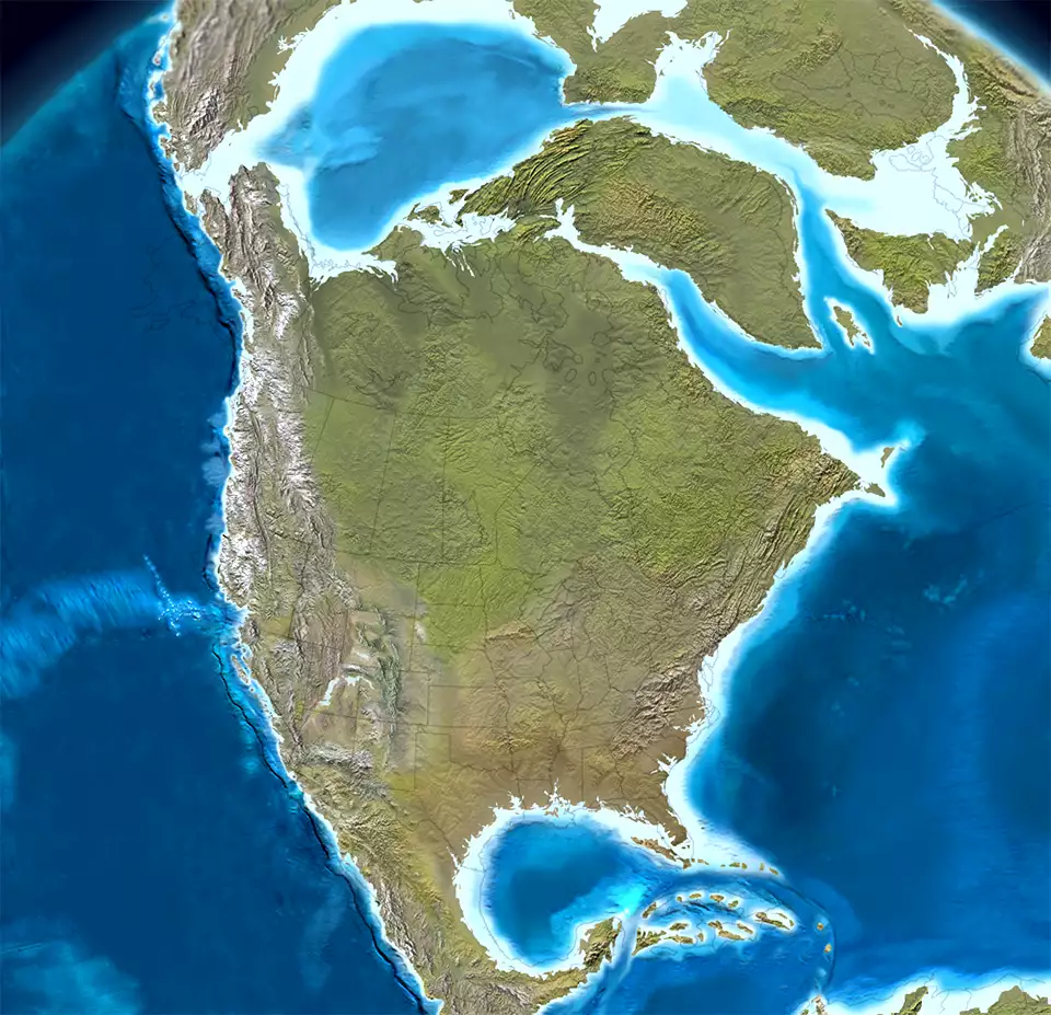
North America 60 million years ago, Click or tap to see a larger version
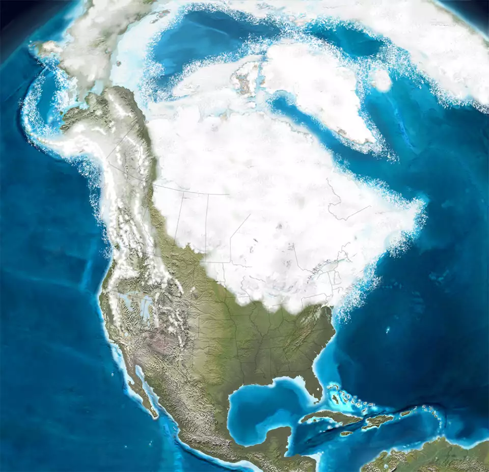
North America about 25,000 years ago, Click or tap to see a larger version
The Cenozoic is the Age of Mammals as they have grown to dominate the planet.
The Age of Mammals
Quaternary Period
- Holocene
- Pleistocene
Present-2 million years ago
Marked by increases and decreases in global glaciation, Bering Land Bridge. The beginnings of Man, minor mass extinctions continue around the globe
- Miocene
- Pliocene
2-23 million years ago
North America crashes into South America, Isthmus of Panama rises, Antarctica ices over, glaciers spread across high mountains and polar oceans.
Mountain building
15-30 million years ago
Vulcanism and mountain building in western North America: the modern Rockies are built, Basin & Range Province is built, Coast Ranges are pushed up
- Oligocene
- Eocene
- Paleocene
23-65 million years ago
Paleocene-Eocene Thermal Maximum Extinction Event: 55.5 million years ago.
Eocene Maximum Thermal Event: 47 million years ago. Last major global warming event
Laramide and Sevier Orogenies
63-65 million years ago
Overlapping mountain building events in the western US and Canada along the Cordillera and to the west: the Ancestral Rockies and the Colorado Plateau pushed up
Cretaceous-Paleogene Extinction Event, K-T Boundary
65 million years ago
Asteroid impact near the Yucatan peninsula, postulated to have combined with on-going geological and atmospheric processes to cause global climatic conditions that wiped out the dinosaurs
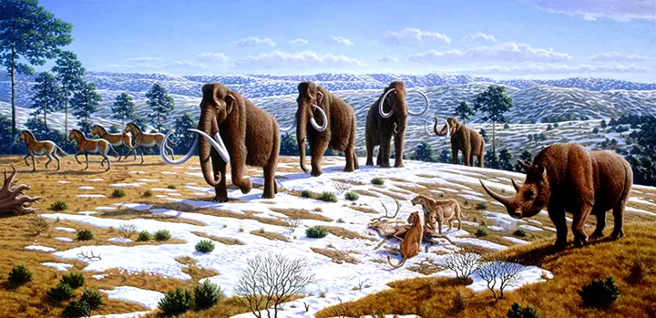
Mammals of the early Pleistocene
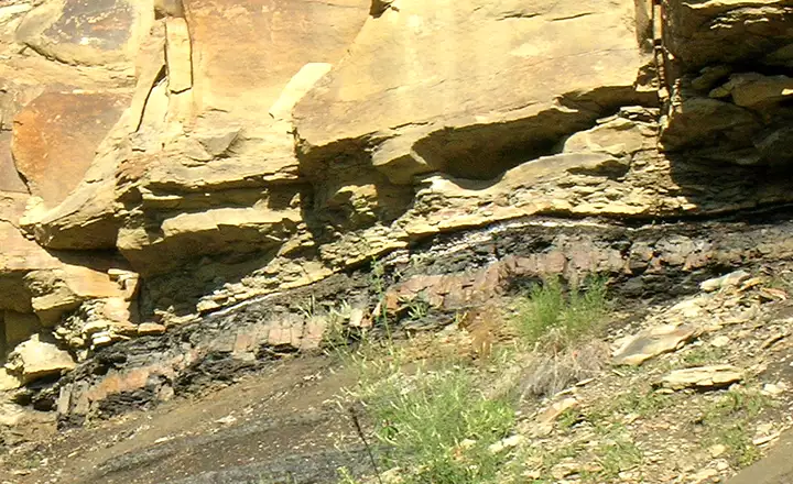
The thin white layer above the coal and below the sandstone is the iridium marking the K-T Boundary
Upper image is in the public domain
Maps are © Ron Blakey, NAU Geology, Deep Time Maps
Lower image courtesy of The Public Library of Science, CCA 3.0 License
Bottom photo courtesy of TheArmchairExplorer, CCA-by-SA 3.0 License
Maps are © Ron Blakey, NAU Geology, Deep Time Maps
Lower image courtesy of The Public Library of Science, CCA 3.0 License
Bottom photo courtesy of TheArmchairExplorer, CCA-by-SA 3.0 License