The Silurian Period

The Eurypterus lived in Silurian seas
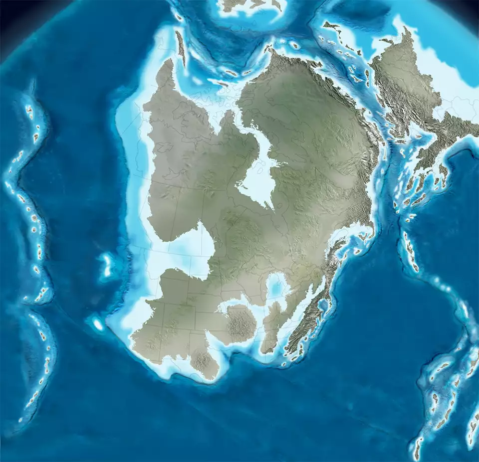
North America 430 million years ago
Click or tap to see a larger version
The Silurian Period lasted from about 443.8 million years ago to about 419.2 million years ago. The Silurian began with the Ordovician-Silurian Extinction Event in the middle of a period of major glaciation.
Marine life exploded in the Silurian with evolution producing a wide diversity of jawed and bony fish. Life on land was rare, confined to a series of moss-like vascular plants that evolved to exist alongside regular water sources and some small arthropods to feed on them.
The supercontinent Gondwana hovered over the equator and most of the southern hemisphere. The northern hemisphere was mostly ocean and high sea levels throughout the period made most land not part of Gondwana into island arcs with a rich diversity of ecological environments. Gondwana was slowly drifting south and flowed across the South Pole but generally warm temperatures throughout the period kept glaciation to a minimum.
During the Silurian the Iapetus Ocean closed as Baltica-Avalonia collided with Laurentia, causing the Scandian and Acadian phases of the Calledonian orogeny. This pushed up mountains in today's Scandinavian region, across northern Scotland, through the Canadian Maritimes across New England and into upstate New York. Eventually, the eastern margin of Laurentia was rimmed with uplands and mountain ranges. The collision of the three cratons formed the supercontinent Euramerica near the equator.
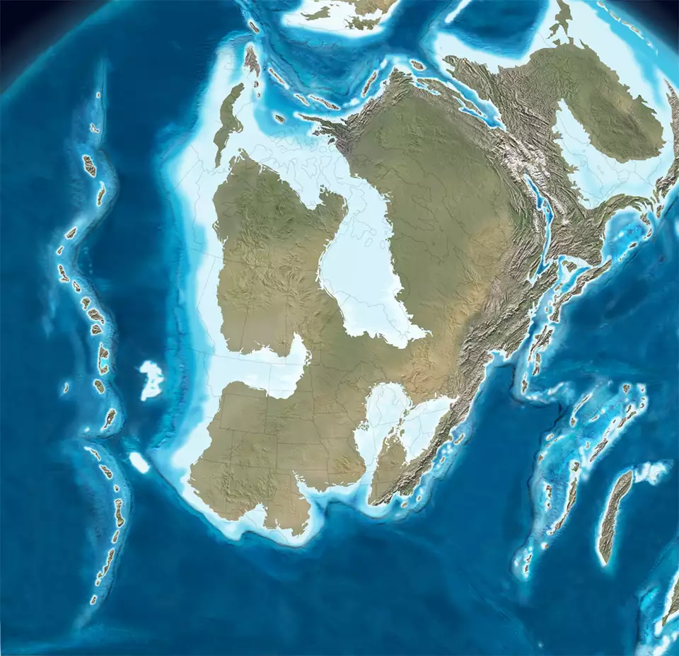
North America 420 million years ago
Click or tap to see a larger version
The western side of the Laurentia craton saw widespread carbonate deposition across its interior, resulting from the erosion of the eastern mountains and regular fluctuations in sea level. Tectonically, the western margin of Laurentia saw passive action as the Antler terrane was still well offshore. At the end of the Silurian, sea levels dropped rapidly. That contributed to an increase in erosion of the eastern Laurentia mountains.
A complex string of microcontinents rifted from Gondwana (what became the Hun superterrane) to the southeast of Laurentia and Baltica late in the period.
There have been three minor extinction events identified during the Silurian, each coinciding with a rapid drop in sea level.

Earth 430 million years ago
Upper image courtesy of Wikipedia userid Obsidian Soul, CCA 2.0 License
Geological maps © Ron Blakey, NAU Geology, Deep Time Maps
Bottom map courtesy Ron Blakey, NAU Geology, CCA-by-SA 4.0 License
Geological maps © Ron Blakey, NAU Geology, Deep Time Maps
Bottom map courtesy Ron Blakey, NAU Geology, CCA-by-SA 4.0 License