Jumbo Springs Wilderness
In Jumbo Springs Wilderness
Jumbo Springs is a small wilderness area (4,631 acres) about 50 miles east of Las Vegas. Most of Jumbo Springs Wilderness is contained within the upper canyons of 3 large, rugged washes that drain eastward to Lake Mead from the plateau that forms Jumbo Basin.
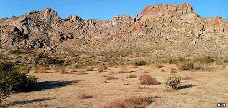
The wilderness rises from about 2,700' on the southeastern boundary to about 4,700' at the ridge that runs along the northern boundary. Vegetation in the area is primarily desert scrub: creosote bush, Mohave yucca, Joshua trees and various cacti. You might find desert bighorn sheep in the area but more likely you'll come across Gambel's quail and the threatened desert tortoise. Looking up you might see Cooper's hawk, golden eagle, American kestrel, peregrine falcon and red-tailed hawk. Closer to Lake Mead you might also see American white pelican, osprey, bald eagle and white-faced ibis.
In the higher areas of Jumbo Springs Wilderness you'll get some good views of Iceberg Canyon and the lower reaches of the Grand Canyon. While most of Jumbo Springs Wilderness is very dry, you'll usually find water at Sandstone Spring and Cottonwood Spring.
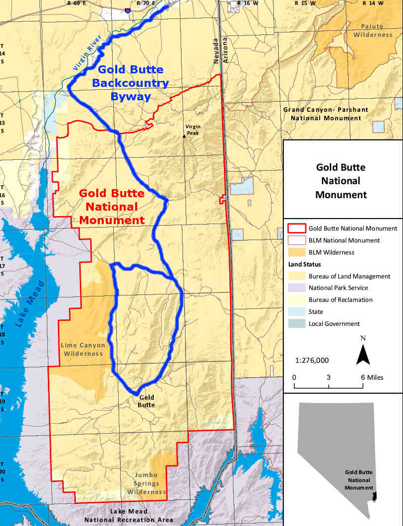
To get there take the Gold Butte Backcountry Byway to Gold Butte. From Gold Butte there is a 4WD-only route wrapping around Jumbo Peak to the south. So from Gold Butte the road will head southwest, then turn south, then southeast before stopping at the wilderness boundary near the boundary with Lake Mead National Recreation Area.
Jumbo Springs Wilderness was incorporated into Gold Butte National Monument when that was created in December, 2016.
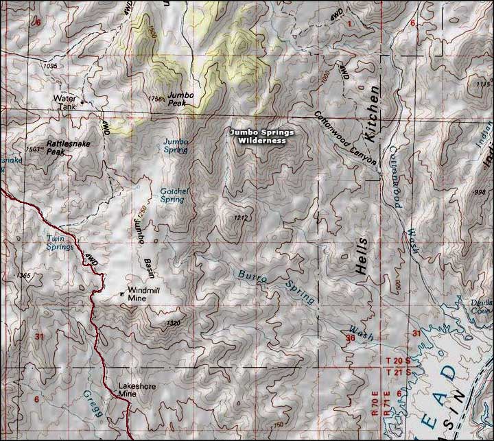
Jumbo Springs Wilderness area map
Upper photo courtesy of the Bureau of Land Management
Map courtesy of National Geographic Topo!
Map courtesy of National Geographic Topo!
Related Pages
Map courtesy of the BLM