Los Padres National Forest
Los Padres National Forest
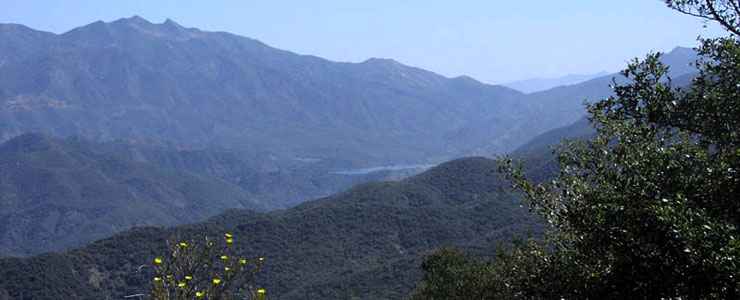
The Monterey and Santa Barbara National Forests were merged in 1936 to create the 1,762,400-acre Los Padres National Forest. The forest stretches across almost 220 miles of the central California Coastal Range between Monterey and Santa Barbara, from the Pacific Coast to the Central Valley. The property is divided into two separate land divisions, the north being mostly in Monterey and northern San Luis Obispo Counties, the south being in southern San Luis Obispo, Santa Barbara, Ventura and Kern Counties.
The forest is also divided into two major types of vegetation: forested lands (30%) and chaparral (68%). That's because of the effect of straddling those mountains: the coast is wetter and supports redwood forest, inland is drier to the point of being semi-desert. The total forested area is covered with a mix of evergreens, pinon-juniper woodland, oak woodland and conifer forest.
The terrain, climate and habitats are varied enough to support about 468 species of fish, birds and mammals. Among those, 23 are on the threatened or endangered lists, 20 are considered sensitive. Among the plants 3 species are threatened or endangered, 71 considered sensitive.
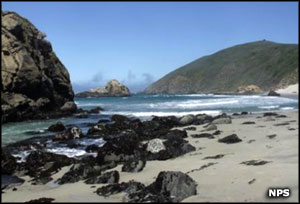
Pfeiffer Beach
Los Padres National Forest is a participant in the California Condor Recovery Program and there are currently more than 70 condors in the wild living on the forest, mostly in either the 1200-acre Sisquoc Condor Sanctuary in Santa Barbara County or in the 53,000-acre Sespe Condor Sanctuary in Ventura County. There is also the Black Mountain Wild Horse Territory in the Santa Lucia Ranger District which is managed for about 20 horses under the 1971 Wild Horse and Burro Act.
Since 1912, an average of 25,000 acres of the forest have burned every year. This number has been rising steadily over the last 60 years as most wildfires on the forest are human-caused. About 95% of those burned acres consist of chaparral.
Wilderness Areas
Los Padres National Forest maintains more than 1,257 miles of hiking trails, a lot of that in the 10 designated wildernesses that make up about 48% of the Forest. There are also more than 459 miles of roads and trails available for off-road vehicle use. Much of the forest is primitive and roadless. Elevations range from sea level to 8,847 feet.
Minerals found on the forest include copper, gold, zinc, antimony, chrome, uranium, silver, gypsum, mercury, bentonite and limestone. The forest also leases land for the production of phosphates, geothermal energy and oil and gas (primarily in the Sespe Oil Field in Ventura County). The forest also provides commercial quantities of sandstone, siltstone, sand and gravel.
Top photo is in the public domain
Smaller photos courtesy of Jennifer Gray, National Park Service