Machesna Mountain Wilderness
Machesna Mountain Wilderness
A 19,760-acre property, Machesna Mountain Wilderness is located in the La Panza Range of the Coastal Mountains, about 25 miles from the city of San Luis Obispo. On the wilderness is a 1,500-acre Research Natural Area set aside for scientists to study a unique strain of Coulter pine. About 120 acres of the wilderness is on BLM land, the rest on Los Padres National Forest.
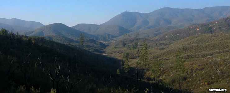
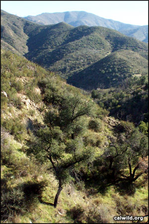
Machesna Mountain Wilderness offers high peaks rising above a dense chaparral-covered lowland with oak woodlands in the middle elevations and conifer forest in the upper reaches. Probably 3/4 of the wilderness is deep in the chaparral, about 10% in the conifers, the rest a grassland sprinkled with stands of oak. Elevations range from a low of about 1,600 feet to a high of 4,063 feet on the summit of Machesna Mountain in the southwest corner of the wilderness. From the high ridges it is possible on a clear day to see the peaks of the Sierra Nevadas far to the east.
In addition to the usual black bear, deer, coyote, bobcat and mountain lion found in the Coast Ranges, Machesna Mountain Wilderness also has a few resident Tule elk. The area is also critical habitat for the protection of the California condor.
Camping and hiking are the primary uses of this little visited wilderness. There are two trails on the wilderness: one leading down into American Canyon, the primary drainage on the wilderness, the other leading up to the summit of Machesna Mountain. Both trails are approximately eight miles long. Streams flow only seasonally and only at the bottom of the hill so you'd better bring plenty of your own water. Most folks access Machesna Mountain Wilderness via the Pine Mountain 4WD/OHV Road that runs along the northern boundary.
Photos courtesy of calwild.org