Kolob Fingers Scenic Road
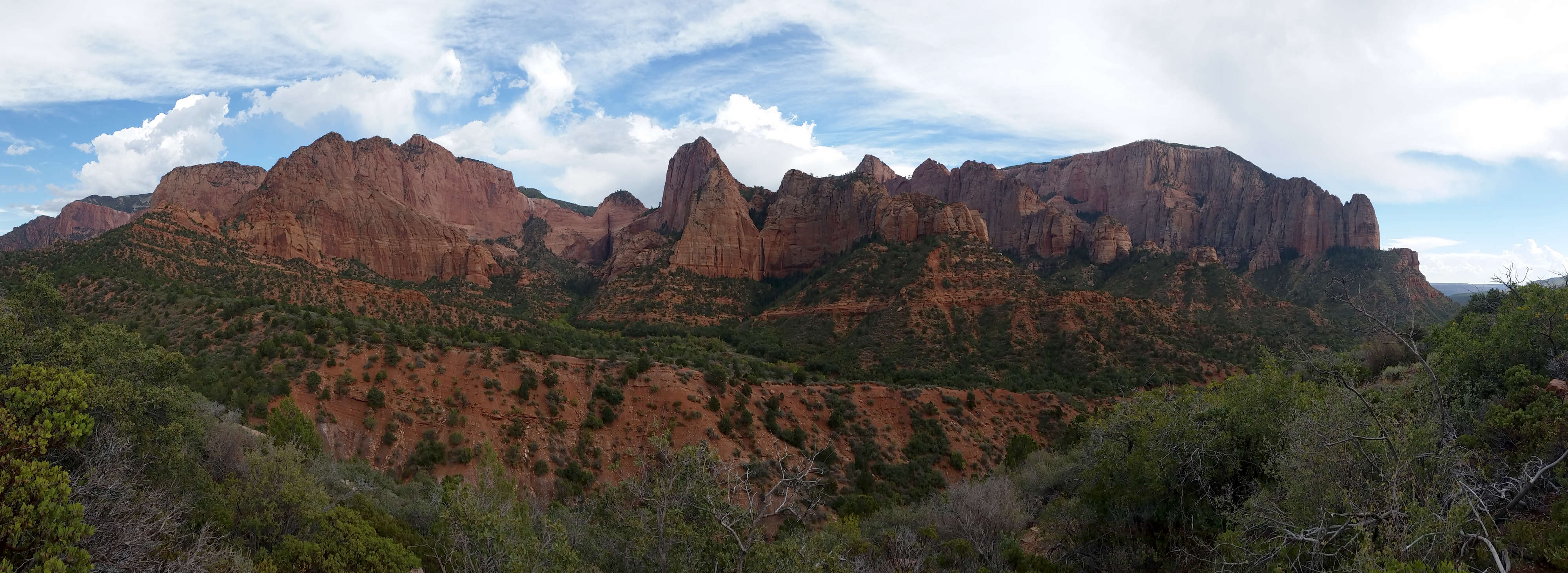
A view near the end of the Kolob Fingers Scenic Road
Click on the image to see a larger version

Kolob Fingers Scenic Road is a five-mile route from the Kolob Canyon Visitor Center to the Kolob Canyon Overlook Rest Area. The route mostly follows Taylor Creek to the South Fork of Taylor Creek before turning and climbing the wall above Timber Creek and ending at the overlook. The route is purely a very scenic route and serves several trailheads in the national park.
Views along the route are into various of the Kolob Canyons. The rock on display is a mix of Entrada, Navajo and Kayenta formations. The Navajo sandstone is from a time when the whole southwestern US was buried under several thousand feet of desert sand dunes. The Kayenta formation is a mix of sandstone, mudstone and siltstone from when this area was at the edge of a vast inland sea and streams worked to deposit sands, mud and rock across the surface. Some layers of rock were deposited in those ages when the area was actually sea bottom. The layers of color come from the rock materials and the mix of organic debris available in those times. Some layers are filled with fossils, some with petrified wood. The Kayenta formation in particular has been twisted, squeezed and shifted over time so that much of that strata is now tilted whereas the Navajo and Entrada formations tend to run horizontally.
At the beginning of the Kolob Fingers Scenic Road are the Hurricane Cliffs: Kaibab limestone exposed as a result of a 120-mile fracture in the Earth's surface. Kaibab limestone was laid down during the days when the area was beneath a shallow ocean. Further along the Kolob Fingers Scenic Road you'll drive past Horse Ranch Mountain: at 8,726' it's Zion's highest point. The cliffs around the mountain are almost entirely composed of Navajo sandstone. This is in the area of Taylor Creek, in the first couple miles of the road. There are several trail heads along here that head into the back country along the creek beds and through the fiery red cliffs.
Just above the beginning of the Timber Creek Canyon is the trail head for the Lee Pass and LaVerkin Creek Trails. The Lee Pass Trail is a 14.4-mile round trip journey to Kolob Arch, possibly the largest sandstone arch on Earth. It's a strenuous hike that most folks take two days to do, meaning you'll need a back country permit and there are limited campsites available. The LaVerkin Creek Trail goes to LaVerkin Creek. LaVerkin Creek crosses the Kolob Canyons region of Zion Wilderness from the BLM's LaVerkin Creek Wilderness on the north to the BLM's Red Butte and Blackridge Wilderness areas on the south.
The overlook at the end of the road offers a 270° view across of most of southern Utah, but who really looks in that direction with what is on display to the east...
Update 2015: I drove the road in late September. I thought it was going to be crowded given the parking lot at the visitor center, but there was no problem with traffic or parking once I got past there. I have seen photos from the area before so I was prepared for the journey... sort of. It was far better than any photos I'd seen. The views were too large for the camera...
I found a pullout pretty much everywhere I wanted to stop. Wish I'd had some time to do some real hiking...

In the Kolob Fingers area

A view along the road

Photos courtesy of TheArmchairExplorer, CCA-by-SA 4.0 License
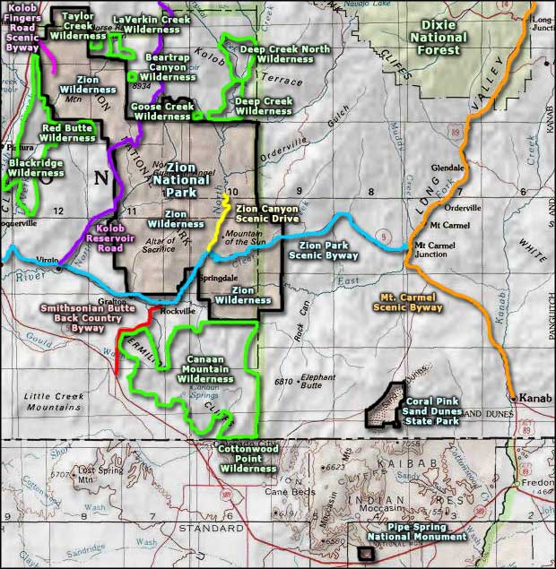
Map courtesy of National Geographic Topo!
Map courtesy of National Geographic Topo!
Related Pages
Beartrap Canyon Wilderness
Blackridge Wilderness
Canaan Mountain Wilderness
Coral Pink Sand Dunes State Park
Cottonwood Point Wilderness
Deep Creek North Wilderness
Deep Creek Wilderness
Blackridge Wilderness
Canaan Mountain Wilderness
Coral Pink Sand Dunes State Park
Cottonwood Point Wilderness
Deep Creek North Wilderness
Deep Creek Wilderness
Map courtesy of National Geographic Topo!