Kasha-Katuwe Tent Rocks National Monument

Kasha-Katuwe Tent Rocks National Monument from the parking lot

The Kasha-Katuwe Tent Rocks National Monument (4,645 acres) is an area on the Pajarito Plateau where erosion has shaped the layers of volcanic ash in a very unique way. The volcanic ash was deposited during eruptions from the Valle Caldera area in the heart of the Jemez Mountains between 6 and 7 million years ago. The pumice, ash and tuff deposits are more than 1,000' thick in the area. The volcanic eruptions were so violent that you can still find pieces of translucent obsidian ("apache tears") that were created by rapid cooling in the aftermath of the pyroclastic flows.
The tapering hoodoos are still here because they were topped with boulder caps, all of the softer surrounding materials having been removed by erosion. The tent rock formations are fairly uniform in shape and vary from a few feet to 90' tall. The volcanic material is also uniformly layered with bands of gray interspersed between layers of pink and beige.
The Kashe-Katuwe Tent Rocks National Monument is located up the hill northwest of the Pueblo de Cochiti (Kasha-Katuwe means "white cliffs" in Keresan, the traditional language of the Pueblo). This area is in the zone of pinon-juniper and Ponderosa pines, with manzanita shrubs growing in some places on the cliffs.
There are 2 hiking trails in the Monument that begin at the designated parking area. The Cave Loop Trail is about 1.2 miles long and rated easy. It loops around through the lower part of the Monument through the hoodoo area and visits a cave in the ash along the way. The Canyon Trail is about 1.3 miles long (one way) and rated more difficult. It follows a narrow canyon steeply up to the mesa top (630' in elevation gain) and gives great views over the tent rocks and panoramas of the Sandia, Jemez and Sangre de Cristo Mountains, and the Rio Grande Valley. Both trails are part of a National Recreation Trail and both are maintained. That said, the hike through Slot Canyon is along a sandy streambed and there are places where rockfall will cause you to climb over boulders in some places and climb under one in another. The trail isn't hard to negotiate but I wouldn't want to be in there with a heavy rainfall happening up the hill either...
To get to the Kasha-Katuwe Tent Rocks National Monument: From the north, get off the I-25 at exit 264 and go to the Pueblo of Cochiti. From the south get off the I-25 at exit 259 and go to the Pueblo of Cochiti. From the Pueblo of Cochiti follow the signs. The parking area is about 5 miles past the fee station on a paved road. I went on a Sunday in July and the place was crowded.
Winter hours (November 1 to March 10): 8:00 AM to 5:00 PM (gates close at 4:00 PM).
Summer hours (March 11 to October 31): 7:00 AM to 7:00 PM (gates close at 6:00 PM). Sometimes access is closed per order of the Cochiti Tribal Governor. Closures are posted at the gate.
Special Rules:
> Day use only.
> Do not trespass on tribal or other private land.
> No camping, fires, firearms, alcohol, glass containers, or climbing on the tent rocks.
> Past the parking area all access is by foot only.
> No collecting of firewood or tree-cutting allowed.
> No collecting of wildlife, plants, rocks or "apache tears."
> Stay on designated trails and roads.
> No geocaching allowed.
Maps: BLM - Los Alamos

Some of the Tent Rocks along the canyon

In the bottom of the slot canyon
Photos courtesy of TheArmchairExplorer, CCA-by-SA 4.0 License
Related Pages
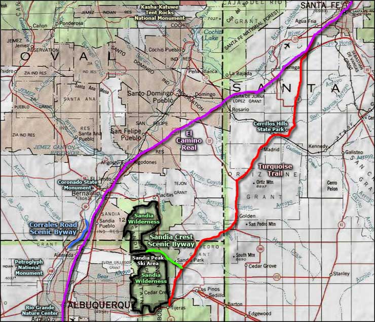
Map courtesy of National Geographic Topo!