Gasparilla Island State Park

Boca Grande Lighthouse

Part of a chain of barrier islands along Florida's Gulf Coast, Gasparilla Island is on the Gulf side of Pine Island Sound, near the mouth of Charlotte Harbor. Centuries ago, the Calusa tribe used this area for shelling and fishing, leaving behind large mounds of oyster shells. Spanish fishermen arrived in the 1700's and set up camps along the shore, catching and then shipping their fish to Cuba. American settlers arrived in the 1800's, attracted to Charlotte Harbor by the great fishing and shipping opportunities. By the early 1900's, Boca Grande Pass was famous among sport anglers for the great tarpon fishery in the area. The Coast Guard built the Boca Grande Lighthouse in 1890 and operated it until 1966. Florida came into possession of the property in the early 1980's, opening Gasparilla Island State Park in 1983 and rededicating the renovated Boca Grande Lighthouse in 1986. The Lighthouse is now listed in the National Register of Historic Places.
The Boca Grande Lighthouse is open to the public from November through April, 10 am to 4 pm daily. From May through July and during the month of September, the Lighthouse is open only Wednesdays through Sundays. It is closed for the entire month of August. The Lighthouse is also closed for Martin Luther King Jr. Day, Easter, Memorial Day, July 4th, Labor Day, Thanksgiving Day, Christmas and New Year's Day.
Gasparilla Island State Park can be accessed via the Boca Grande Causeway (a private toll road) from County Road 775 in Placida. The park is open from 8 am to sunset, every day of the year. There are fees involved.

The Gasparilla Island shoreline

One of the picnic pavilions

Photo of Gasparilla Island shoreline courtesy of Larry Arington, Florida State Parks
Other photos and map courtesy of Florida State Parks
Other photos and map courtesy of Florida State Parks
Related Pages
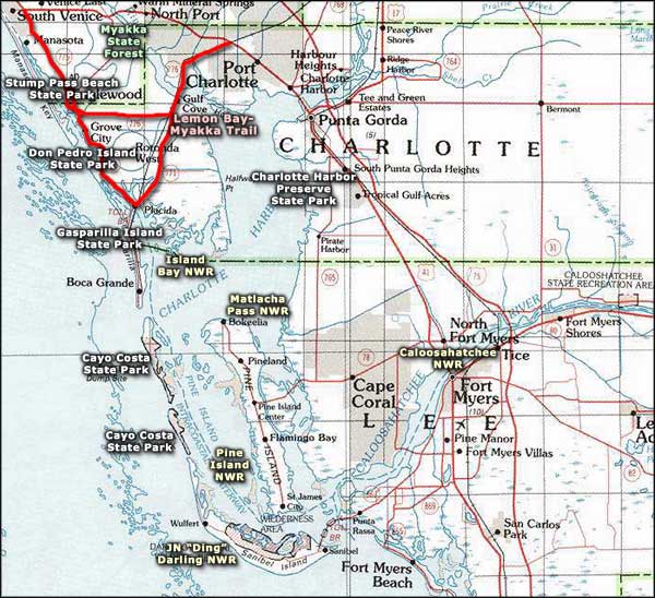
Area map courtesy of National Geographic Topo!