Grand Junction, Colorado
In downtown Grand Junction
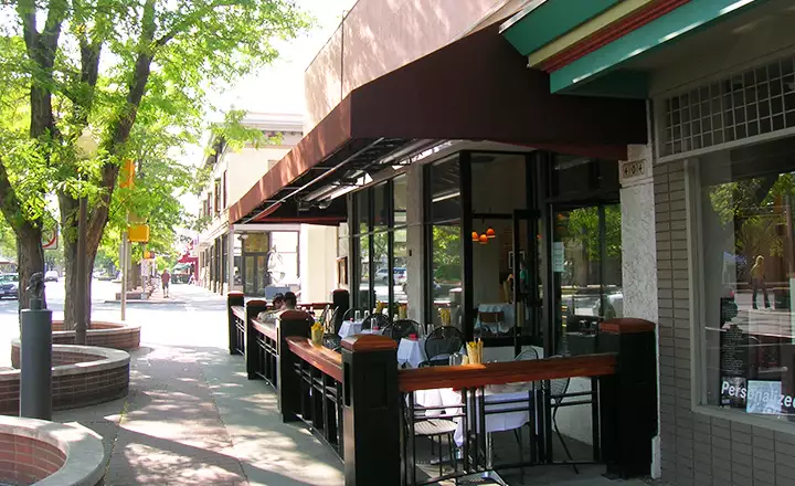
Once I left the I-70 and headed into Grand Junction, I went through several miles of city streets before arriving in downtown. Main Street was not at all what I expected: it was much nicer. The city fathers have seen fit to turn Main Street into a mostly pedestrian mall with lots of sculptures displayed along several blocks in the very heart of town. There were also several sidewalk cafes and lots of flower beds with mature trees all around.
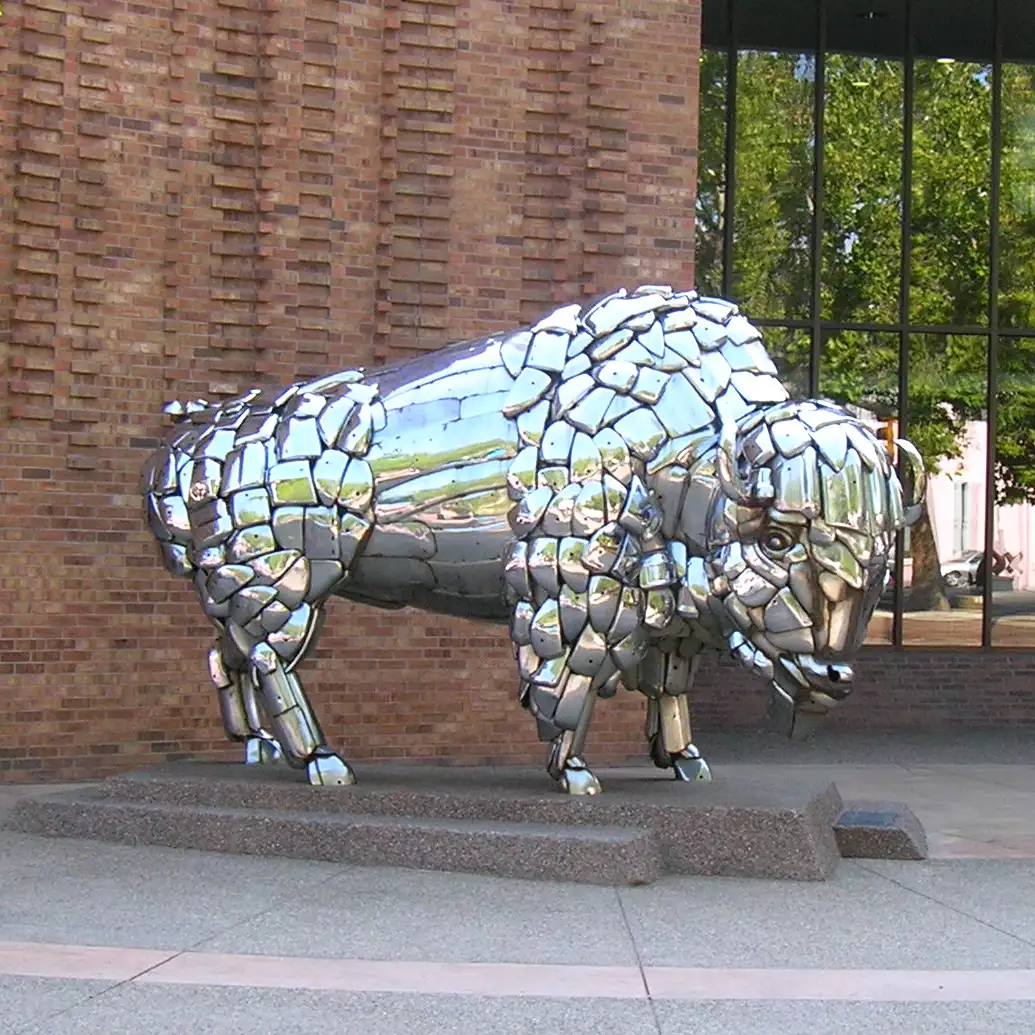
The buffalo sculpture pictured on the left was in front of one of the banks. As beautiful and inviting as central Main Street was, just a few blocks away (especially to the south) the ambiance began to fade. US Highway 50 passes through this part of town on two one-way streets with some nice parks in between. But this was obviously an older, more faded business section of town and parts of it could use some refurb. The area around the History Museum of Western Colorado and the Smith Tower was pretty nice, as was the park area across the street to the south. But a couple of blocks east, west and south of there and you started seeing buildings boarded up some time ago, just as you would see near the downtown areas of most American cities these days. Something about all those new-fangled shopping malls...
Grand Junction is located in the Grand Valley of western Colorado, near the confluence of the Colorado and Gunnison Rivers. To the west are the canyonlands of Utah. To the north are the Book Cliffs. To the east rises Grand Mesa and to the south is the Colorado National Monument. Across the Grand Valley floor are a number of small towns and lots of vegetable farms, fruit orchards and grape vines.
From the beginnings of Grand Junction in the 1880s to the 1960s, farming and cattle ranching were the main drivers of Grand Junction's economy. Then Exxon came in and tried to work the vast reserves of oil shale in the area. In 1982, after spending about $5 billion, Exxon gave up on the money-losing project and walked away (but they still hold the lease rights). Now, with sustained prices above $95 per barrel of crude, the gas and oil companies are back to give it another try. Supposedly, there's enough oil trapped in the shale to meet US demand at current levels for another 110 years. And in layers above and below the oil shale there is natural gas.
Getting around in Grand Junction seemed pretty easy until it came time to find my way back out. US 50 and US 6 were close to downtown but the I-70 was quite a ways out. I did stumble across Mesa State College along the way and while it looked like a nice campus, the light wasn't right at that time of the evening for any decent photos. And between the campus construction and the one-way streets all over that area... I just couldn't get my mind around the layout of the city streets. I ended up getting a motel room on the east side of town where dinner, AA batteries and a second memory card for my camera were easy enough to find.
The next morning I was up early, got breakfast, a tank of gas and headed east on US 6 until I started seeing signs for the Interstate. I drove up the eastbound ramp and headed for the northern end of the Grand Mesa Scenic Byway, taking photos of the Book Cliffs and the Colorado River Canyon along the way. I hope to get back to Grand Junction with more time on my hands: there's a lot more to explore but I just couldn't get there on this trip.
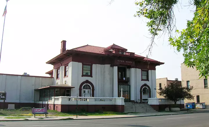
This is the Grand Junction Elks Lodge
Retail shops and offices
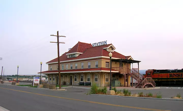
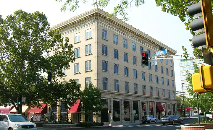
Union Station of the Denver & Rio Grande Western
Mesa County Related Pages
Collbran - De Beque - FruitaGrand Junction - Mesa - Palisade - Mesa County
Grand Mesa National Forest - Grand Mesa Scenic Byway
Colorado National Monument - James M. Robb-Colorado River State Park
Highline State Park - Vega State Park
Photos are courtesy of TheArmchairExplorer, CCA-by-SA 4.0 License