Quebradas Backcountry Byway
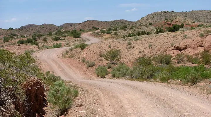
Halfway point on the Quebradas Backcountry Byway
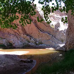
At the Ojo de Amado
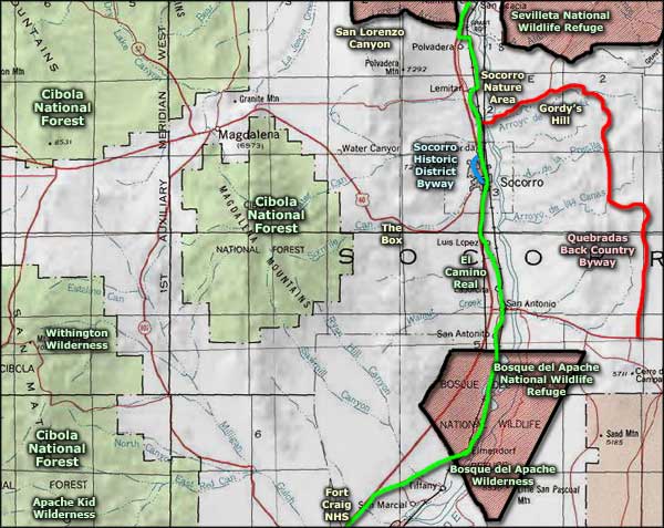
The Quebradas Backcountry Byway is between Sevilleta National Wildlife Refuge and Bosque del Apache National Wildlife Refuge on the east side of the Rio Grande near Socorro. This is 24 miles of unpaved road crossing a rugged and colorful landscape. The area includes the typical sparse vegetation of the upper Chihuahuan Desert and mountain ranges. Along the route you'll cross the Arroyo de la Presilla (centerpiece of the Presilla Wilderness Study Area), Arroyo del Tajo and the Loma de las Canas (centerpiece of the Sierra de las Canas Wilderness Study Area). These are very colorful and scenic geological settings. You'll also pass through areas of convoluted badlands, narrow box canyons and near-vertical multi-colored, water-sculpted limestone, sandstone and granite cliffs. In some areas you might see gray fox, mule deer, coyote, bobcat, porcupine, raccoon, ground squirrel, opossum, jackrabbit and cottontail.
To get to the Quebradas Backcountry Byway: the south end of the backcountry byway starts 11 miles east of San Antonio where US 380 meets County Road A129. Turn north on CR A129 and follow the signs. To get to the north end of the byway take the Escondido exit off the I-25 and follow the east frontage road north to Escondido Lake. Then go east over the Rio Grande. At the T-intersection in Pueblito, go right for about 1 mile to the beginning of the byway. Once there, go east and follow the signs. The road is an annually maintained dirt road. A high clearance 4WD vehicle is recommended. When wet, the road may become impassable. The backcountry byway is open year round and there are no fees involved.
Maps: BLM - Socorro, Oscura Mountains
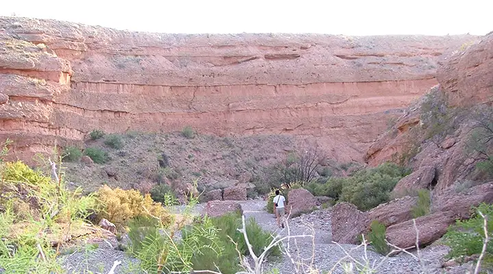
Hiking in Arroyo del Tajo along the Quebradas Backcountry Byway
Upper and lower photos courtesy of Brenda Wilkinson
Upper left photo courtesy of the Bureau of Land Management
Upper left photo courtesy of the Bureau of Land Management
Related Pages
Apache Kid Wilderness
Bosque del Apache National Wildlife Refuge
Cibola National Forest
El Camino Real
Bosque del Apache National Wildlife Refuge
Cibola National Forest
El Camino Real
Map courtesy of National Geographic Topo!