Great Sand Dunes National Park and Preserve

The trail meets Mosca Creek

The Great Sand Dunes sit on the eastern side of the San Luis Valley in a crook of the Sangre de Cristo Mountains between the main range of the Sangres and the spur of the Blanca Massif. The dunefield covers about 39 square miles and rises to almost 750 feet above the valley floor. The sand has piled up here for several reasons:
The prevailing winds blow eastward across the San Luis Valley from the San Juan Mountains, picking up sand from an ancient lake bed on the floor of the valley.
As the winds meet the foothills of the Sangre de Cristo Mountains, they also meet winds blowing westerly from the Sangres and drop their sand.
The sands fall on a large wet area fed by Medano Creek as it flows down out of the Sangres and heads out into what is now Baca National Wildlife Refuge. It's that water that holds the sand in place.

Sand dunes rise into the distance
It has taken millions of years for the sand pile to grow to the size it is today... and the dunes are still growing. The dunes are still moving, too, because surface layers dry and blow around. Certain areas have amounts of vegetation on them that help to hold the sand in place but even near the tops of the dunes, the sand is wet only a few inches down. Most of the dunefield is designated as Wilderness Area in order to preserve its unique character. That Wilderness designation also helps to keep the water that makes the dunes flowing into the dunes. With Colorado''s cities growing rapidly on the east side of the Sangre de Cristos, the temptation to divert that water flow is very strong.
In 2000, Congress passed the Great Sand Dunes National Park and Preserve Act. That Act allowed plans to move forward with The Nature Conservancy brokering a deal to acquire 97,000 acres of the Baca Ranch (to the north and west) to add to Great Sand Dunes National Monument and other federal lands in the immediate area.
Some of that acquisition was added to Rio Grande National Forest, making Challenger Point and Kit Carson Peak (two of Colorado's 14,000-foot mountains) public property. Part of that acquisition was added to Great Sand Dunes National Monument in the 2004 declaration that made the National Monument into Great Sand Dunes National Park and Preserve. The rest of that acquisition was added to some land from the Zapata-Medano Ranch (another Nature Conservancy property on the south side of Great Sand Dunes) to form the Baca National Wildlife Refuge. Certain research, management and maintenance duties are shared on the properties among the National Park Service, National Forest Service, US Fish & Wildlife Service and The Nature Conservancy.
The Great Sand Dunes Visitor Center offers accessible restrooms, extensive exhibits, overlooks of the sand dunes, interpretive and educational videos, an excellent book store and acts as the principal source of information and directions. The Visitor Center is open daily from Memorial Day to Labor Day, 9 am to 6 pm. Hours vary during the rest of the year. The Visitor Center also offers a wheelchair designed for travel in the sand.

People at play in the sand
The Pinyon Flats Campground is the main developed campground on the property and in addition to a total of 88 RV, trailer and tent sites, offers a couple of accessible sites and accessible restrooms. Each site comes with a picnic table and fire grate but there are no hookups. The restrooms include running water and flush toilets. The Sawmill Canyon Backcountry Site offers a parking area with a graded trail leading to tent pads and an accessible privy. Buy your firewood either at the Visitor Center or at the Oasis Campground Store (outside the entrance to the park). Quiet hours run from 10 pm to 6 am, although generators can only be run from 7 am to 8 pm.
Backpackers need to get a back country permit from the Visitor Center. Camping on the dunes is allowed, as well as in any of the six designated sites along the Sand Ramp Trail. You'll want a stove in the back country as open fires are not permitted. Group size is limited to six. You can also car camp in the back country but you'll want a good, high-clearance 4WD vehicle to get there (small SUVs won't do it).

Looking south from high in the dunes
There are several primitive sites scattered along the Medano Pass 4WD trail that are available first come, first served. To get there, you'll need to cross five miles of soft sand road... At the amphitheater parking lot near the park entrance is an air compressor if you need one. Most folks on the Medano Pass Trail come in over the mountains from the east and deflate their tires when they start the drive on the sand. Deflating your tires first and going the other way doesn't work nearly as well (unless you carry your own air compressor).
This entire area is black bear country. There are also elk, mule deer, mountain lion, bobcat, wild turkey, pronghorn and lots of small game. But those bears will make you wish you kept all your food in bear-proof containers. Don't leave any garbage or coolers outside either.
Many days in the spring and fall and most days in the summer, you can catch Ranger-led nature walks, short talks and evening programs at the Visitor Center. Topics often covered include plants, wildlife, geology and local history.

Evidence of nearby water
There are a number of trails that travel across the dunes. The routes vary slowly but most folks head out across Medano Wash and make their way some distance up High Dune. Once on the top of High Dune you'll be about 650 feet above the valley floor and be able to enjoy a 360° view. From there you'll see another dune top to the west that rises to 750 feet above the valley floor. That is Star Dune and it's about 1.5 miles away across the sand ridges.
There are several trails that run up the hills to the east of the dunes complex, too. One of them is the Mosca Pass Trail. A hundred years ago, Mosca Pass was one of the major trade routes into the San Luis Valley, then a large mudslide almost blocked the pass and traffic shifted south and east to La Veta Pass. The Medano Pass 4WD Trail is also to the east (a few miles to the north of Mosca Pass) and crosses over the spine of the Sangre de Cristos into Upper Huerfano County. The road is not recommended for small SUVs (the bit about high clearance is serious) but taking this drive when the leaves are changing is spectacular. Winter can often close the route and spring runoff can make the creek crossings hazardous.

The view up while up in the dunes
With the addition of the new property to Great Sand Dunes came a whole new section of the Sangre de Cristos that is well to the north of the main park area. One trail leaves the Medano Pass road at about 10,000 feet and travels north along the ridge through lush meadows and forest to Medano Lake (just above treeline at about 12,000 feet). Advanced hikers can easily make their way from there to the summit of Mt. Herard (13,297') and enjoy some spectacular 360° views. Further north is Music Pass and the Upper Sand Creek Basin at the edge of the 250,000-acre Sangre de Cristo Wilderness. This is an area with progressively higher 13,000' peaks rising above glacier-carved basins: simply spectacular mountain scenery. Inside the Wilderness boundary is where you'll come to 14,000' peaks...
Great Sand Dunes National Park is located in northeast Alamosa County, about 35 miles from Alamosa. Access from the south is via State Road 150 off of US Highway 50. Access from the west is via County Lane 6 from State Highway 17. There is no access from the north and access from the east is limited to high-clearance 4WD drive vehicles over a primitive road that may be closed for six months of the year.

Great Sand Dunes National Park visitor center

Photos courtesy of TheArmchairExplorer, CCA-by-SA 4.0 License
Map courtesy of the National Park Service
Map courtesy of the National Park Service
Trails at Great Sand Dunes National Park
Exploring the Dunes
Medano Creek Trail - In spring and summer there's water in Medano Creek at the base of the dunes. Everyone seems to enjoy playing in this beach-like environment. As mounds of sand form and fall in the creek bed, a phenomenon called “surge flow” happens, causing an action similar to waves on a sandy beach.

It's easier to climb the dune ridges
The tallest dunes - While it looks that way from the Visitor Center parking lot, High Dune is not the tallest nor the highest in elevation. High Dune is actually about 650 feet high. To reach it, zigzag up the ridgelines: the 360° view there is truly inspirational. Once you''re there, that skyscraping dune to the west is Star Dune, the tallest dune in North America, rising 750 feet above the valley floor. To reach it from High Dune, hike another mile and a half up and down across the dunes to its summit.

The visitor center from the dunes
Eastern dune ridge - With a high-clearance 4WD vehicle you can drive to the Sand Pit or Castle Creek Picnic Areas. With a 2WD vehicle you'll only make it to Point of No Return and have to hike the next 1/2 mile to Sand Pit. Both areas offer close access to Medano Creek while Castle Creek offers an impressively tall, steep dune face.
Forest Trails
Montville Nature Trail - This is an excellent afternoon hike when you need to escape the heat of the dunes. This is a shady mountain trail named for a late 1800's settlement comprising about 20 houses in its heydey. Near the trail's high point you'll find outstanding views of Mt. Herard, the dunes and the San Luis Valley.

Looking north from high in the dunes
Mosca Pass Trail - This trail winds through aspen and evergreen forests along a small creek in the Sangre de Cristo Mountains.The trail is 3.5 miles one-way, allow 2-3 hours to reach the pass. This was one of the main routes into the San Luis Valley from the east until a mudslide almost blocked it about 100 years ago.

Kit Carson Peak and the Crestones in the distance
Dunes Overlook/Sand Ramp Trail - The Sand Ramp Trail starts in Loop 2 of Pinon Flats Campground. This trail travels along the foothills of the Sangre de Cristo''s and offers exceptional scenery. While it's only a mile to the Dunes Overlook, this trail continues for 10 more miles around the eastern and northern perimeter of the dunes.

Looking north near the entrance to the park
Medano Pass 4WD Road - This road requires a high-clearance 4WD vehicle (not recommended for small SUV's). While gorgeous any time of year, this is an especially spectacular drive in the fall. The road is closed when winter conditions create hazards and the creek crossings can be hazardous during spring runoff.
Related Pages
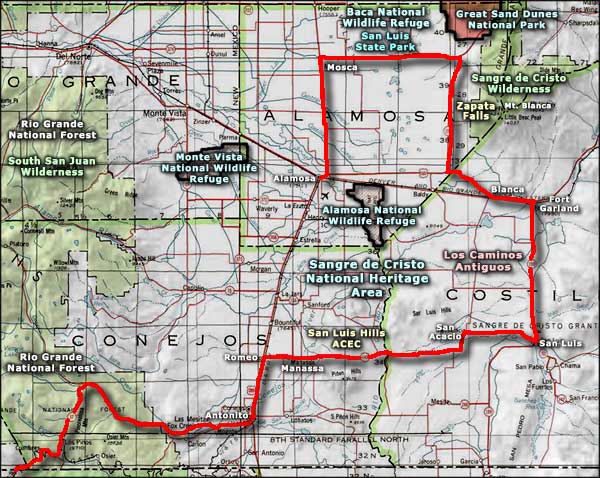
Alamosa National Wildlife Refuge
Baca National Wildlife Refuge
Great Sand Dunes National Park
Los Caminos Antiguos
Baca National Wildlife Refuge
Great Sand Dunes National Park
Los Caminos Antiguos
Map courtesy of National Geographic Topo!