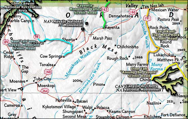
Tse'Nikani-Flat Mesa Rock Scenic Road
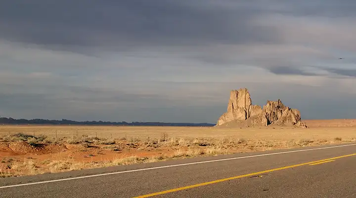
A typical view in the Mexican Water area
The Tse'Nikani Flat Mesa Rock Scenic Road follows US Highway 191 for its entire 48-mile length. The south terminus is at Many Farms, the north terminus at Mexican Water. For a significant part of the journey, the route runs along the canyon floor of Chinle Wash. This is not your usual touristic route as there are essentially no amenities along the way, only pure, unadulterated red rock scenery - extraordinary to the point of being almost overwhelming. This is a journey across an almost waterless world where the landscape is made up entirely of giant red-and-orange sandstone mesas with sheer vertical cliffs, vertical varnished-sandstone buttes and tall, delicate red spires. The landscape has been carved by eons of wind and water into the vast multi-colored, pressure-hardened sand dunes laid down up to 220 million years ago when the sands of the great southwest desert were up to 1,000' deep. Then, about 65 million years ago, the Colorado Plateau was pushed up and these ancient rocks were exposed to the elements again.
There are settlements with trading posts at Mexican Water, Rock Point and Many Farms. You'll probably also find little stands along the roadside where individual Dineh offer their exquisite silver jewelry and hand-woven blankets for sale. Depending on the season and the day of the week, you might even come across a jackpot rodeo or two where you can visit a bit with the local folks and watch some of the best cowboys in the West do their thing.
Whatever you do out in this countryside, don't be in a hurry: as the Dineh say, "Don't run with the clock, walk with the sun." I've only driven this route once, and it was too hot that day for my taste.
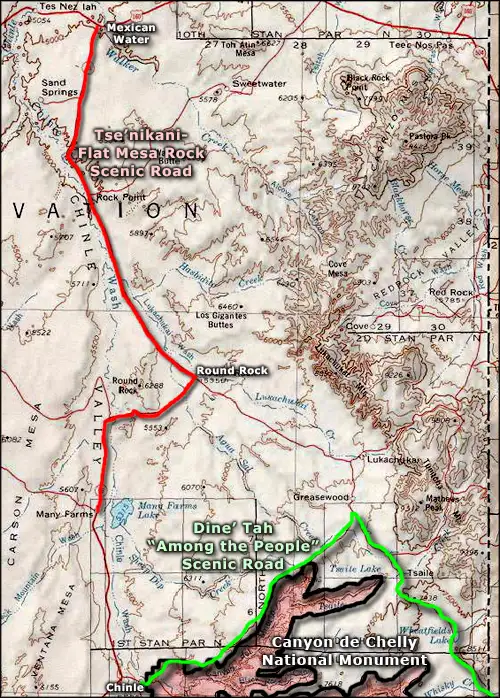
Photo courtesy of TheArmchairExplorer, CCA-by-SA 4.0 License
Map courtesy of National Geographic Topo!
Related Pages
Map courtesy of National Geographic Topo!