Glen Canyon National Recreation Area

Glen Canyon National Recreation Area: Lake Powell, August 2018

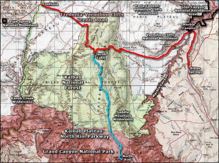
Glen Canyon National Recreation Area encompasses some 1,254,429 acres of desert, rock and water surface (Colorado River, Lake Powell, Cataract Canyon). The property extends mostly along the Colorado River from about 20 miles downstream of Glen Canyon Dam to about 150 miles upstream of the dam. The centerpiece of the National Recreation Area is Lake Powell. Lake Powell offers some 2,000 miles of shoreline, the vast majority of it accessible only by boat. There is road access in the area of Page at the southern end, near Hite at the northern end and to Halls Crossing and Bullfrog in the middle. There is a ferry that connects Halls Crossing with Bullfrog that is run by the State of Utah. The ferry is a fee service and is sometimes out of operation for repairs.
The eastern lake shore and the San Juan River essentially determine the boundary of the Navajo Indian Reservation. At the very north end, the property abuts Canyonlands National Park. West of Bullfrog, Glen Canyon abuts Capitol Reef National Park for a bit, then a lot of that western boundary is against Grand Staircase-Escalante National Monument. Below Glen Canyon Dam, the western boundary of the National Recreation Area is against Vermilion Cliffs National Monument and the Paria Canyon-Vermilion Cliffs Wilderness. At the southernmost extension of the property along the Colorado River is the boundary with what used to be Marble Canyon National Monument. However, Marble Canyon National Monument was merged into Grand Canyon National Park in 1975.

Hole-in-the-Rock
Between the geological wonders, Ancient Puebloan ruins and early Anglo-American settlement history in the area, there's a lot of history in the canyons around here. The flooding of Lake Powell put hundreds of archaeological sites under water and the outcry over that has changed the way the Army Corps of Engineers and Bureau of Reclamation view dam building in the West. The Hopi, Navajo, San Juan Southern Paiute, Kaibab Paiute and White Mesa Ute hold most of this land to be sacred. The Navajo Nation sued the Commissioner of the Bureau of Reclamation, the Director of the National Park Service and the Secretary of the Interior in US District Court in 1974, charging them with the wanton destruction of important tribal religious and ancestral sites by drowning them under the lake.
By holding back so much water at Glen Canyon Dam, riparian areas and greater ecological systems hundreds of miles downstream on the Colorado River have been adversely affected. At this point, the Bureau of Reclamation and the National Park Service are experimenting with allowing larger periodic water flows through the dam in an effort to resuscitate certain natural areas down the Colorado River as far away as Lake Mead. Between the Native American suits and the environmental damage, dam building on the Colorado River is now officially finished.
Human history in the area has been significantly influenced by the depth and the number of canyons eroded into the Colorado Plateau in this area. The photos on the left above and to the right are of "Hole in the Rock," the slot where Mormon settlers lowered their filled wagons down through the canyon to reach the Colorado River where they built a ferry and crossed to begin the settlement of San Juan County in 1880. But just reaching the river and getting across it turned out to be the easy part of their journey, the canyons on the east side almost defeated them in their mission. Today, a good 2WD vehicle with good clearance can make the journey across BLM roads through (Grand Staircase-Escalante National Monument) to the edge of Glen Canyon NRA but once you cross the park boundary, the last 5 miles to the top of Hole in the Rock almost demand high clearance 4WD. And the slot itself can only be negotiated by hand-and-foot climbing. If you are out there and it starts raining, you might want to shelter in place before you get in more serious trouble trying to move around.

Travel on any of the tribal roads on the Navajo Reservation require permission from the tribe and the presence of a Navajo guide in your vehicle. The Navajo Mountain area is sacred to the tribe and requires special permission for non-tribal visitors. The only public access to Rainbow Bridge National Monument is via boat to Bridge Canyon and hike from there. The length (and difficulty) of that hike varies with the water level in the lake.
Most folks come to Glen Canyon National Recreation Area to enjoy the water: boating, water skiing, personal watercraft, fishing, diving, etc. To that end there are several companies offering houseboat rentals. There are five marinas on the lake: Wahweap, Antelope Point, Dangling Rope, Halls Crossing and Bullfrog. The primary concessionaire around the lake is Aramark and they operate most of the marinas, lodges, motels, cabins, gift shops, restaurants, grocery stores, campgrounds, laundries, showers, restrooms, boat rentals, boat tours, gas stations and repair shops. Dangling Rope is accessible only by water. The Antelope Point Marina is operated by Antelope Point Holdings, a concessionaire separate from Aramark. At some of the marina areas the National Park Service offers free boat launch ramps, picnic areas, boat pump-out stations, toilet dump stations, fish cleaning stations and the occasional Ranger Contact Station. There is also a small boat launch at Hite but services are limited and staffed only intermittently. Same for the ranger station at Hite.

Glen Canyon offers a multitude of recreational opportunities other than just the water sports: there are plenty of hiking and mountain biking trails and scenic drives. Some areas can only be approached by boat. Access to land-based activities is also affected by water levels in the lake: a couple years ago the water level was very low and places that have been under water since the lake first started to fill in the 1960s were exposed. However, the drought has mitigated somewhat and the lake is rising again. But the lake level was so low that most water activities in the Hite area were abandoned. I drove through the Hite area in September, 2015 and there is open lake water below Hite (see the upper large photo) but Hite is still high and dry (see the large photo below). The bathtub ring left by the water levels of 20 years ago are still well above today's water line.
Rainbow Bridge National Monument is under the jurisdiction of Glen Canyon NRA but camping is not allowed there. Rainbow Bridge is also accessible only via boat as the Navajo Nation will not allow overland access to non-Dineh.

Looking down on what remains of Hite, UT in 2015: The concrete pad was once a busy boat ramp...

Echo Falls Canyon, downstream from Glen Canyon Dam

The upper end of Marble Canyon, just below Glen Canyon Dam

More views from the river

More views from the Colorado River

The river just above Lee's Ferry

Glen Canyon Dam itself
Large photos and sign photo are courtesy of TheArmchairExplorer, CCA-by-SA 4.0 License
Other photos and small map are courtesy of the National Park Service and the USGS
Related Pages
Fredonia-Vermilion Cliffs Scenic Road
Glen Canyon National Recreation Area
Grand Canyon National Park
Glen Canyon National Recreation Area
Grand Canyon National Park
Map courtesy of National Geographic Topo!