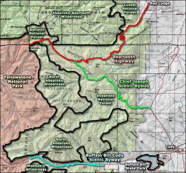
Chief Joseph Scenic Byway
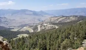
Climbing to Dead Indian Pass
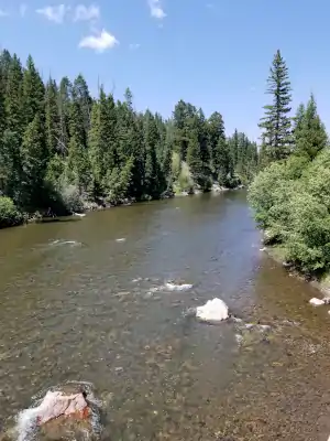
Clarks Fork of the Yellowstone
The Chief Joseph Scenic Byway runs along Wyoming Highway 296 for 47 miles between US Highway 212 (the Beartooth Highway) and Wyoming Highway 120 (about 17 miles north of Cody). This is incredible countryside in the Shoshone National Forest as the route travels beside the Clarks Fork of the Yellowstone between the Absaroka and Beartooth Mountains.
The byway is named for Chief Joseph, leader of the Nez Perce during the Nez Perce War in 1877. To escape from Army cavalry, Joseph led his people into and across Yellowstone country, emerging in the Absarokas and crossing this whole area before going to see their old hunting buddies on the Crow Indian Reservation to the east. The Nez Perce couldn't stay with the Crows without causing them trouble so Joseph's people continued moving north, trying to reach safety on the other side of the Canadian border. A blizzard stopped them at Bear Paw, Montana, 30 miles short of their goal. After a six-day battle, they surrendered to the Army and while being promised one thing (the right to return to their lands), they were immediately given another (rail transport to Oklahoma for several years).
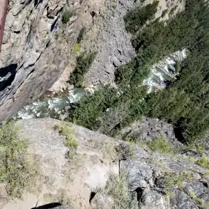
Sunlight Creek
The high point of the drive, literally, is at Dead Indian Pass. The road rises through several hairpins to the summit of Dead Indian Pass before passing down several more hairpins to the more gradual slope down to Highway 120 (I traveled the road from northwest to southeast).
Dead Indian Pass got its name after the Nez Perce passed through. A wounded warrior chose to remain atop the pass to signal when the cavalry was getting near. He carried out that duty, then was killed by the soldiers as they crested the ridge and prepared to move on.
The best time to drive this beautiful stretch of road is summer and fall. Snow plows do keep the road open year-round but winter in this neighborhood can be nasty.
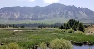
Wetlands at the foot of mountains
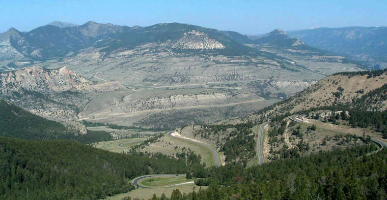
Dead Indian Overlook at Dead Indian Pass

The Red Wall begins to appear north of Cody
Upper left photo courtesy of Crystal Mathias, via Byways.org
Bottom photo courtesy of Talbot Hauffe, Wyoming DOT, via Byways.org
Other photos courtesy of Katie Armstrong of the National Scenic Byways Office
Bottom photo courtesy of Talbot Hauffe, Wyoming DOT, via Byways.org
Other photos courtesy of Katie Armstrong of the National Scenic Byways Office
Related Pages
Map courtesy of National Geographic Topo!