Bureau of Land Management Sites in New Mexico
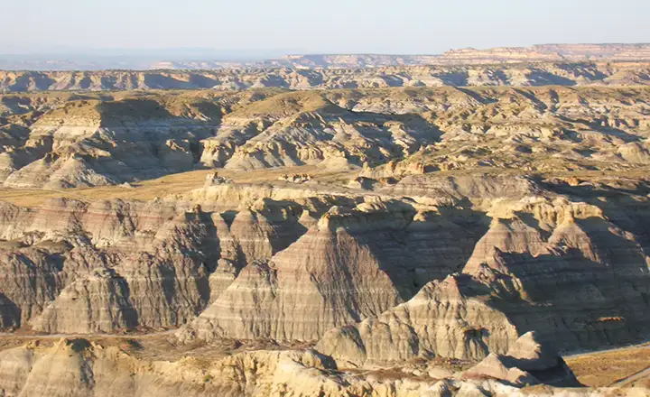
Angel Peak National Recreation Area
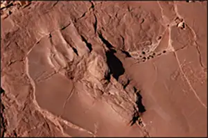
Dinosaur track from Prehistoric
Trackways National Monument
In the list of BLM sites below you will find Wilderness Areas and Wilderness Study Areas. For the most part, Wilderness Areas and Wilderness Study Areas forbid access by all motorized or mechanized vehicles (including mountain bikes and hang gliders). That's because they are areas that retain an essential primeval character and are mostly undisturbed by the actions of modern man. Wilderness Study Areas have been determined to meet the basic criteria for designation as Wilderness Areas but Congress has yet to take action on formally making that designation. The Bureau of Land Management manages 4 designated Wilderness Areas and 59 Wilderness Study Areas in New Mexico.
There are quite a few BLM sites in New Mexico that are primarily for Off-Highway Vehicle (OHV) use. OHVs include dirt bikes, ATVs, rock crawlers, some motorcycles, etc. In New Mexico, that means if you aren't somehow exempted by the New Mexico Department of Motor Vehicles, your vehicle must be registered and carry a license plate on it. Drivers must also have a valid driver's license or learner's permit, or be directly under the supervision of a licensed person at least 18 years old, or be certified by the state as being competent to drive OHVs as a result of passing a state approved operator's training program.
Anyone between the ages of 13 and 69 needs to have a Habitat Improvement Stamp in order to fish on BLM lands in New Mexico.
Cabezon Peak
Bureau of Land Management Sites in New Mexico
Aguirre Spring Campground
Angel Peak Recreation Area
Bisti/De-Na-Zin Wilderness
Black River Recreation Area
The Box Recreation Area
Cebolla Wilderness
Chain of Craters Backcountry Byway
Continental Divide National Scenic Trail
Datil Well Recreation Area
Dripping Springs Natural Area
Dunes OHV Recreation Area
El Malpais National Conservation Area
Fort Craig National Historic Site
Fort Stanton-Snowy River Cave National Conservation Area
Gila Lower Box Canyon Recreation Area
Glade Run Recreation Area
Gordy's Hill Recreation Area
Granite Gap Recreation Area
Guadalupe Backcountry Byway
Hackberry Lake Recreation Area
Haystack Mountain Recreation Area
Ignacio Chavez Special Management Area
Kasha-Katuwe Tent Rocks National Monument
Kilbourne Hole Volcanic Crater
La Cueva Non-Motorized Trail System
Lake Valley Backcountry Byway
Lake Valley Historic Townsite
Mescalero Sands North Dune OHV Area
Ojito Wilderness
Orilla Verde Recreation Area
Pecos River Corridor Recreation Area
Perea Nature Trail
Prehistoric Trackways National Monument
Quebradas Backcountry Byway
Rio Chama Wild and Scenic River
Rio Grande del Norte National Monument
Rio Grande Wild and Scenic River
Robledo Mountains Recreation Area
Sabinoso Wilderness
San Lorenzo Canyon Recreation Area
Santa Cruz Lake Recreation Area
Sierra Vista Trails
Simon Canyon Area of Critical Environmental Concern
Socorro Nature Area
Soledad Canyon Day Use Area
Three Rivers Petroglyph Site
Valley of Fires Recreation Area
West Malpais Wilderness
White Mesa Bike Trails
Wild Rivers Backcountry Byway
Wild Rivers Recreation Area
Ignacio Chavez Special Management Area
Wilderness & Wilderness Study Areas
Aden Lava Flow Wilderness
Ah-Shi-Sle-Pah Wilderness
Alamo Hueco Mountains WSA
Antelope WSA
Apache Box WSA
Big Hatchet Mountains WSA
Blue Creek WSA
Broad Canyon Wilderness
Brokeoff Mountains WSA
Cabezon WSA
Canyons WSA
Carrizozo Lava Flow WSA
Cedar Mountains WSA
Chain of Craters WSA
Chamisa WSA
Cinder Cone Wilderness
Continental Divide WSA
Cooke's Range WSA
Cowboy Spring WSA
Culp Canyon WSA
Devil's Backbone WSA
Devil's Den Canyon WSA
Devil's Reach WSA
Eagle Peak WSA
East Potrillo Mountains Wilderness
El Malpais WSA
Empedrado WSA
Florida Mountains WSA
Gila Lower Box WSA
Gray Peak WSA
Guadalupe Canyon WSA
Horse Mountain WSA
Hoverrocker WSA
Ignacio Chavez WSA
Jornada del Muerto WSA
La Leña WSA
Little Black Peak WSA
Lonesome Ridge WSA
Manzano WSA
Mathers WSA
McKittrick Canyon WSA
Mesita Blanca WSA
Mount Riley Wilderness
Mudgetts WSA
Ojito WSA
Organ Mountains Wilderness
Peloncillo Mountains WSA
Petaca Pinta WSA
Potrillo Mountains Wilderness
Presilla WSA
Rio Chama WSA
Robledo Mountains Wilderness
San Antonio WSA
Sierra de las Cañas WSA
Sierra de Las Uvas Mountains Wilderness
Sierra Ladrones WSA
Stallion WSA
Veranito WSA
West Malpais Wilderness
Whitethorn Wilderness
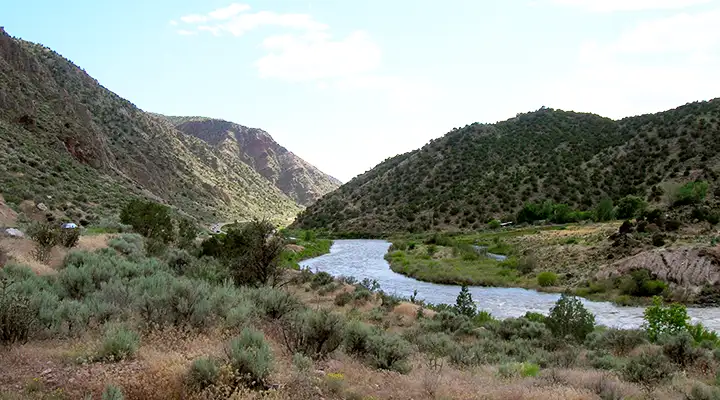
Orilla Verde National Recreation Area
Some photos courtesy of the Bureau of Land Management
Some photos courtesy of TheArmchairExplorer, CCA-by-SA 4.0 License