Alamo Hueco Mountains Wilderness Study Area

In the Alamo Hueco Mountains Wilderness Study Area
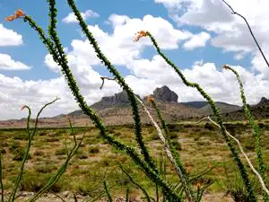
The Alamo Hueco Mountains Wilderness Study Area is a 16,264-acre property in the lower boothell area of New Mexico. It's an area of highly eroded volcanic mountains with mesas, sheer cliffs and long snaking canyons. the vegetation is a mix of juniper, oak brush and desert cactus. The archaeological sites, wildlife diversity and general desert views make the area unique, but there are no developed trails in the area. The elevations vary from about 4,800 feet to about 6,800 feet. Among the wildlife you'll find, desert bighorn sheep, javelina, mountain lions, red-tailed hawks, golden eagles, prairie falcons and Montezuma quail. You'll want a good map, a compass, plenty of water, good hiking shoes and perhaps a GPS device before heading off into the distance here.
To get there: From Hachita, NM, drive NM Hwy 81 south for about 27.5 miles to a dirt road between mile markers 18 and 17. There'll be a BLM signed gate there. The road crosses private land for the first three miles and the public must remain on the road through the private land. Go east through the gate for approximately 2.25 miles, then turn right before a fence and drive south for just under 1/2 mile past another fence. The road will then turn southeast for about 6 miles (passing several unmarked and unmaintained roads) to a dirt road leading south. Turn and go south for approximately 1.25 miles to a T intersection. Turn left or right at the T: the wilderness study area boundary is south of the road for about 4.25 miles in either direction. This is a dirt road that is usually drivable in 2WD vehicles that have good clearance. When it's wet out there, you're on your own. Be aware that the area is very close to the Mexican border and often sees illegal activity.
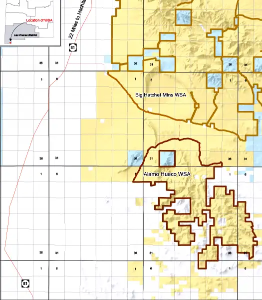
Alamo Hueco Mountains Wilderness Study Area map
Photos and map are courtesy of the Bureau of Land Management