Alaska - The Last Frontier
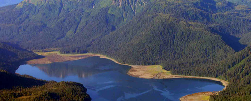
Windfall Harbor
To say Alaska is large is to make a horrible understatement. You can cut the state in half and both halves would still be larger than Texas. About 65% of Alaska is owned and/or managed by various agencies of the Federal Government. The Bureau of Land Management manages some 87 million acres (about 23.8% of Alaska). At 19,286,482 acres, the Arctic National Wildlife Refuge, managed by the US Fish & Wildlife Service, is the largest wildlife refuge on Earth. 101 million acres of the state is owned by the government of Alaska. 44 million acres is owned by a dozen regional and dozens of local Native Alaskan corporations. About 1% of Alaska is owned by other private interests.
Half the glaciers on Earth are in Alaska. That said, the highest temperature ever recorded in Alaska was 100°F, recorded at Fort Yukon (8 miles north of the Arctic Circle) on June 27, 1915. The lowest temperature was -80°F at Prospect Creek on January 23, 1971.
Alaska also has quite a few active volcanoes, some of which are always smoking. Most of them are in the Aleutian Island chain or on the Alaska Peninsula.
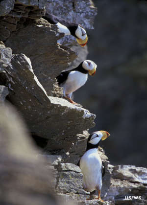
Alaska is also known for its incredible abundance of wildlife. Some areas see as many as 700 different species of birds through the year. Most of us are also aware of the large numbers of black, Alaska brown and grizzly bears, the elk, moose, caribou, reindeer, mountain sheep and mountain goats, the salmon, the muskies and the steelhead trout...
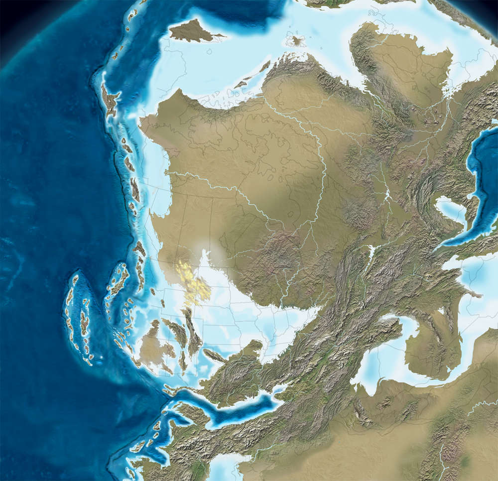
North America, 300 million years ago, click or tap to see a larger version
Geologically, the land that now makes up Alaska is a child of the Laurentia craton that the elements that make up today's Alaska have been slowly accreted onto. While the Laurentia craton has been dated to be more than 3 billion years old, about 380 million years ago the basement of what is now central Alaska began to fill in as the Kanayuk Conglomerate was formed. The Kanayuk was an undersea drainage delta that eventually widened to about 30 miles and ran for about 500 miles. Deposits in the delta fan are up to 8,000 feet thick. That former ocean-bottom drainage channel is now part of the Endicott Mountains in the central Brooks Range.
300 million years ago, though, the Kanayuk was beneath shallow seas and that which now makes up the bulk of Alaska hadn't yet been formed. 300 million years ago the supercontinent Pangaea was coming together with Africa crashing into what is now the East Coast of North America and significantly smaller island arcs approaching from what was then the north and accreting onto what is now the West Coast.
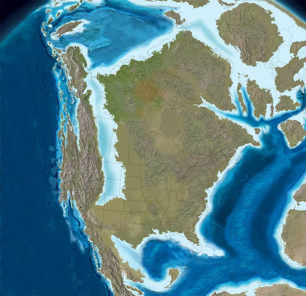
North America, 100 million years ago, click or tap to see a larger version
By about 100 million years ago the Cordilleran region (the Greater Ancestral Rocky Mountains running from Alaska to Arizona) had pushed up due to the continual pressure from the Pacific. In Alaska that appeared as the early Brooks and Alaska Ranges. The southern part of today's Alaska came together as the Wrangell Terrane, a composite of the original Wrangellia, Peninsular and Alexander Terranes (all island arcs from earlier times), pushed onto the side of the Codilleran region.
The defining unit of the Wrangell Terrane is a layer of flood basalts laid down in the late Triassic on top of an island arc from Permian and Pennsylvanian times. The platelets that accreted onto the Laurentia craton broke off of a heavier plate to the west and floated over the subduction zone that we now call the Ring of Fire. The Wrangell Terrane now runs from central Alaska southward through the Yukon, British Columbia and into Washington. Some geologists contend it runs as far south as central Oregon.
It's that continual accretion of lighter land masses breaking off tectonic plates approaching from the Pacific and floating over the subduction zone that have created Alaska and raised virtually all the mountain ranges there. It's that same action that causes today's volcanoes and earthquakes.
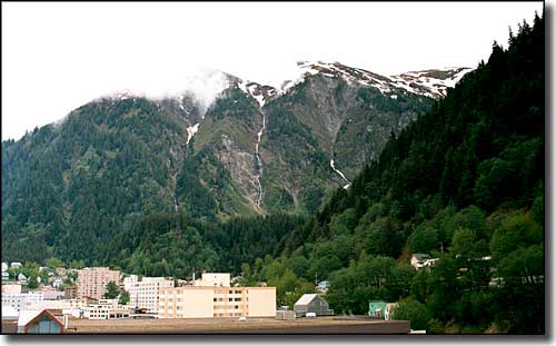
Juneau, Alaska

Mount Shishaldin on Unimak Island in the Aleutians: the world's most visually perfect volcanic cone
Fast Facts about Alaska
Capital: Juneau
Largest City: Anchorage
Became a State: January 3, 1959 - 49th
Largest City: Anchorage
Became a State: January 3, 1959 - 49th
Area: 663,268 square miles - 1st
Highest Point: Mt. McKinley - 20,320'
Lowest Point: Pacific Ocean - 0'
Highest Point: Mt. McKinley - 20,320'
Lowest Point: Pacific Ocean - 0'
2020 Alaska Population Demographics
Total Population
733,374
Males
385,425
Females
347,949
Population by Age
Under 18
180,757
18 & over
552,617
20-24
50,154
25-34
141,238
35-49
141,238
50-64
136,351
65 & over
92,771
Population by Ethnicity
Hispanic or Latino
50,328
Non Hispanic or Latino
683,046
Population by Race
White
439,181
African-American
24,144
Asian
47,616
Native American
109,199
Hawaiian or Pacific Islander
15,413
Two or more
56,939
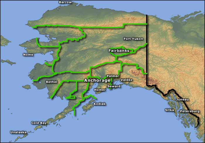
Photo of Windfall Harbor courtesy of the US Forest Service
Photo of Juneau courtesy of Robert A. Estremo © 2002, CCA-by-SA 2.0 License
Photo of puffins courtesy of Bill Hickey, US Fish & Wildlife Service
Photo of Mount Shishaldin courtesy of C. Nye, USGS
Map courtesy of Cartesia MapArt US Terrain
Geological maps © Ron Blakey, NAU Geology, Colorado Plateau Geosystems