Chain of Craters Backcountry Byway
The Chain of Craters Backcountry Byway
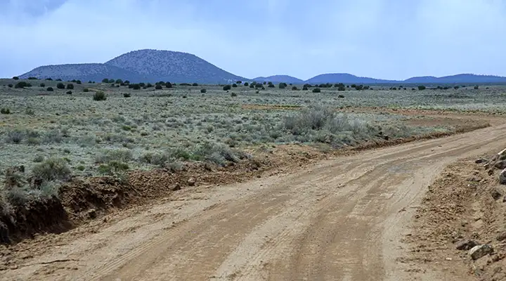
The Chain of Craters Backcountry Byway stretches for 33 miles along County Road 42 through the El Malpais National Conservation Area and El Malpais National Monument. The road forms the western boundary of the West El Malpais Wilderness as it connects NM 53 with NM 117.
This is a very scenic and remote area. The road is dirt and gravel and can usually be driven in a 2WD vehicle with high clearance. In rain or snow the road may be completely impassable (even for 4WD).
To get there: Take the San Rafael exit off the I-40 west of Grants and go south on NM 53 for about 25 miles to where County Road 42 begins on the south side of the road. Or, get off the I-40 about 5 miles east of Grants and head south on NM 117 for about 35 miles to the junction with NM 42 (on the east side of the road).
The Chain of Craters Backcountry Byway is open year round, depending on the weather, and there are no fees involved. Parts of the route define parts of the boundaries of the West Malpais Wilderness and the Chain of Craters and El Malpais Wilderness Study Areas.
Maps: BLM - Zuni, Fence Lake
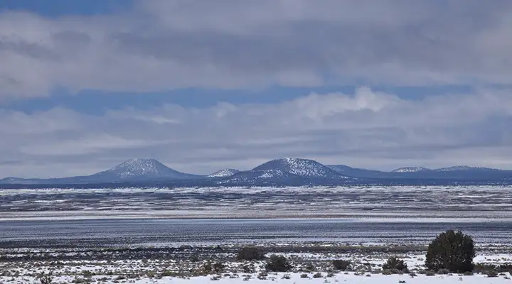
The Chain of Craters
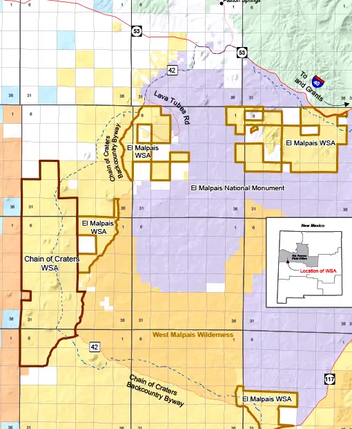
Map of the Chain of Craters Backcountry Byway area
Photos and map courtesy of the Bureau of Land Management
Related Pages
Bluewater Lake State Park
Cibola National Forest
Cebolla Wilderness
Chain of Craters Backcountry Byway
Cibola National Forest
Cebolla Wilderness
Chain of Craters Backcountry Byway
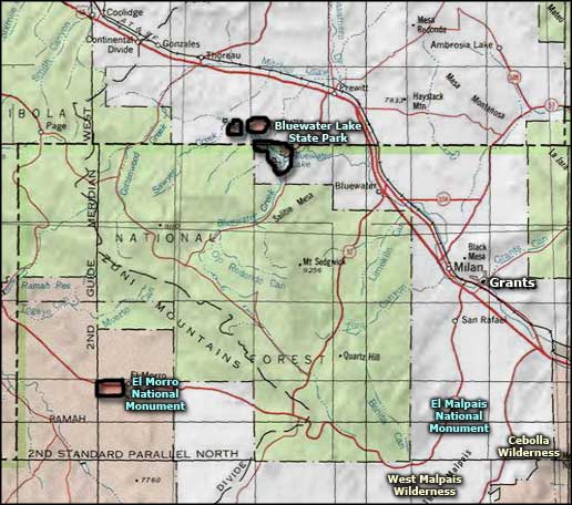
Map courtesy of National Geographic Topo!