Guadalupe Backcountry Byway
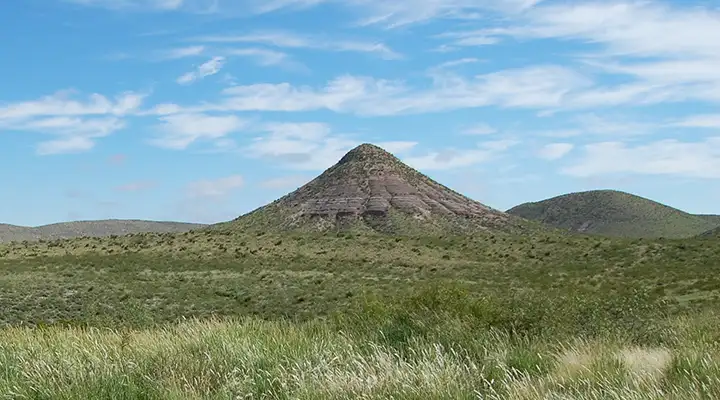
A typical view along the Guadalupe Backcountry Byway
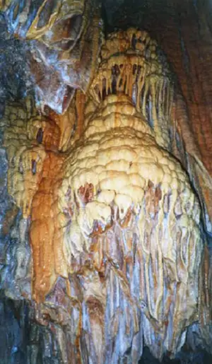
Stone draperies inside Sitting Bull Cave
The Guadalupe Backcountry Byway is a bridge between the pines atop the Guadalupe Escarpment and the cholla-strewn Chihuahuan Desert west of Carlsbad. In just 30 miles you can go from sand, cactus, pronghorns, and rattlesnakes into conifers and pines sheltering mule deer, gray fox and porcupines.
The Guadalupe Backcountry Byway passes along the Capitan Reef of the Permian Basin: an area of steep limestone outcroppings cut by deep, dry arroyos. Along the way you'll pass through an area of producing oil and gas wells. The Byway is along State Road 137 which connects US 285 (just north of Carlsbad) with the town of Queen and then continues to the Texas border and ends at the northern boundary of the Guadalupe Mountains National Park. In places along the road you'll be above some of the underground caverns in Carlsbad Caverns Wilderness and in the southern end of Lincoln National Forest. Along the Byway there are interpretive signs posted explaining some of the natural resource protection measures in place, the scale of oil and gas development, various recreational uses, and other land use opportunities available out here close to the middle of nowhere (this is a very undeveloped, "wild" region). Once you turn onto this road, the nearest drinking water, restrooms, gas, and convenience store is in Queen, well down the road (and depending on the season, Queen may be closed for business).
A popular destination along the byway is Sitting Bull Falls and Cave in Lincoln National Forest.
The Guadalupe Backcountry Byway is a paved 2 lane road that can be driven by a normal passenger car, but you will be moving slowly when you come to the winding canyons and the steep switchbacks leading up onto the Guadalupe Escarpment.
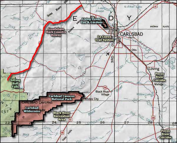
Maps: BLM - Carlsbad
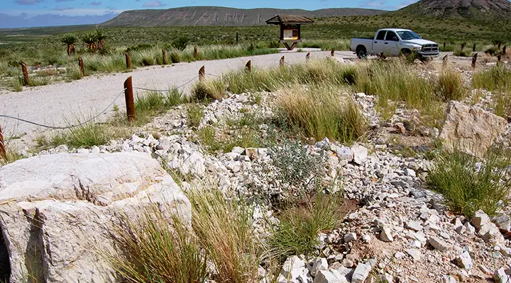
Parking area at Kiosk #2 on the Guadalupe Backcountry Byway
Photos courtesy of the Guadalupe Backcountry Byway, via Byways.org
Related Pages
Map courtesy of National Geographic Topo!