Ignacio Chavez Special Management Area
Ignacio Chavez Special Management Area
The Ignacio Chavez Land Grant was awarded to a local entrepreneur by the Spanish Government in 1768. The plan was to settle the area and develop communities and commerce. For whatever reason it didn't happen. In 1848, the Treaty of Guadalupe Hidalgo ended the Mexican-American War and all undeveloped Land Grant lands in New Mexico and Colorado came into the possession of the US Government.
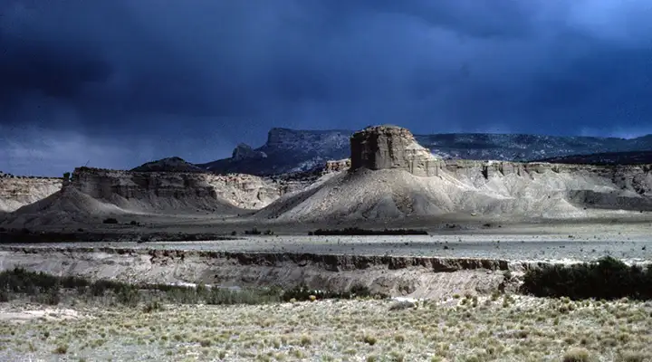
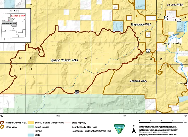
Today, the Ignacio Chavez Special Management Area is comprised of the Ignacio Chavez Wilderness Study Area (33,300 acres) and the Chamisa Wilderness Study Area (13,700 acres). This is an area of rugged cliffs rising above steep canyons crossed by the Continental Divide National Scenic Trail. The Trail parallels BLM Road 1103 and is marked with signs and cairns.
Hunting, hiking, backpacking, horseback riding and primitive camping are allowed. All roads and trails are open to mountain biking, unless specifically designated. Other uses though, like guiding, outfitting and commercial filming all require permits.
To get to the Ignacio Chavez Special Management Area: From the junction of US 550 and County Road 279 (about 43 miles northwest of Bernalillo) go west on CR 279 for about 18 miles past the village of San Luis, past the bridge over Chico Arroyo to where the road forks. CR 279 goes left (south) to Guadalupe and BLM 1103 begins to the west. Another mile or so and CR 25 splits off to the north. BLM 1103 continues west to the top of the mesa on the Ignacio Chavez Land Grant. From San Luis on, the roads are dirt and can become impassable in wet conditions. Because of the road conditions, the BLM closes Road 1103 from July 1 to September 15 and again from November 14 to April 15. When the road is open, keep all your vehicles on the designated roads.
Maps: BLM - Chaco Mesa
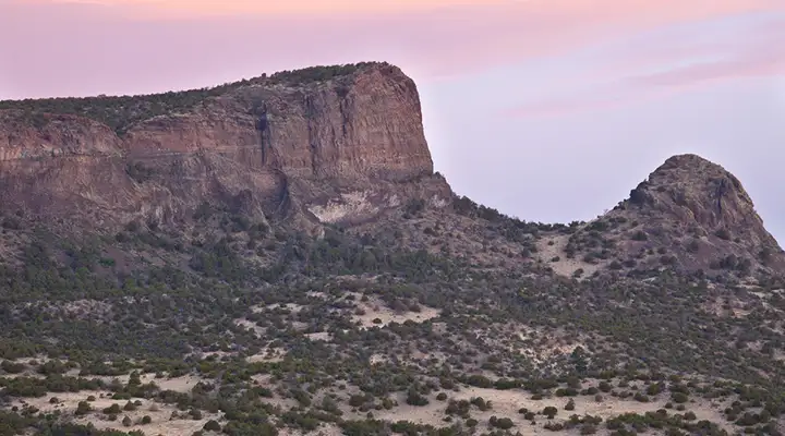
A view in the Ignacio Chavez Special Management Area
Photos and map courtesy of the Bureau of Land Management