Calico Mountains Wilderness

Calico Mountains Wilderness

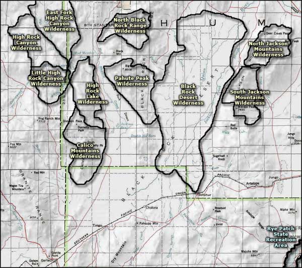
The Calico Mountains are a typical, north-south trending, Great Basin mountain range in northwestern Nevada. The wilderness contains about 64,984 acres in a 17-mile-long, 7-mile-wide chunk in the southern portion of the range. The northern boundary is against the High Rock Lake Wilderness.
Elevations range from a low around 3,950' to a high of 8,491' at the summit of Donnelly Peak. The lower reaches of the wilderness carry some saltbrush and greasewood but most of the vegetation in this area is straight-out sagebrush. You'll also find small riparian areas with cottonwood, aspen and willow in some canyons. Area wildlife includes California bighorn sheep, pronghorn antelope, mule deer, mountain lion, coyote, sage grouse and kit fox. You may also find a herd of wild horses in the area.
The Calico Mountains got their name from the wildly colorful rock layers and formations that make up the southern portion of the range. Calico Mountains Wilderness is part of the Black Rock Desert-High Rock Canyon Emigrant Trails National Conservation Area. The eastern side of the Calico Mountains Wilderness (Petrified Canyon, Mormon Dan Canyon and numerous other side canyons) is accessible via the Soldier Meadows Road. The turn off is about 30 miles northeast of Gerlach.
BLM Map of the Area - 300 KB.

Calico Mountains Wilderness

Donnelly Peak

Map of the Calico Mountains Wilderness area
Photos and map are courtesy of the Bureau of Land Management
Related Pages
Applegate-Lassen National Historic Trail
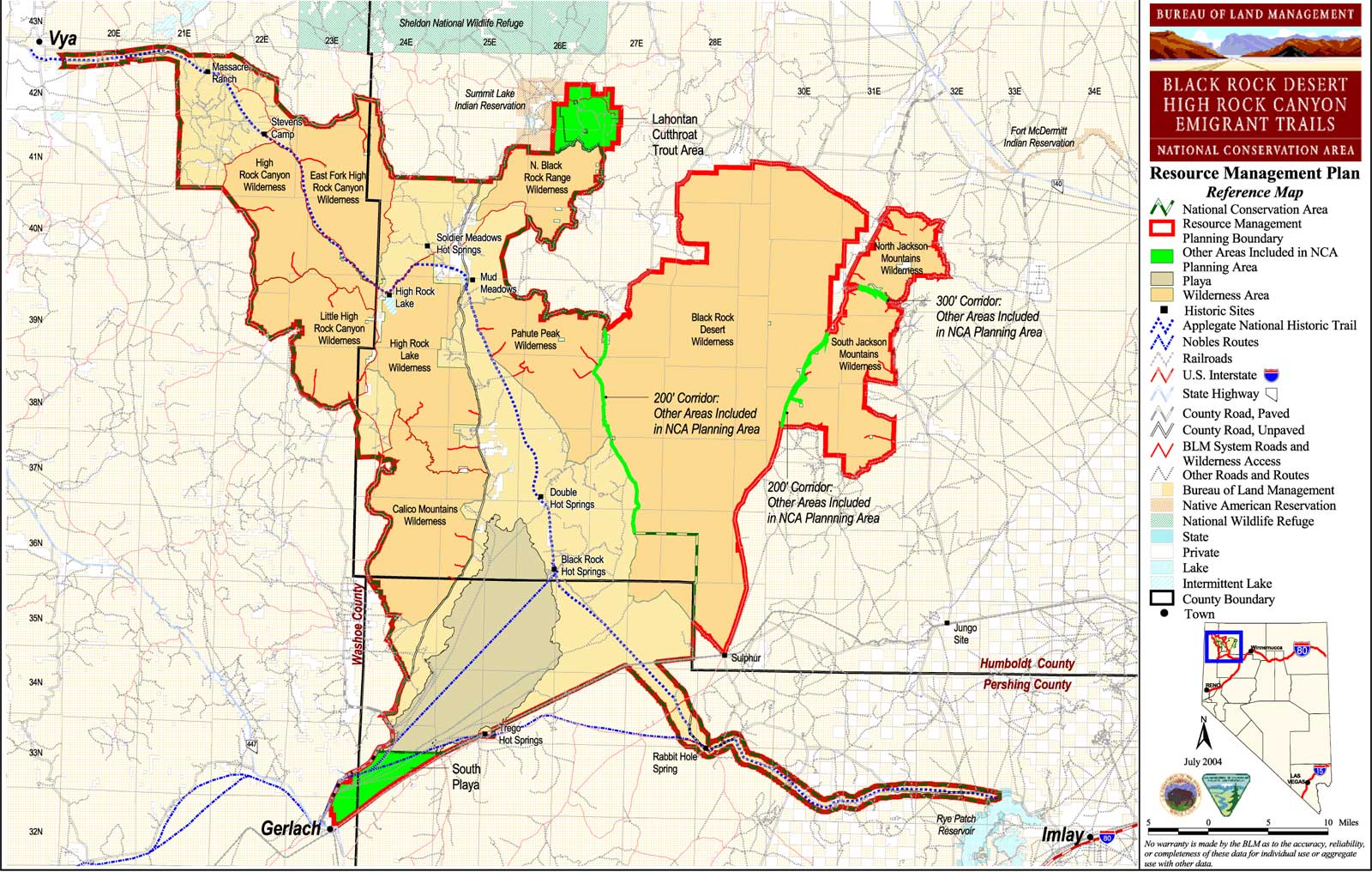
Black Rock Desert-High Rock Canyon Emigrant Trails National Conservation Area
Black Rock Desert Wilderness
Black Rock Desert-High Rock Canyon Emigrant Trails National Conservation Area
Black Rock Desert Wilderness
Map courtesy of National Geographic Topo!