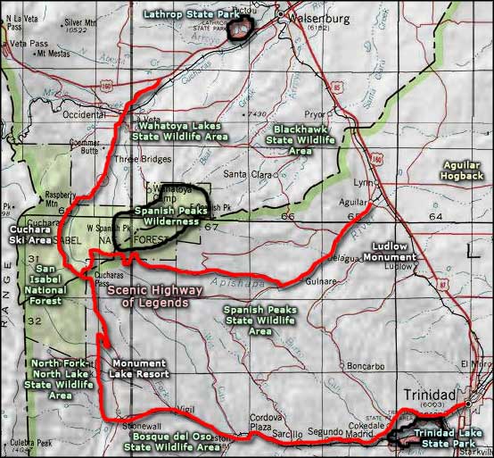
Scenic Highway of Legends
The Scenic Highway of Legends, Colorado Highway 12
State Highway 12, The Scenic Highway of Legends, was designated as a Colorado State Byway in 1987 and as a National Forest Byway in 1988. The Scenic Highway of Legends starts at the cities of Trinidad, Aguilar and Walsenburg and loops around the Spanish Peaks.
Depending on which section of the Scenic Highway of Legends you take, you will pass through San Isabel National Forest somewhere along the road and cross either Cuchara Pass (9,994 feet) or Cordova Pass (11.248 feet) or both. The Scenic Highway of Legends connects areas of unique geological, cultural and historic features and includes a myriad of legends from the Native Americans, the Spanish Conquistadors, and the pioneers, miners, trappers, and ranchers who explored and then settled this region.
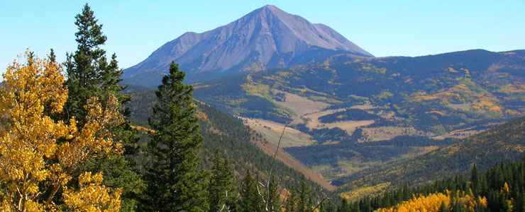
Before the Spanish arrived, the Tarahumare Indians believed the Spanish Peaks to be the place where all life emerged on Earth. They tell stories of their Great Prophet Grandote coming here looking for water during a great drought. Their name for the peaks was "Wahatoya" meaning: "Breasts of the Earth."
When the first Spanish explorers came into the area they found gold near the Spanish Peaks. They enslaved a group of local Native Americans and forced them to dig more gold. When they had all the gold they felt they could carry, they killed the slaves and collapsed the mine on top of them. As the Spaniards headed out they went south over Cuchara Pass and down to the Purgatoire River near Stonewall. From the Stonewall area they continued south along the Dakota Wall and crossed San Francisco Pass into what is now New Mexico, then headed west to cross the Sangre de Cristo Mountains. Somewhere in that crossing they were set on by a group of Native warriors and wiped out to a man. There are still legends of their gold being stashed somewhere in a river valley either upstream from Stonewall or in the Valle Vidal area.
The Army of the West traveled through the Trinidad area, crossing Raton Pass to invade Nuevo Mexico during the Mexican War in 1846. That's when Lieutenant Waldemar Fischer climbed Fishers Peak and left his name behind (sort of). Just southeast of Trinidad, on Scofield Ridge, is a rock covered with the names and initials of Union soldiers carved during Civil War times as they traveled south to engage the Confederates at the Battle of Glorieta Pass.

Soldiers names and initials carved in a sandstone boulder near Trinidad, most from Civil War days
The first European settlers in the Trinidad area came from Mora, New Mexico in the early 1860s. Several of the families that traveled north with Felipe and Dolores Baca in 1862 made their way up the Purgatoire River and homesteaded different plazas along the way. Richard Russell and his wife Marion settled in the Stonewall Valley about 1865. Uncle Dick Wootton began his toll road over Raton Pass shortly thereafter. Tom Tobin made a name for himself by killing a couple of Mexican serial killers just over La Veta Pass and delivering their heads to the commander at Fort Garland. The government only ever did pay him half the reward they promised. There's even stories of Jesse James having his horse shod by John Goemmer in La Veta in those days.
La Veta was first settled in 1862 by John Francisco and Henry Daigle, on land they bought from the Vigil-St. Vrain Land Grant. Francisco is reported to have said, "This is paradise enough for me," on his arrival in the Valley. Walsenburg was first settled as La Plaza de los Leones on the north side of the Cuchara River by Don Miguel Antonio Leon and a family named Atencio. Fred Walsen settled nearby and opened his large mercantile in 1870. After Fred assisted in the incorporation of the town's 320-acre site, it was suggested that he be honored. The US Postal Service agreed and the settlement took on the name Walsenburg.
Las Animas County was known as a wilder-than-normal place for many years. On the occasion of statehood in 1876 the Governor was speaking in Denver, saying: "Colorado has become very civilized, except for that area around Trinidad." After Bob Ford shot his cousin Jesse James in the back, killing him for the reward, he came through the area. Bob was run out of Trinidad on general principles but he lived with his wife in Walsenburg for several years before moving on to South Fork and Creede (where he was killed by the Sheriff, grandson of a woman Bob had tortured and robbed when he was a member of the James Gang back in Missouri).
The early 1870's brought the discovery of coal in the area. People began coming in from all over the world but the population didn't peak until the coal camps really came into their own in the early 1900's. Between 1876 and 1878 over 50 gold mines were staked out in the Spanish Peaks area with more around Silver Mountain, but the veins played out quickly and the hard rock miners moved on. 1882 saw Bat Masterson as Marshall in Trinidad. When the Earps and Doc Holliday left Tombstone, Arizona after the Gunfight at the OK Corral, they headed straight for Trinidad. When Madame Lily left her brothel business in Trinidad for the last time (early 1920s), she moved to a log cabin in the spruce forest above Cuchara Pass. She was tired of all the hassle and felt she might at least get some privacy there most of the year.
From this short blurb you can see that much of what was the real Wild West flourished in this area. And a lot of it has been preserved. Trinidad was rated by the National Trust for Historic Preservation as having the most (and the most restorable) Victorian architecture in the state (Leadville was a distant second). And it wasn't all that long ago that the best source of Championship Texas Longhorn breeding stock was here in the Cuchara Valley. Come and see for yourself: take the journey and experience some of what the first settlers came to call home. It isn't much different now than it was back then...
I'm a bit biased: I was a member of the Board of Directors of the Scenic Highway of Legends for more than 10 years. I lost count of how many times I've driven bits and pieces, or whole sections, of the entire route during those years, and through the years before and after. I got to know Las Animas and Huerfano Counties very well over a 20-year period.
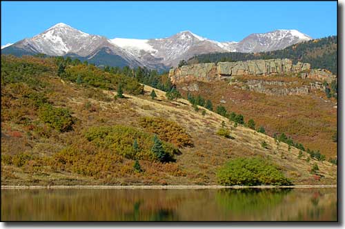
Mounts Mariquita, Maxwell and Cuatro (l-to-r) rise west of North Lake
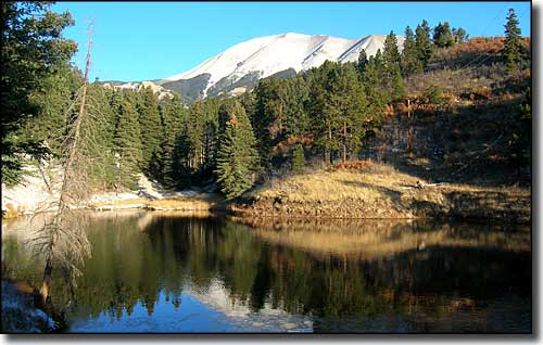
The West Spanish Peak from the Apishapa Road
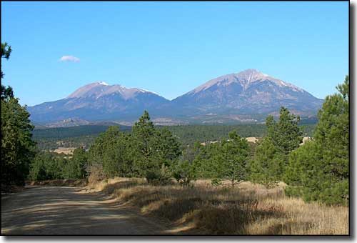
The Spanish Peaks from Gulnare on the Apishapa Road
Related Pages
Map courtesy of National Geographic Topo!