Mount Trumbull Wilderness
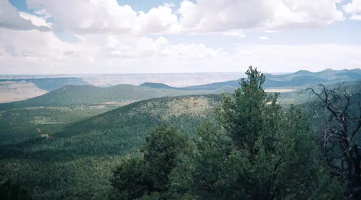
The view south from Mount Trumbull Wilderness
Mount Trumbull Wilderness is a 7,880-acre property located on the southern end of the Uinkaret Plateau in the Arizona BLM Strip (north of the Grand Canyon). Mount Trumbull itself is a large mesa of volcanic origin that tops out at 8,028 feet. The mountain's west and south slopes are steep but support large stands of pinion and juniper mixed with shrub oak, manzanita, cliff rose and silktassel. Midway up the hill you'll find aspen and Gambel oak while the top of the mountain offers a virgin forest of Ponderosa pine. Surrounding the whole is a countryside dominated by cactus, agave and big sagebrush.
As much as the surrounding countryside seems a bit stark, the Mount Trumbull area has squirrels, bobcats, mountain lions, coyotes, skunks, porcupines, jackrabbits, big brown bats and other small mammals. Hawks, owls, wild turkeys and other birds are also abundant. You'll also find the usual assortment of reptiles, insects, arachnids and rattlesnakes Arizona is so famous for.
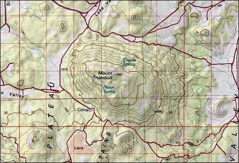
Most folks who visit climb the Mount Trumbull Trail. From the edge of the wilderness to the summit is a five-mile round-trip, however, the trail gets more and more faint as you approach the summit. You'll probably want a good map and a compass or GPS device in your hands. Near the trail head is the BLM's Nixon Spring Campground, just in case.
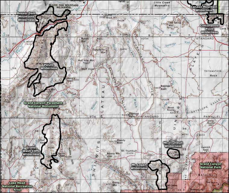
Mount Trumbull Wilderness is about 40 miles south of Colorado City. Most folks arrive via the Mount Trumbull Road, heading south off Arizona Highway 389 between Colorado City and Fredonia. The Mount Trumbull Road is also known as Mohave County Road 5. From the Fredonia area you might take Mohave County Road 109 to the Mount Trumbull Road. Coming from St. George, Utah, you can also follow BLM Road 1069 (Quail Hill Road) to the Mount Trumbull Road. Travel in the Arizona BLM Strip is travel in the middle of nowhere: you'll want plenty of food, water, clothing, equipment, a full tank of fuel, maybe an extra spare tire and a copy of the Arizona BLM Strip road map.
7.5-Minute Topo Maps: Mt. Trumbull NE, Mt. Trumbull SE, Mt. Trumbull NW
Upper photo courtesy of Wikipedia userid Tainter
Map courtesy of National Geographic Topo!
Related Pages
Beaver Dam Mountains Wilderness
Canaan Mountain Wilderness
Cottonwood Point Wilderness
Grand Canyon National Park
Canaan Mountain Wilderness
Cottonwood Point Wilderness
Grand Canyon National Park
Map courtesy of National Geographic Topo!