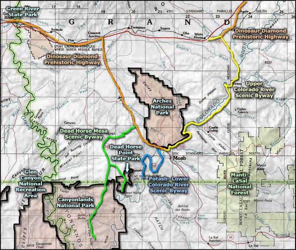
Highway 128 Colorado River Scenic Byway
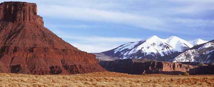
The La Sal Mountains from along the Highway 128 Colorado River Scenic Byway
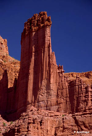
Fisher Towers
The Highway 128 Colorado River Scenic Byway is a 44-mile route through the valley of the Colorado River upstream from Moab to the intersection with the Dinosaur Diamond Prehistoric Highway (near Cisco, right next to Interstate 70). Along the route you'll see sight after sight after sight that will evoke memories of countless classic Western movies, among them: The Comancheros, Wagon Master, Ten Who Dared, Against a Crooked Sky, Rio Conchos and Rio Grande (all filmed in this area).
The canyon beside the river is narrow and the road has many blind corners, many spots with no shoulders. It's dangerous enough that Utah DOT has limited the traffic to a maximum of 55,000 pounds per vehicle (which cuts out most big trucks).
One of the outstanding sites along the route is the Fisher Towers Recreation Area where you'll find rock pinnacles that rise 900 feet above the red-and-purple canyons. The towers are composed of three fins of Cutler Formation sandstone that is emerging from the greater mesa on a geological timescale. The Cutler sandstone is harder than the surrounding rock and is capped with a thicker layer of Moenkopi sandstone (which means that when the Moenkopi materials were being laid down, these fins of Cutler sandstone were in a local low spot on the surface of the planet). Today, the Fisher Towers are famous around the world because of the photos taken of them and for the classic rock climbing routes they offer.
The Dewey Suspension Bridge was the longest suspension bridge in Utah but it was only eight feet wide from rail to rail. The bridge was constructed of iron and wood in 1916 and served as one of only three bridges that crossed the Colorado River in Utah for many years. By the time the bridge was replaced and the highway rerouted in 1989, many drivers had lost their side mirrors to the bridge. In 1989 the bridge became part of the Kokopelli Trail, a bike and hike route along the Colorado River. On the west side of the bridge is a park and roadside rest area. On the east side is an abandoned gas station and the ghost town of Dewey. Below the bridge on the river's edge is a campground. In April, 2008, a 7-year-old was playing with matches in the campground and accidentally lit a brush fire that shortly burned all the wood sections of the bridge. Presently, the steel towers and cables that supported the bridge are still there but nothing else...
Once you pass the turn-off to Castle Valley (coming from the east) you'll be coming into the area of the Big Bend Recreation Site with multiple river access points (for rafters and kayakers) and a BLM-developed-and-maintained campground (I rafted this part of the Colorado River once and had a blast - but swimming is not allowed because of strong currents and bad undertows in many areas). The north side of the river will be the southern boundary of Arches National Park, although you probably wouldn't know it because of the dramatic red-rock cliffs that rise almost from the river's edge and deny reasonable access to the park.
About four miles out of Moab you find the trailhead for Negro Bill's Canyon. It's a two-mile trail along the stream in the bottom of a side canyon leading to the Morning Glory Natural Bridge. It's steep in spots and rises about 330 feet over its length. The usual hiking time varies from two to four hours for a round trip...
Technically, the Highway 128 Colorado River Scenic Byway is part of the Dinosaur Diamond Prehistoric Highway but efforts are under way to designate the route as an "All American Road" (meaning: a route so scenic as to be a destination unto itself).
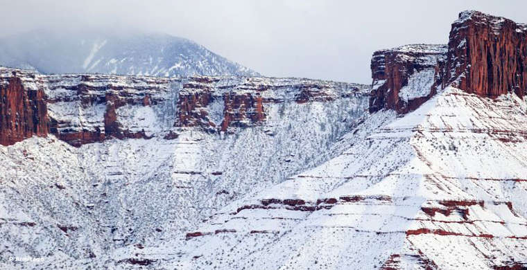
Along the Highway 128 Colorado River Scenic Byway in winter
Upper photos courtesy of Phil Armitage
Other photos courtesy of TheArmchairExplorer, CCA-by-SA 3.0 License
Other photos courtesy of TheArmchairExplorer, CCA-by-SA 3.0 License
Related Pages
Map courtesy of National Geographic Topo!