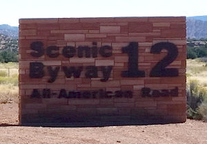
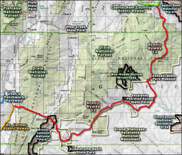
Highway 12 Scenic Byway
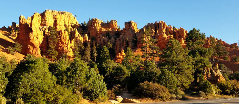
In the Red Canyon area
Highway 12 Scenic Byway is a 124-mile route that follows Utah Highway 12 between Bryce Canyon Junction (where it meets with the Mt. Carmel Scenic Byway) and Torrey (where it meets with the Capitol Reef Country Scenic Byway). In between is wide open countryside eroded into incredible shapes and forms over the millenia. Some areas are high enough to be densely forested in pines, firs, spruces and aspens but most areas are open rock with a mix of sagebrush, chaparral, Utah juniper and pinyon pine growing where it can find a toehold. This is an isolated area of valleys, canyons and plateaus where elevations vary from 4,000' to about 9,000'.
Driving Highway 12 Scenic Byway is to travel among some of Utah's finest scenery and several of southern Utah's famous national parks: Bryce Canyon, Grand Staircase-Escalante, Capitol Reef. You'll also find Escalante Petrified Forest State Park, Kodachrome Basin State Park and the Anasazi State Park Museum.
This countryside sits at the western edge of the Colorado Plateau, a large chunk of rock uplifted during the Laramide Orogeny about 65 million years ago. Wind and water have been eroding the rock since that time, cutting deeply into the sandstone, limestone, mudstone and siltstone to create the countryside we see today. Over the years, there have been added stresses and strains put on the landscape as the tectonic plates have shifted and pushed and pulled chunks of Utah up and down in fault blocks creating landforms like the Pausaugunt and Markagunt Plateaus. The mountain ranges and cliffs that define Grand Staircase are vast exhibits detailing the geological history of the area... then there's Waterpocket Fold in Capitol Reef National Park to the east...
Archaeological evidence points to this area being occupied as long ago as 10,000 years by members of the nomadic Basketweaver culture. Later came the Ancestral Puebloans who left pithouses and ancient pueblo ruins in some areas (stop at Anasazi State Park Museum to explore one of these and see some of their artifacts). Most of this area was on the boundary between the Ancestral Puebloans and the Fremont, another prehistoric people who mostly lived to the north and west. Artifacts found in some places point to a merger between the two ancient cultures of some architectural and pottery styles. Some artifacts also testify to this area being in the heart of a trade empire that extended for thousands of miles in all directions. More recently, this region was hunted and fished by the Paiutes, until the Mormons began to arrive in the 1850's.
Whatever your particular bent in terms of exploring the surface of Planet Earth, the area around Highway 12 Scenic Byway should be at the top of your list of places to go.
Update 2015: I drove the whole length of Highway 12 Scenic Byway in late September. It was better than I remembered it. However, it had been raining recently and the dirt and gravel roads off to the side weren't passable in many areas. I didn't remember Red Canyon very well but took the time to stop and look around. Noticed the new bike path Dixie National Forest was putting in all through the area. I hope it will eventually connect with the bike trails in nearby Bryce Canyon National Park.
The views along the route were large, usually too large to fit in the camera. I remembered the Escalante Canyon area but not Calf Creek Canyon. I also remembered the Hogback: a stretch of road that follows a very narrow ridgeline with steep dropoffs immediately on both sides of the road. The Boulder Valley area was beautiful, as was the drive up and over Boulder Mountain to come down to the Capitol Reef Country Scenic Byway just east of Torrey. There were bluffs, mesas, canyons, rock walls, talus slopes and pine forest along the way. I took too many pictures to put them all here at once...
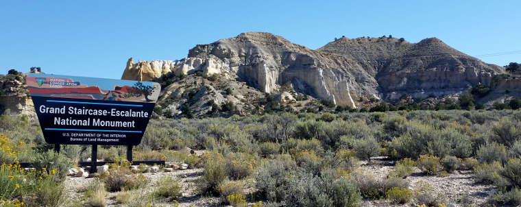
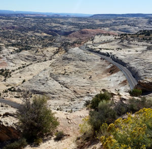
Entering Grand Staircase-Escalante National Monument along Highway 12 Scenic Byway
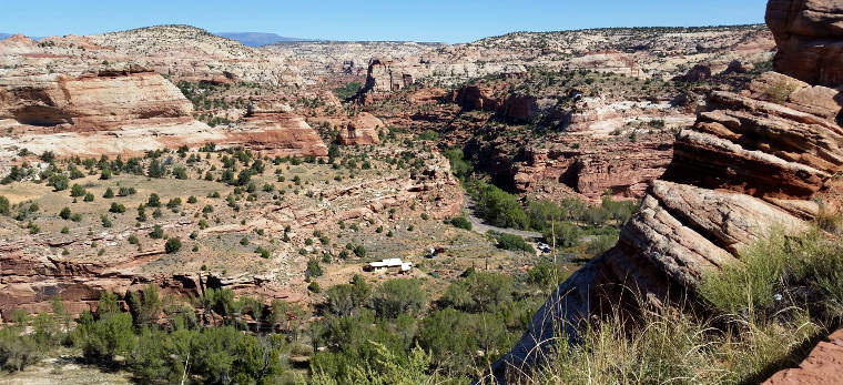
Escalante Canyon in the Boynton Overlook area
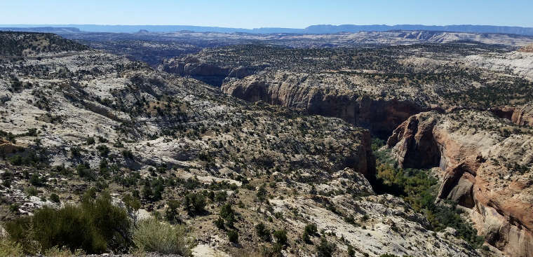
A view into Calf Creek Canyon
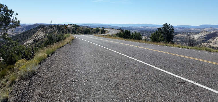
On the famous Hogback on Highway 12 Scenic Byway
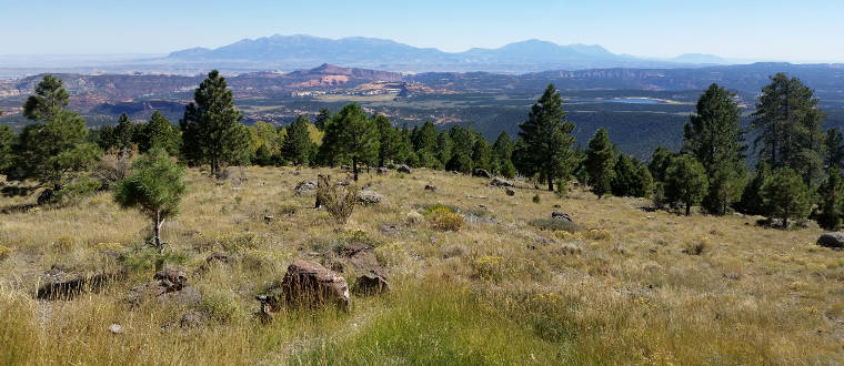
The view east from Boulder Mountain
Photos courtesy of TheArmchairExplorer, CCA-by-SA 4.0 License
Related Pages
Anasazi State Park Museum
Box-Death Hollow Wilderness
Bryce Canyon National Park
Capitol Reef National Park
Capitol Reef Country Scenic Drive
Dixie National Forest
Box-Death Hollow Wilderness
Bryce Canyon National Park
Capitol Reef National Park
Capitol Reef Country Scenic Drive
Dixie National Forest
Map courtesy of National Geographic Topo!