Bryce Canyon National Park
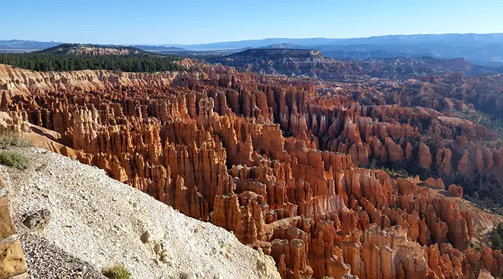
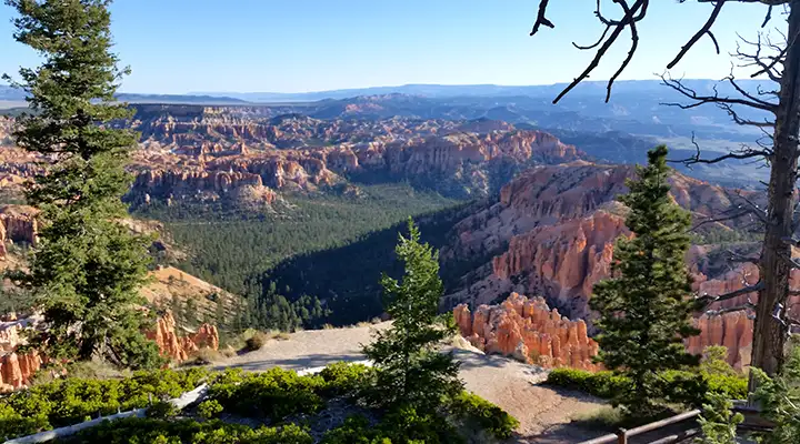
A view from Sunrise Point at Bryce Canyon National Park

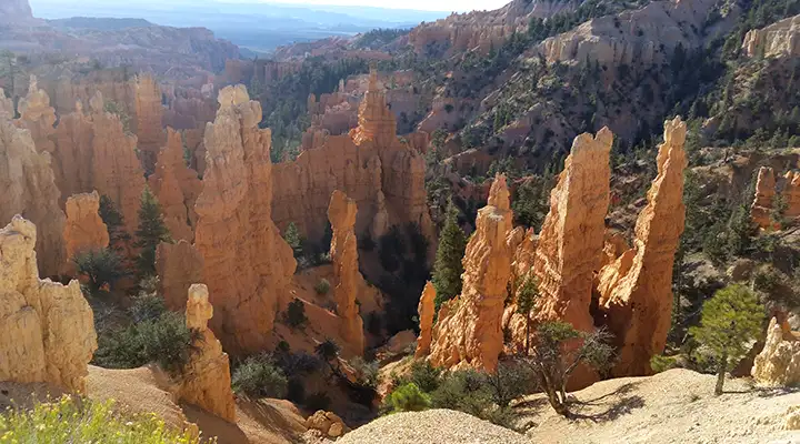
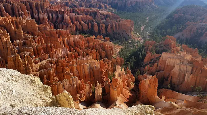
Bryce Canyon (named for Ebenezer Bryce, a Mormon pioneer who settled in the Paria Valley in 1875 and harvested timber around the edge of the canyon) is one of several horseshoe-shaped amphitheaters eroded into the Paunsaugunt Plateau of southern Utah. Some 10 million years ago, geological forces pushed up the massive blocks of the Paunsaugunt Plateau and the Tower Cliffs (further west). The single original block cracked in the middle and the Tower Cliffs were pushed up about 2,000 feet higher than the rest of the Paunsaugunt Plateau. The crack in the middle opened further over time and has eroded into what we now know as the Paria Valley. Over those same millions of years, flowing water carved into those stone blocks and created the "hoodoos" (the fins, spires and pillars of fantastically carved rock) that abound all through Bryce Canyon National Park.
Bryce Canyon National Monument was established by the US Forest Service in 1923. Congress passed legislation to create the park in 1924 and the park was officially established in 1928. Bryce Canyon Lodge was designed by Gilbert Stanley Underwood and was built in 1924. Today it is a National Historic Landmark, the last one standing of four Union Pacific Lodges built about the same time at Zion, Cedar Breaks, Bryce and the North Rim of the Grand Canyon.
Over the last 60 million years, this land has been up and down, sea bottom and mountain top. The Cretaceous Inland Seaway covered the land for millions of years and deposited the brown and gray materials that are found at the lowest elevations of the canyon. Then that sea was pushed north as the land was pushed up. Then, for a few million years, Bryce Canyon was at the bottom of a large freshwater lake system and iron-rich lime-filled sediments were deposited in layers many feet thick. Then horizontal pressure was applied to the sedimentary rock as the Ancestral Rocky Mountains were forming to the east. And then, about 10 million years ago, the land was deformed and displaced vertically along the north-south trending fault lines as the Pacific tectonic plate "slammed" into North America and everything along that fault "wrinkled" up to 1,000 miles to the east. Most of what we see in Bryce Canyon today has been exposed (and carved) by wind and water erosion since then.
Elevations in the park vary from 6,000 to 9,105 feet. The plant life and wildlife here vary directly with the elevation. The most common large mammal found in the area is mule deer, but there are also populations of black bear, mountain lion, elk and pronghorn antelope.
Basketmaker-period artifacts several thousand years old have been found just south of Bryce Canyon National Park. Other artifacts from the Ancestral Puebloan and Fremont cultures have also been found. These older cultures abandoned the area around the middle of the 12th century and then the Paiute moved in. Over time, the Paiute developed a mythology concerning the hoodoos at Bryce Canyon. They believed these were the Legend People whom Coyote, the trickster, had turned into stone.
Today, human visitors to the park number around 1.5 million annually, with the heaviest traffic in summer and the least traffic from December through February. I last visited the park in late September, 2015, and it looked as though half the people in the park were tourists from China. I saw road construction happening in several places but I also saw the park was adding a paved bike path throughout the northern regions of the park. The Ruby's Inn area (incorporated as Bryce Canyon City in 2007) was packed with people getting on the shuttle buses that offered free rides to the various viewpoints around the northern part of the Bryce Canyon Amphitheater (to get to the viewpoints further south, you are on your own).
Depending on the angle of the sun during the day, the sun's rays reflect off the amphitheater walls and backlight the hoodoos... Really beautiful effect. And photos of the hoodoos last year can be quite different than photos of the hoodoos this year as the material they are made of is relatively soft and erodes quickly. Geologically speaking, Bryce is an eroding, retreating plateau margin and not a canyon.
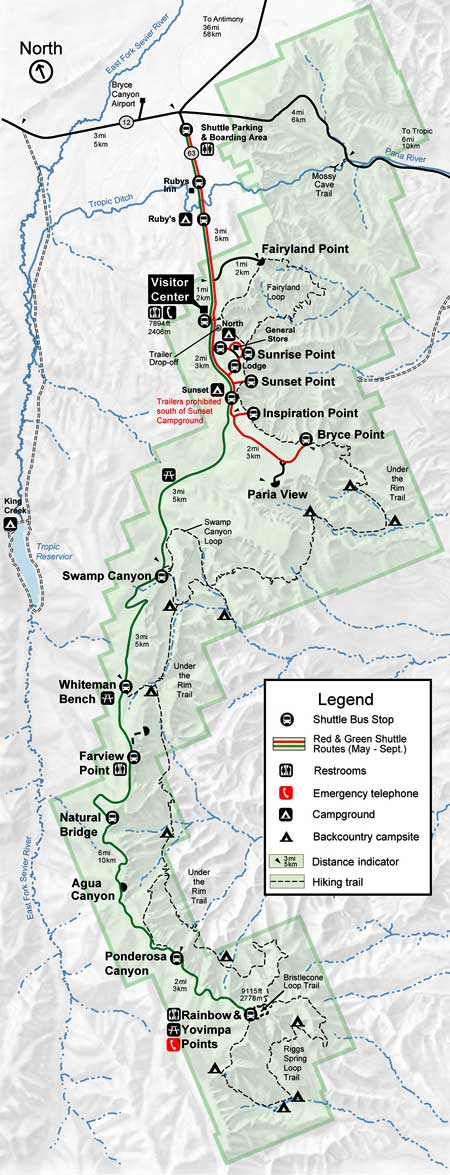
The Bryce Canyon Visitor Center is open in summer from 8 am to 8 pm. Fall, winter and spring hours are 8 am to 6 pm. North Campground is open year-round (only one loop in the winter months). The campground offers 101 campsites, first-come/first-served from October to early May. Sunset Campground offers 102 camp sites and 20 tent sites from late spring to early fall. All campsites can be reserved up to six months in advance. There is one group campsite, available by reservation only. Most trails in the park are day-use only but the 9-mile Riggs spring Loop and the 23-mile Under-the-Rim Trail allow back country camping, permitted on a first-come/first-serve basis. Fees for everything seem to go up every year as Congress appears to be trying to make the place more attractive for private interests to "buy" (this is what "concessionaires" are about). As of my visit, entry fee was $30 per vehicle, $15 per individual, good for 7 days after purchase. Camping fees are somewhere between $5 and $20 per night, depending on where the campsite is. There are no hookups in the park but there is a dump station.
Once a person descends a few feet below the edge of the canyon rim, he/she enters Bryce Canyon Wilderness and is subject to the usual wilderness rules and regulations.
A view from Inspiration Point
A view from Bryce Point
A view from Paria Point
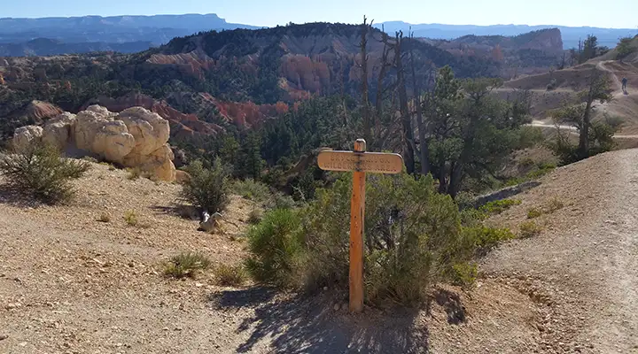
Entering Bryce Canyon Wilderness
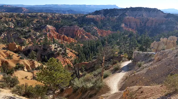
In the Fairyland area of the wilderness
Photos courtesy of TheArmchairExplorer, CCA-by-SA 4.0 License
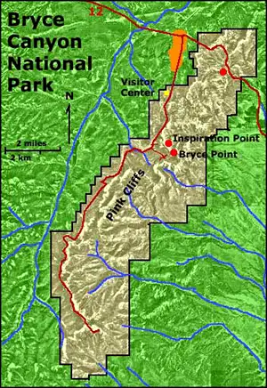
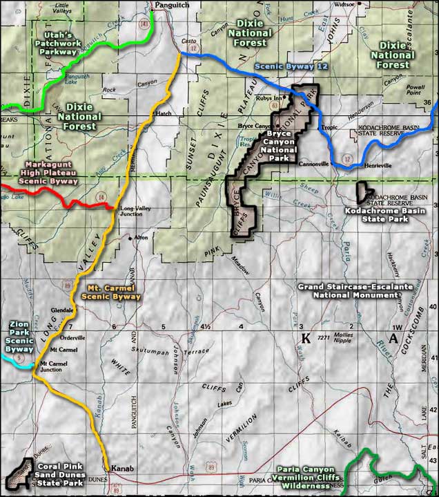
Maps courtesy of the National Park Service
Maps courtesy of the National Park Service
Related Pages
Bryce Canyon National Park
Coral Pink Sand Dunes State Park
Dixie National Forest
Grand Staircase-Escalante National Monument
Coral Pink Sand Dunes State Park
Dixie National Forest
Grand Staircase-Escalante National Monument
Map courtesy of National Geographic Topo!