Zion National Park Scenic Byway
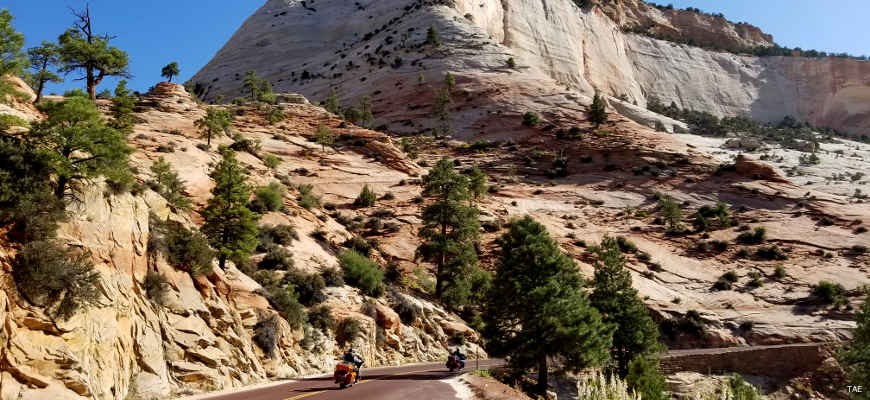
A typical summer view
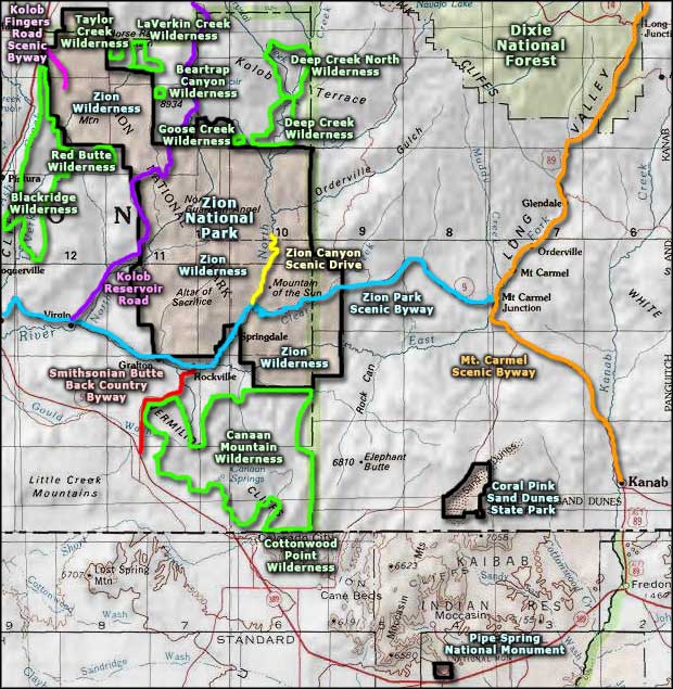
The Zion National Park Scenic Byway follows Utah Route 9 between St. George and Mt. Carmel as it crosses Zion National Park. This is a region of multi-colored landscapes, towering cliffs, deep river valleys and historic towns. Along the route the Zion National Park Scenic Byway gives access to the Kolob Reservoir Scenic Road, Smithsonian Butte Back Country Byway, Zion Canyon Scenic Drive and ends in Mt. Carmel at the intersection with US Highway 89, the Mt. Carmel Scenic Byway. Between St. George and Hurricane, the byway also gives access to Quail Creek and Sand Hollow State Parks.
To get across Zion National Park, you'll have to stop and pay entry fees at the park's south or east entrance station. Entering through the south station you'll pass the Zion Canyon National Park Visitor Center and continue up the side of the Virgin River. Once you cross the bridge over the Virgin, the road forks: the left side becoming the Zion Canyon Scenic Drive and heading north to dead end in five miles, the right side being the continuation of Utah Route 9. Stay to the right and shortly you'll enter the mile-long tunnel through Zion Canyon's east wall, then begin climbing the switchbacks to the Zion Canyon Overlook and entrance to the Checkerboard Mesa area. Beyond Checkerboard Mesa is an easy drive through more scenic country to Mt. Carmel Junction.
If you decide you want to travel the Zion Canyon Scenic Drive while you're in the area, private vehicles are not allowed on the road from early April through the end of October. You'll need to park at the park's Visitor Center and board one of the free Zion Shuttle Buses to make that journey. The shuttles stop all along the route to let people on and off and turn around at the Temple of Siwanava for the return trip.
Update 2015: I tried to make the drive through Zion National Park in late September but couldn't get into the park due to a rockslide blocking the road on the east side of the park. I ended up going back to Virgin and making the drive over the Kolob Reservoir Scenic Road. But I got more than a few shots leading up to the park entrance... and I did finally get back and make the drive across Zion in the late spring of 2018.
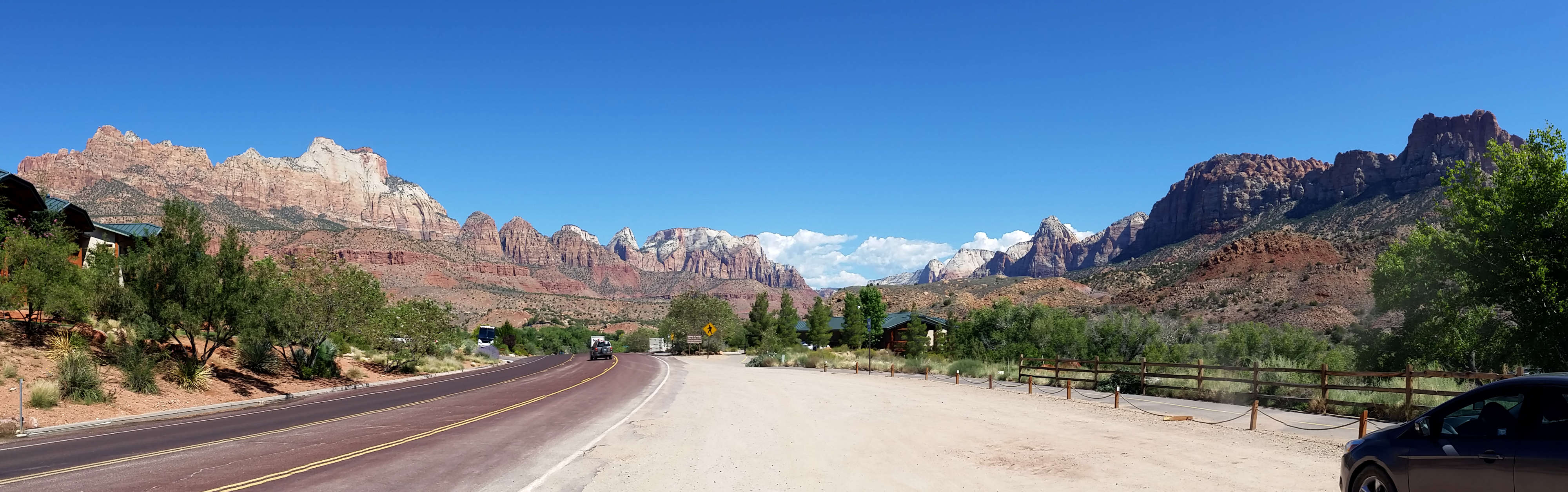
Coming to the south entrance of Zion National Park
Click on the image for a larger version
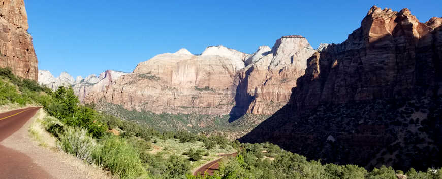
In the switchbacks below the tunnels
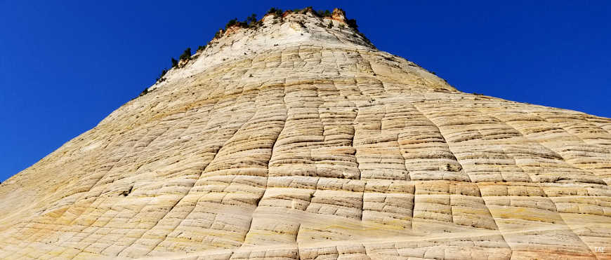
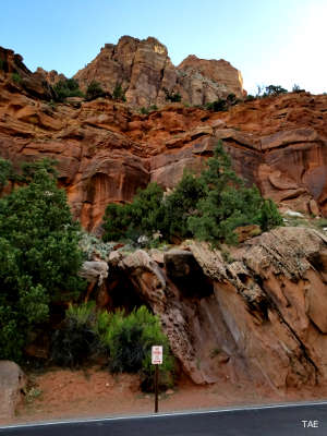
Checkerboard Mesa
Photos courtesy of TheArmchairExplorer, CCA-by-SA 4.0 License
Related Pages
Beartrap Canyon Wilderness
Blackridge Wilderness
Canaan Mountain Wilderness
Coral Pink Sand Dunes State Park
Cottonwood Point Wilderness
Deep Creek North Wilderness
Deep Creek Wilderness
Blackridge Wilderness
Canaan Mountain Wilderness
Coral Pink Sand Dunes State Park
Cottonwood Point Wilderness
Deep Creek North Wilderness
Deep Creek Wilderness
Map courtesy of National Geographic Topo!