LaVerkin Creek Wilderness
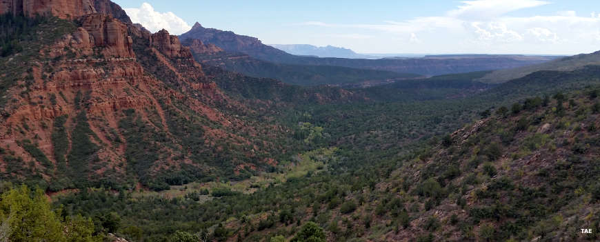
The Laverkin Creek Trail follows Timber Creek, the riparian area in the lower part of the photo above
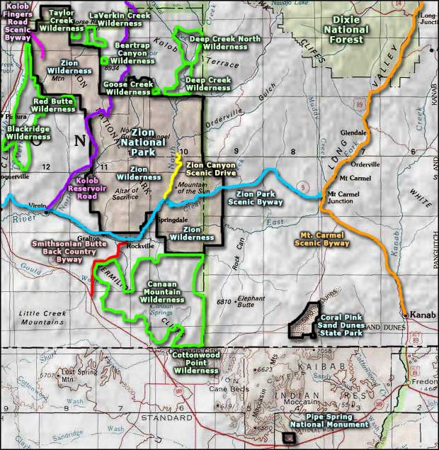
LaVerkin Creek Wilderness is a 453-acre property contiguous to Zion Wilderness near the northern end of Zion National Park. It's an isolated area that is surrounded on three sides by private property, making public access from above almost non-existent. If it wasn't for that boundary contiguous to Zion Wilderness, the property would be too small to qualify for wilderness designation.
Nearly the entire property is composed of very steep canyon walls dropping to LaVerkin Creek. Public access is via the LaVerkin Creek Trail, a route beginning in the Lee Pass area of Kolob Fingers and heading south along the slopes above Timber Creek to round the red bluffs above the junction of Timber Creek and LaVerkin Creek and turn to the northeast, going upstream along LaVerkin Creek. About 7 miles in from the trailhead at Lee Pass there's a side trail north to Kolob Arch, possibly the largest free-standing stone arch on Earth. Kolob Arch is a very popular destination in Zion National Park. Heading straight ahead (instead of taking the left trail to Kolob Arch), the LaVerkin Creek Trail continues along LaVerkin Creek past the outlet of Beartrap Canyon until it reaches the junction with Willis Creek. There the trail turns east and goes upstream along Willis Creek to the edge of Zion National Park where it ends. Of that stretch of Willis Creek, 1.9 miles is designated Wild: 1.6 miles in Zion National Park and 0.3 miles on BLM land beyond that boundary. To go north from that junction with Willis Creek along Upper LaVerkin Creek is to attempt a very strenuous route through a narrow slot canyon where climbing ropes, hardware and significant previous practice are liable to be required.
The upper reaches of the wilderness sit at about 7,200 feet in elevation while the drop to the creekbed can be up to 2,000'. The upper flat areas are vegetated with dense stands of pine, juniper and scrub oak. The canyon bottom is a bit on the riparian side as water does often flow in this area.
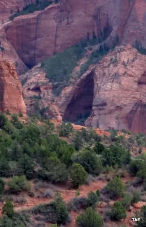
16.2 miles of LaVerkin Creek itself is a designated Wild & Scenic River, 7.6 miles in the BLM wilderness, 8.6 miles within Zion National Park. Geologically, the creek has cut its way down the Jurassic-era Navajo sandstone, a remnant of the world's largest geologically ancient desert of sand dunes (what remains of the super-continent Rodinia). These bluffs are along the western edge of the Colorado Plateau and the ancient dunes are exposed in deep layers of multicolored stone that has eroded over the millenia into the slot canyons we see today. There is an aquifer contained in the red layers and seeps and springs flow through soft spots in less-compacted zones of the stone. It's the erosional effect of those seeps, springs and seasonal snowmelt that has cut the steep-sided, deep canyons. That can be also seen among the many slot canyons off to the sides of LaVerkin Creek, all tributaries to the main stream which itself eventually empties into the Virgin River. In spring and early summer the increased waterflow is highlighted by hanging waterfalls fed by snowmelt. That makes the best time to visit summer and fall as in many areas, the trails run through the creekbeds.
The LaVerkin Creek Trail offers 13 designated campsites along its route, mostly in places where the slot canyon opens out a bit and affords views of the tops of the surrounding sandstone bluffs and cliffs. Some campsites may offer a bit of water but most are generally dry camps. Some can be reserved in advance but most are available only on a walk-up basis. The largest sites have a maximum group size of 12 while most of the campsites are limited to a group size of 4.
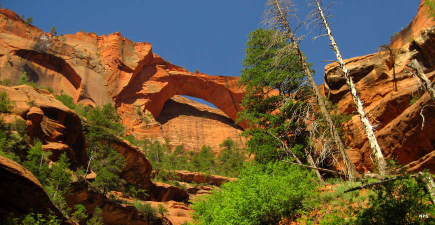
Kolob Arch
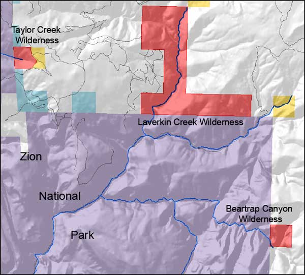
Map of the LaVerkin Creek Wilderness area
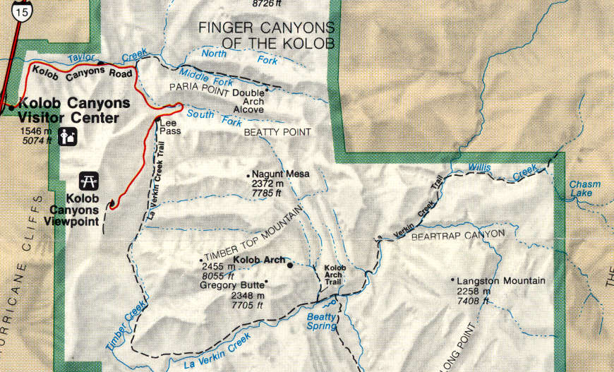
LaVerkin Creek Trail map
Kolob Arch photo courtesy of the National Park Service
Other photos courtesy of TheArmchairExplorer, CCA-by-SA 4.0 International License
Shaded map courtesy of the Bureau of Land Management
Trail map courtesy of the National Park Service
Other photos courtesy of TheArmchairExplorer, CCA-by-SA 4.0 International License
Shaded map courtesy of the Bureau of Land Management
Trail map courtesy of the National Park Service
Related Pages
Beartrap Canyon Wilderness
Blackridge Wilderness
Canaan Mountain Wilderness
Coral Pink Sand Dunes State Park
Cottonwood Point Wilderness
Deep Creek North Wilderness
Deep Creek Wilderness
Blackridge Wilderness
Canaan Mountain Wilderness
Coral Pink Sand Dunes State Park
Cottonwood Point Wilderness
Deep Creek North Wilderness
Deep Creek Wilderness
Map courtesy of National Geographic Topo!