Jewel Cave National Monument

A calcite flower
Jewel Cave is the second longest cave on Earth. 151 miles of underground cavern have been mapped so far and the exploration isn't over yet.
Jewel Cave was first discovered around 1900. That year Frank and Albert Michaud filed a mining claim on the property after discovering an opening in the ground with cold air flowing from it. They had to enlarge the entry with dynamite in order to see what was inside. As calcite crystals had virtually no value in those days, the brothers were probably planning on turning the cave into a tourist attraction. Tourism was already beginning to be an economic force in the Black Hills region back then. A few years later, the Michaud brothers sold their interest in the cave to the federal government (for $750) and President Theodore Roosevelt proclaimed the area a National Monument on February 7, 1908. The National Park Service didn't really start to arrive until 1933 when rangers began appearing in the summer time, sent over from Wind Cave National Park. The Civilian Conservation Corps completed several projects on the property beginning in 1935. A ranger was finally stationed full-time at the monument in 1941. The monument was closed for a while during World War II but other than that, there have been rangers on the property offering guided cave tours since then. In the 1950's there were significant discoveries made in the cave by more intrepid explorers. This led to an expansion in land dedicated to the National Monument in 1965. After that came construction of new parking lots, new cave tour trails, the elevator shafts, a new visitor center and new maintenance area.
Today, the surface area of Jewel Cave National Monument is 1,279 acres. This is in a Ponderosa pine, fir and spruce forest, part of Black Hills National Forest. Air flow studies in the cave indicate that exploration of the underground labyrinth is hardly begun. Modern spelunkers seem to add about three miles of maps to the cave system every year.
 Rafts of calcite in Jewel Cave
In contradistinction to most other caves, Jewel Cave was formed by slowly circulating, acid-rich groundwater flowing in the thick layer of limestone left behind when ancient seas deposited sediments and calcium carbonate seashells across the area. During periods of high evaporation, bodies of calcium sulfate precipitated from the seawater, forming irregular masses of gypsum within the limestone. Over time, that layer of calcium-heavy sediments was compressed to form the Pahasapa Limestone. In the first stage of cave development, thin beds of gypsum near the top of the Pahasapa Limestone dissolved away and overlying layers of limestone collapsed into the voids. At the same time, the sea kept advancing and retreating, at times exposing the limestone layers to the open air and allowing the dissolution that created sinkholes and caves. Then beginning about 320 million years ago, freshwater streams deposited sediments across the surface that became layers of sandstone, limestone and dolomite. These sediments filled in the exposed sinkholes and caves in the Pahasapa Limestone. 60 million years ago (during the latter part of the Laramide Orogeny), the Precambrian rocks of the Black Hills were thrust several thousand feet into the air. As the upthrust was mostly in the form of a "dome," the central layers of overlying softer sedimentary rocks were eroded away exposing that ancient granite. Surrounding that zone, the Minnelusa (sandstone) and Pahasapa (limestone) formations are still in place, allowing the continuing dissolution of limestone and on-going creation of Jewel Cave.
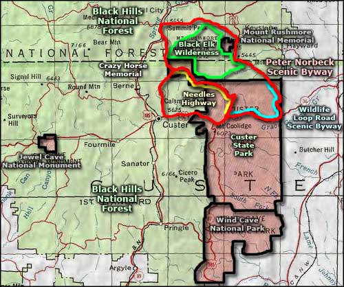
Jewel Cave National Monument is located on US Highway 16, about 13 miles west of Custer, South Dakota and 24 miles east of Newcastle, Wyoming. The Visitor Center is open from 8 am to 7 pm from early June to late August. The rest of the year, the regular schedule is usually 8:30 am to 4:30 pm, every day except Thanksgiving, Christmas and New Year's Days. Entry to the property is free but tours of the cave have fees attached. There is a shorter "Discovery" tour that is easier than the 80-minute hike up-and-down 723 steps along a half-mile loop of the regular tour. The "Discovery" tour only visits one room for about 20 minutes.
Photos courtesy of the National Park Service
Related Pages
Area map courtesy of National Geographic Topo!