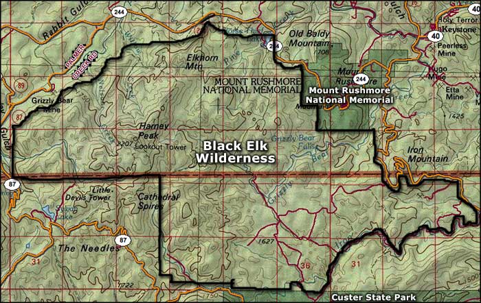
Black Elk Wilderness
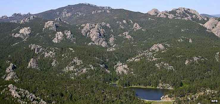
Horsethief Lake in Black Elk Wilderness
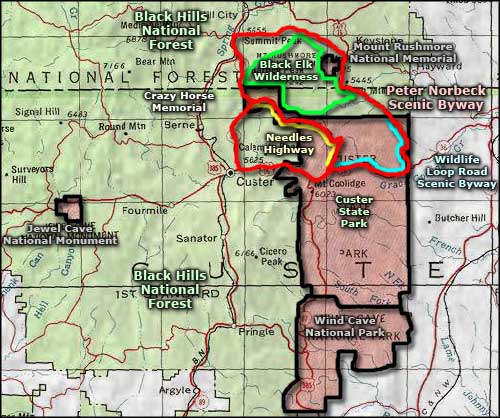
Black Elk Wilderness is a 13,426-acre property within Black Hills National Forest. Contained within Black Elk Wilderness is the Harney Range, a mountain range long held sacred by several tribes of Native Americans. The wilderness is named after Black Elk, a holy man of the Oglala Lakota (Sioux). Black Elk Wilderness is further protected by being surrounded by the 35,000-acre Norbeck Wildlife Preserve.
A dense forest of Ponderosa pine, firs and spruce covers the rocky slopes and craggy peaks. The more rugged areas are where the bighorn sheep and mountain goats hang out. In the rest of the forest you're likely to see elk, mule deer, pronghorn, badger, wolverine, gray wolf, coyote, porcupine, jackrabbit, hawks, falcons and other small mammals and raptors.
There are several trails that wind through Black Elk Wilderness and most of them offer good opportunities for solitude. One trail that doesn't is Harney Peak Trail #9. Harney Peak (7,242') is the highest point in South Dakota and, in season, there's a regular line of "peak baggers" heading for it.
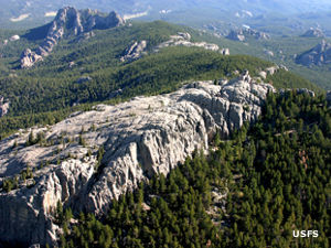
The most popular trail to Harney Peak begins in Custer State Park on the Needles Highway (part of the Peter Norbeck Scenic Byway). The Needles area is filled with granite columns, spires, domes and pinnacles. The trail is a 7-mile round trip to the summit of Harney Peak and crosses through the region of Cathedral Spires.
Geologically, the granite of the Harney Range was formed as an intrusion during the collision of the Wyoming, Superior, Hearne-Rae and Slave cratons to form the core of Laurentia about 1.72 billion years ago.
Photos courtesy of the US Forest Service
Map of Black Elk Wilderness courtesy of National Geographic Topo!
Map of Black Elk Wilderness courtesy of National Geographic Topo!
Related Pages
Area map courtesy of National Geographic Topo!