Glade Run Recreation Area

Glade Run Recreation Area
Glade Run Recreation Area is 19,000 acres of prime Four Corners countryside: rolling terrain, sandy arroyos and slick rock with pinons, junipers, sagebrush and rabbitbrush separated by sparse native grasses. About 3,800 acres on the southern side of the site are managed as an open OHV area. The northern 3/4 of the site are managed as a limited trail use area with about 42 miles of marked trails for use by mountain bikes and motorized trail bikes. Many of these trails are through sandy washes and over some challenging slick rock. Glade Run Recreation Area is also a favorite among rock crawling enthusiasts: the folks who maneuver their highly modified 4WD vehicles over boulders, rock piles, slick rock and mountain foothills that most folks would consider impassable.
There are no facilities on the property, not even restrooms. The property lies between NM 170, 574 and 516 with multiple signed entry points on dirt roads. The site is bounded by private property and there are some parcels of private property within the recreation area. Don't cross fences or drive past signs marking private property and you should be fine.
There are active gas wells on the Glade Run Recreation Area. That means well pads, traffic, heavy trucks, pipelines and miscellaneous oilfield equipment. Be careful around these.
Glade Run Recreation Area is open year round, although sections of it may be closed for short periods of time for authorized events or competitions. In the limited trail use area, keep your vehicle on oilfield roads or on signed trails and two-tracks or in the bottoms of dry, unvegetated arroyos that are wide enough for your vehicle to get through. In bad weather, the roads here may be impassable.
Special rules:
> You need a permit for overnight use.
> No firewood gathering allowed.
> No shooting of any kind.
> You need a permit for any competitive, commercial or organized group events.
Maps: BLM - Farmington; USGS - La Plata, Flora Vista, Adobe Downs, Farmington North
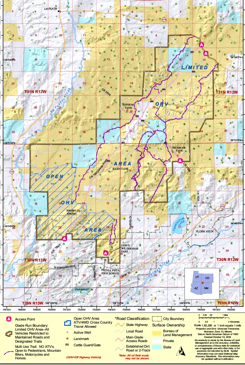
Glade Run Recreation Area map: Click on the map for a larger version
Upper photo courtesy of TheArmchairExplorer, CCA-by-SA 4.0 License
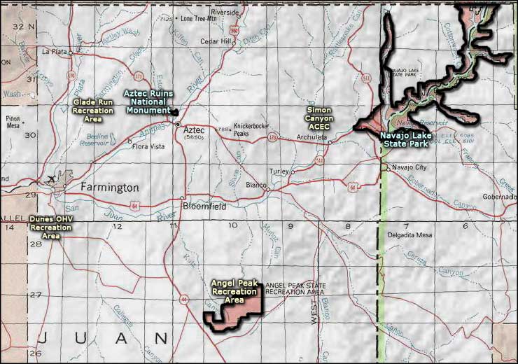
Related Pages
Map courtesy of National Geographic Topo!