Comanche National Grassland
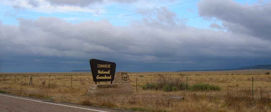
Comanche National Grassland

Allosaur tracks
Comanche National Grassland is a 463,373-acre property in two non-contiguous parcels. The Carrizo Unit is in the Springfield area, the Timpas Unit south of La Junta. Both sections contain prairie grasslands and deep canyons. The Picketwire Canyon area of the Timpas Unit is famous for a long stretch of exposed dinosaur tracks along the riverbed.
Archaeological artifacts found in the area indicate there has been human habitation going back at least 5,000 years. The dinosaur tracks are estimated to be around 150 million years old, from a time when this area was covered with an inland sea and the Purgatoire River bed was a shoreline along which large numbers of dinosaurs lived. Evidence found in the tracksite has changed our views about how dinosaurs lived as the evidence points to babies and young ones traveling in groups with their parents. The trackways parallel the Purgatoire River for one-quarter mile and contain 1,300 visible dinosaur tracks in four different layers that comprise about 100 different trackways. This site yields more footprints than all other known Morrison tracksites combined, including many that are well preserved.
These 150 million year old layers of strata form part of the Late Jurrasic Morrison Formation which is famous for producing fossilized skeletons of Brontosaurus, Stegosaurus and Allosaurus at sites like Dinosaur National Monument. Some folks see the Purgatoire River site as the national treasure trove of dinosaur footprints.
In some layers the tracks are very clear but in others they've been heavily trampled. The impact of large dinosaur activity can also be seen in the trampled plant stems and a collection of several dozen clams that were killed by the heavy footfalls of Brontosaurs.
There are a number of pieces of Rock Art (images carved or painted onto stone surfaces) found along the trail in Picketwire Canyonlands. Due to the lack of research, little is known of the prehistoric American Indians of this area. Archaeologists think they were a nomadic, hunter-gatherer people whose visits to the area were short as they followed migrating game. Some of the Rock Art in this area is estimated at 375 to 4,500 years old.
The Dolores Mission and Cemetery was built sometime between 1871 and 1889 when Mexican pioneers first began making permanent settlements in the valley. Partial remains of the mission and cemetery are still visible.
The Rourke Ranch, also known as the Wineglass Ranch, was a cattle and horse ranch founded by Eugene Rourke in 1871. Three generations of the Rourke family lived and worked on the ranch ensuring its survival for more than 100 years. When the ranch was sold in 1971, it was known throughout southeast Colorado as one of the oldest and most successful local enterprises, expanding from Eugene's original settlement of 40 acres to well over 52,000 acres.
In 1820's the Mountain Branch of the Santa Fe Trail was established through the Timpas Unit. Traffic along the Trail continued until the Atchison, Topeka and Santa Fe Railroad laid tracks beside it and ran the first train through around 1879. Settlers moving west across the plains began filling in the Grassland area in the 1850's, most growing Broomcorn and raising cattle. Most of their efforts were defeated during the drought and Dust Bowl of the 1930's, leaving abandoned farms and homesteads all across the landscape. The Federal Government bought up all the vacant land and deposited it back in the Federal Land Bank. Come 1960 and Comanche National Grassland was born. When the Wineglass Ranch went up for sale in 1971, the US Forest Service bought it and added its acreage to the Grassland.
Today, Comanche and Cimarron National Grasslands plus Pike and San Isabel National Forests are operated out of a common office in Pueblo, CO. The Forest Service tends to run a single guided tour of the Picketwire Canyon tracksite every spring, depending on water levels in the Purgatoire River. The tour group gathers at the pipe gate and drives slowly into and through the canyon until reaching the tracks. Other than that single driving tour, visitors can reach the tracksite only via foot or bicycle.

Picketwire Canyon, a special place on Comanche National Grassland
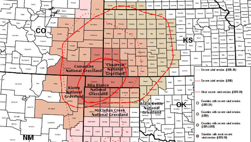
The heart of the Dust Bowl

Upper photo courtesy of TheArmchairExplorer, CCA-by-SA 4.0 License Upper left photo courtesy of Flickr userid cm195902, CCA 2.0 License
Lower photo courtesy of Wikipedia userid Hogs555, CCA-by-SA 3.0 License
Maps courtesy of the US Forest Service