Casa Grande Ruins National Monument

Casa Grande Ruins National Monument
The site that we now call Casa Grande Ruins National Monument was abandoned around 1450 CE after the area had been occupied for at least 1,000 years. The first recorded visit by a European to the site was that of Father Eusebio Francisco Kino in 1694. In his journal entry about his visit he used the words "casa grande" and the name has stuck ever since. The de Anza Expedition to California came this way in 1775 and they spent a day in the area before moving on. The next big recorded visit was when Brig. Gen. Stephen Watts Kearny traveled through, also on the way to California, in 1846. Then came the onrush of pioneers to settle in Arizona. More and more people visited the ruins and went digging for artifacts. After surviving 400 years of exposure to the elements, "Americans" were systematically destroying the place in a few short years. Finally, in 1892 President Benjamin Harrison signed the papers setting aside and preserving one square mile of Arizona desert around the central ruin. President Woodrow Wilson signed the papers making the property a National Monument in 1918.
The Civilian Conservation Corps built the visitor center, parking lot, entrance road and the steel roof over what remains of the original structure of Casa Grande in the mid-1930's. The original structure at Casa Grande was one of the largest prehistoric structures ever built in North America. The building was in the heart of a massive irrigation network and at the center of a large trade network that reached as far south as the Gulf of Mexico and the Sea of Cortez. They brought sea shells from the Pacific Coast, copper bells from central Mexico and parrots from southern Mexico.
We have no idea what the main purpose of the Casa Grande structure was as there were no written/carved records left by the Ancient Sonoran Desert People who built the place. It seems they were descendants of the ancient Archaic culture who survived the transition from hunter-gatherer to a more settled farming existence. They learned to use irrigation techniques and developed a type of "red-on-buff" pottery distinctive to their place and time.
For a thousand years, up until the time of complete abandonment around 1450 CE, they dug canals and grew crops. There are hundreds of miles of irrigation canals in the local Gila River valley, the Salt River valley near what is now Phoenix, the Santa Cruz River valley near what is now Tucson and on most of the designated Indian Reservations in southern Arizona. They grew beans, squash, corn, cotton and tobacco. Apparently, they were very prosperous for their time. The building of the main part of Casa Grande itself happened in the 1300's. It was a large building requiring good planning and organization to collect the massive amounts of materials needed and to channel the efforts of the multitudes of people needed to build the structure. Then, before the century was over, the area began to depopulate until the last remaining residents were gone by 1450.
Several modern Native American tribes trace their ancestors back to Casa Grande and there are ceremonies held every year in honor of those ancestors. For many folks, simply standing on the grounds evokes a feeling of religiousness.
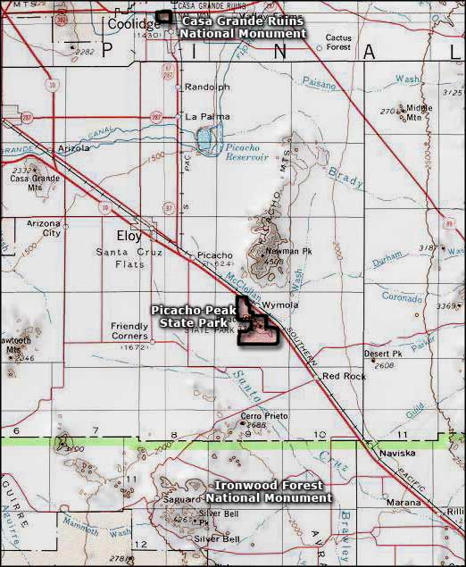
To get there: No, Casa Grande Ruins National Monument is not in the town of Casa Grande. It is nearby in Coolidge. Coolidge is a bit further from Interstate 10 but just get off the highway at any exit for Coolidge and then follow the signs. Casa Grande Ruins National Monument is open from 9 am to 5 pm daily except for Thanksgiving and Christmas Days.

Casa Grande Ruins National Monument
Photos courtesy of the National Park Service
Related Pages
Map courtesy of National Geographic Topo!