Tres Alamos Wilderness
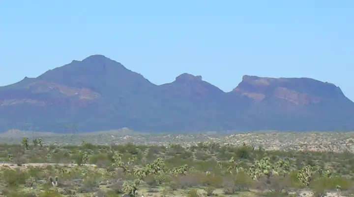
The Tres Alamos monolith, from the Joshua Forest Scenic Byway
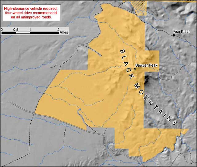
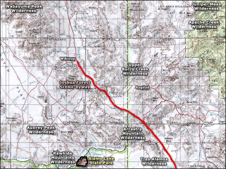
Tres Alamos Wilderness is 8,300 acres of very rugged countryside between US Highway 93 (the Joshua Forest Scenic Byway) and Alamo Lake State Park. Across a jeep trail to the north is Arrastra Mountain Wilderness.
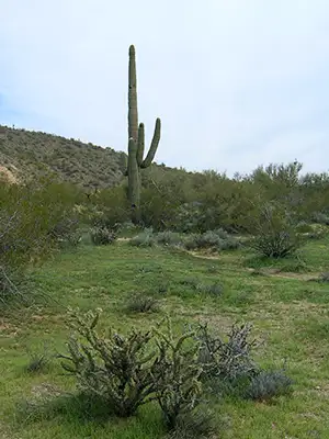
The western half of the property is mostly the lower plains and desert bajadas descending from the canyons, washes and ridgelines of the Black Mountains that occupy the eastern half of Tres Alamos Wilderness. At 4,293 feet, the high point in the mountain range and the wilderness is Sawyer Peak, part of a multi-colored monolith visible for miles in all directions. Vegetation around here is mostly Joshua trees mixed with creosotebush. In the wetter washes you'll find acacia and mesquite, although prickly pear, ocotillo, saguaro, cholla and paloverde are scattered everywhere. There isn't much for wildlife in this forbidding landscape but you might come across a Gila monster or two... maybe some rattlesnakes, lizards and a kit fox.
To get to Tres Alamos Wilderness you're going to need a 4WD with high clearance. Most folks come in from the Palmerita Road (northeast of Alamo Lake) and that last 13 miles of road going to the wilderness boundary is something to write home about. Between October and April you'll find the temperatures don't usually top out above 100°F.
There are no formal trails on the property but a few burro trails from the old days still remain. In the bajadas and plains areas the washes aren't too bad for getting around but once you start up the hill, it gets rugged quickly. There are some springs marked on the better USGS maps but don't count on them: water out there is pretty scarce in the wettest of times.
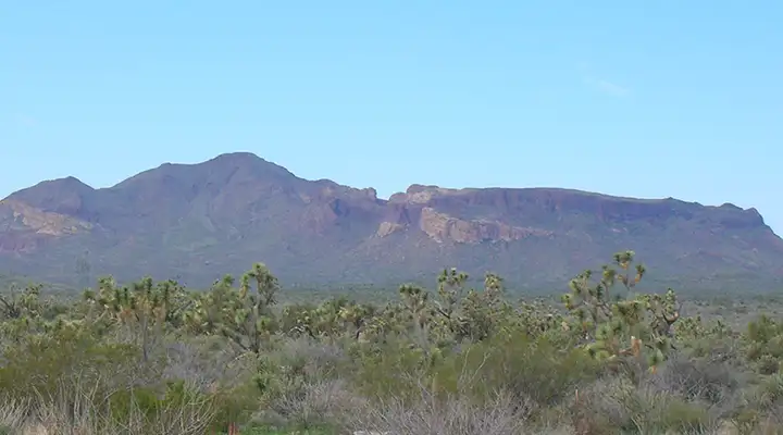
A closer view of Sawyer Peak in Tres Alamos Wilderness
Photos courtesy of TheArmchairExplorer, CCA-by-SA 4.0 License
Map courtesy of the Bureau of Land Management
Related Pages
Map courtesy of National Geographic Topo!