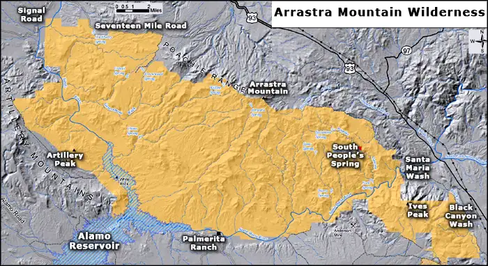
Arrastra Mountain Wilderness
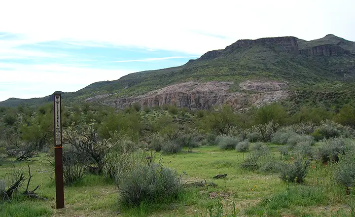
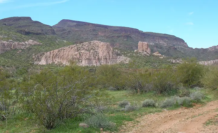
The view west at the eastern Arrastra Mountain Wilderness boundary
Arrastra Mountain Wilderness is a 129,800-acre property located west of US Highway 93 (the Joshua Forest Scenic Byway) and north of US Highway 60. Alamo Lake State Park is directly to the west and there are several possible access routes from that area. There are two access routes from Highway 93: one at milepost 143 and another at milepost 155. Just finding an access route is where the fun begins because this wilderness is severely sign-challenged. Getting to the wilderness boundary on a dry day will require high clearance. Wet days are another story...
I went in by Black Canyon Wash, near milepost 143. There was virtually no signage, you just have to keep your eyes on that big forbidding Poachie Mountain Range and head in that direction. The first indication of the wilderness boundary was about six miles in from the pavement. That road along the wilderness boundary travels northwest along that boundary for maybe five miles before dead-ending at a drop-off at the edge of the wash. So I backed up a bit, turned around and headed back down toward the big sandstone pillars. Once I was on foot, I still had to cross Black Canyon Wash, a wide, deep arroyo that had water flowing in spots (I was there in early March, late winter rainy season).
The lava escarpments up above were forbidding but the buff/orange mudstone pillars were an interesting addition to the viewscape. This is one of those areas where I wish I'd had more time to explore. There were a lot of tracks running up and down in the bottom of the wash but not much going up the west bank and into the deeper wilderness area.
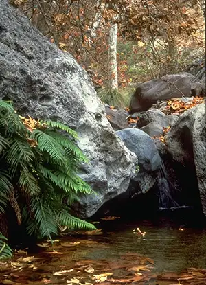
The spring in People's Canyon
The BLM blurb about Arrastra Mountain Wilderness says there are no maintained trails in this very rugged countryside, just a few old jeep trails that lead to abandoned mine sites and a few burro trails in the higher back country. These days, the most commonly used routes in the area seem to be the sandy washes that snake around the place but I'm one of those folks who tend to head for the highest point I can reach so I can see what's on the other side. I hiked around for a good part of a day and didn't make even a dent in the place. If I had a "wilderness bagging" list, I'd have marked this one for a return visit when I have several days to hang out.
The two major washes in this area, the Santa Maria (across the middle of the wilderness) and the Big Sandy (down the western side of the wilderness), form the "headwaters" of the Bill Williams River. The two washes come together just northeast of Alamo Lake, although in a really wet year, the lake expands above the confluence of the two streams. But the upper reaches of both washes are classed as "ephemeral," meaning: only flowing on the surface if it's been raining hard for a few hours. However, if you dig down a few feet in the sand, you just might come across usable water flow. Once you get up the hill into all that lava, there's only a few isolated springs and you need to have a good map to find them.
There is a still-active jeep trail along the southeastern edge of Arrastra Mountain Wilderness that separates Arrastra Mountain from Tres Alamos Wilderness. Around the western side of the wilderness are several old mining sites, some of which may soon be reactivated. The Artillery Mountains area in particular (which range runs along the western side of Arrastra Mountain Wilderness) is rumored to contain sizable reserves of manganese, vanadium, gold and uranium.
As sharp as these mountains are on the northern and eastern slopes, the western and southern slopes are much more gentle. I think next time I go in I'm going to go by Alamo Lake State Park and take the road that leads to Palmerita Ranch and the trail heads along the southern and western sides of the Arrastra Mountain Wilderness.
I did some hiking around on this property in the early spring one year. However, it wasn't early enough (too hot) and it was very humid (recent heavy rains). Hikers here want to be dedicated.
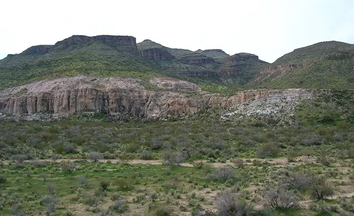
Lava flows make up the higher elevations of Arrastra Mountain Wilderness
Sandstone outcroppings in the lower reaches of Arrastra Mountain Wilderness
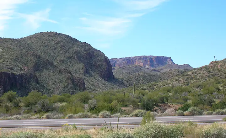
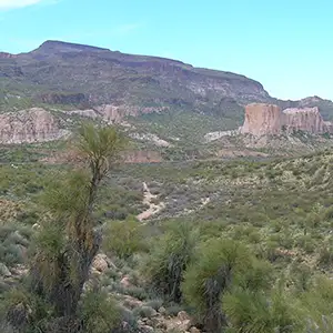
The view west near Santa Maria Wash
Most photos courtesy of TheArmchairExplorer, CCA-by-SA 4.0 License
Photo of Peoples Spring and map of the wilderness area courtesy of the Bureau of Land Management
Related Pages
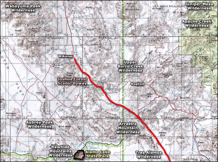
Map courtesy of National Geographic Topo!