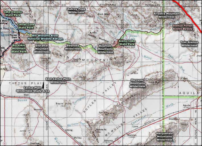
Rawhide Mountains Wilderness
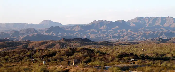
The Rawhide Mountains from Swansea
The Rawhide Mountains Wilderness straddles the Mohave-La Paz county line just west of Alamo Lake State Park. The 38,470-acre property also straddles two mountain ranges: the Buckskins on the south and the Rawhides on the north. In between is an 8-mile stretch of the Bill Williams River. Five miles of that stretch of river is through a gorge with cliffs rising as much as 600 feet above the water. The area also has several side canyons that offer small waterfalls (in season). The canyon bottom is a riparian environment that supports a cottonwood-willow plant community complete with beavers, amphibians, reptiles and raptors (including at least one nesting pair of bald eagles). Because of those eagles, the canyon bottom below Alamo Dam is often closed in late winter and spring to reduce disturbance to the nesting area.
Above the canyon rim is desert vegetation typical of that area where the Sonoran and Mohave deserts meet: saguaro, ocotillo, yucca, paloverde, ironwood, cholla, prickly pear and Joshua tree. The upper areas of the property also offer little in the way of wildlife: jackrabbit, coyote, western diamondback rattlesnake, various other reptiles and insects... It's kinda dry.
The Buckskin Mountains rise to a high of 3,927' on the summit of Ives Peak, the Rawhides to a high around 2,430'. Both ranges are deeply eroded and cut by washes and canyons. Mississippi Wash is a deep wash that runs down out of the Rawhide Mountains through a narrow canyon with several seasonal waterfalls along the walls.
Most visitors to the Rawhide Mountains Wilderness come to raft the Bill Williams River. The mountains do see more than a few hikers, backpackers, birdwatchers and photographers. Easiest access to the property is via Alamo Lake State Park. The wilderness boundary is just below the dam and along the northwest shore of the lake. The Rawhide Mountains portion of the wilderness is accessible from the east and north via jeep trails running west off the Alamo Road, a dirt road that connects Alamo Lake State Park with Yucca on Interstate 40 about 50 miles to the north. There are dirt roads from the south (off Alamo Road north of the Harcuvar Mountains and Wenden) that allow some amount of access to the Buckskin Mountains but be careful of private property in the area.
7.5-minute topo maps: Artillery Peak, Reid Valley, Rawhide Wash, Alamo Dam
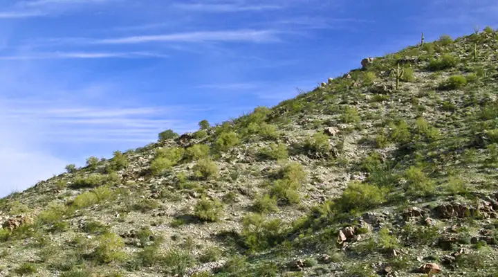
A typical view in the Rawhide Mountains Wilderness
Upper photo courtesy of Chazz Layne, CCA-by-SA 2.0 License
Lower photo courtesy of the Bureau of Land Management
Related Pages
Alamo Lake State Park
Arrastra Mountain Wilderness
Aubrey Peak Wilderness
Bill Williams River National Wildlife Refuge
Buckskin Mountain State Park
Arrastra Mountain Wilderness
Aubrey Peak Wilderness
Bill Williams River National Wildlife Refuge
Buckskin Mountain State Park
Map courtesy of National Geographic Topo!