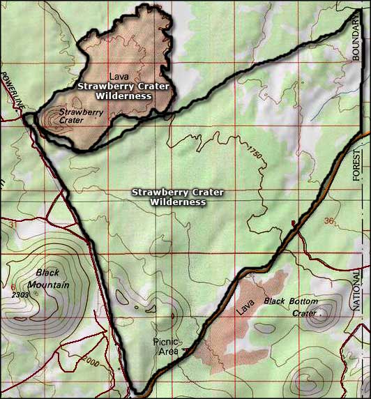
Strawberry Crater Wilderness
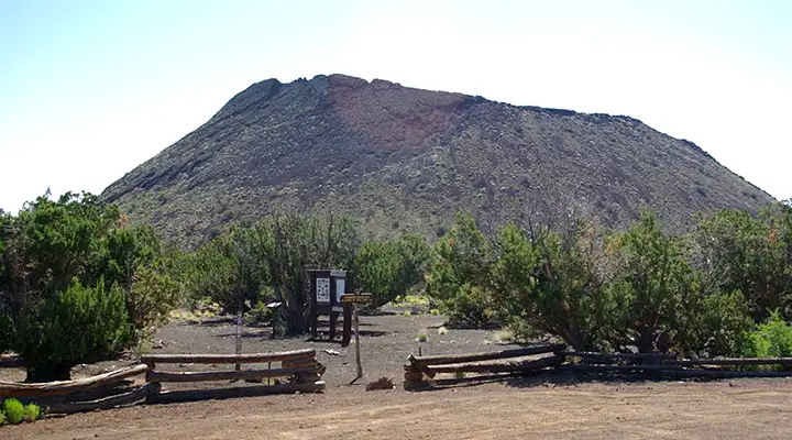
Strawberry Crater itself
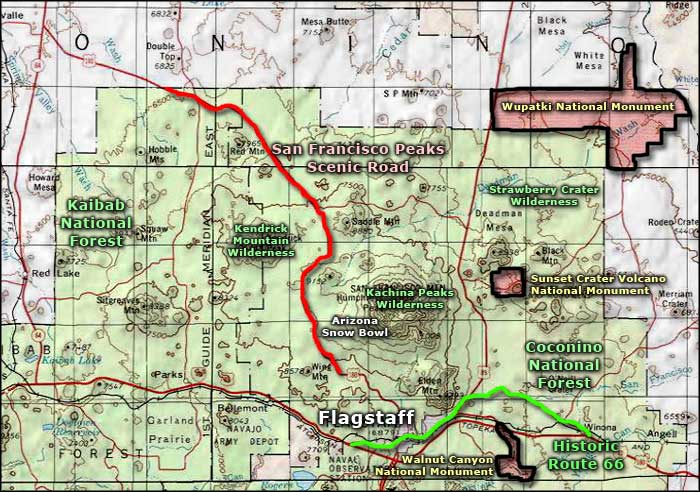
Strawberry Crater Wilderness contains about 10,743 acres of lava-covered countryside in the San Francisco Volcanic Field between Wupatki and Sunset Crater Volcano National Monuments.
There's been volcanic activity in this area for about six million years, the last major eruptions occurring maybe nine hundred years ago at Sunset Crater. Most of the craters in the volcanic field are between 50,000 and 100,000 years old although the stratovolcano that created the Kachina Peaks blew out maybe 400,000 years ago. Strawberry Crater is near the southern end of the Doney Fault, a crack in the ground through which lava used to flow regularly.
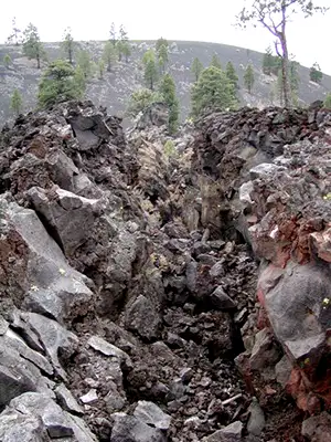
The main geological feature on the property is Strawberry Crater itself but across this cinder-strewn terrain, some of the gently rolling hills are actually the remains of small cinder and spatter cones. The landscape is now quite vegetated but there are lava tubes and other cracks and crevasses in the surface all over Strawberry Crater Wilderness, making a walk in this park not a real "walk in the park."
There's a considerable number of small mammals in the area but larger creatures have problems with the broken surface and sharp, jagged rocks. From the tops of the higher cones, you can get a view to the east of the Painted Desert, the Hopi Buttes and the valley/canyon of the Little Colorado River. Most folks who walk this countryside also carry good cameras: they come in the early morning and just before sunset to get good colors in the air and great shots of the broken ground and twisted junipers.
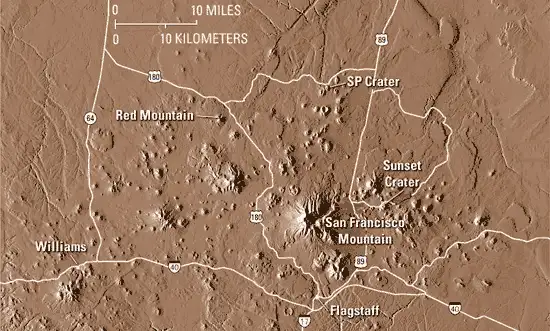
The San Francisco Peaks Volcanic Field
Upper photo courtesy of the USGS
Upper left photo courtesy of Mark Turner
Lower photo courtesy of Wikipedia userid Arne-kaiser, CCA-by-SA 3.0 License
Map courtesy of National Geographic Topo!
Related Pages
Map courtesy of National Geographic Topo!