Harcuvar Mountains Wilderness
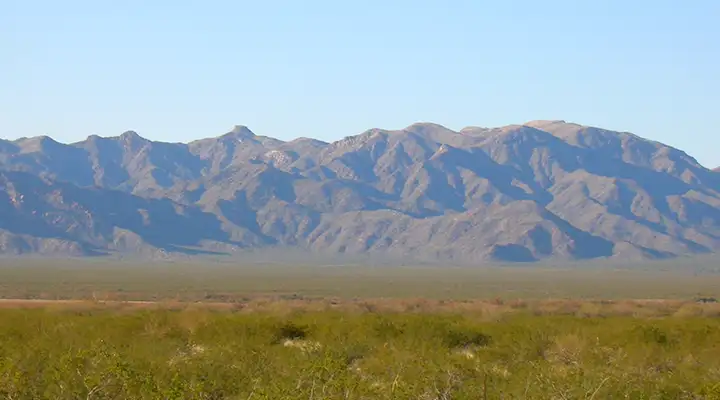
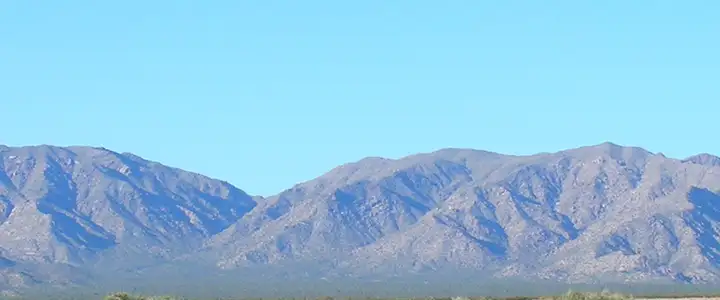
The Harcuvar Mountains
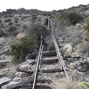
Inclined railway to the Bonanza Mine
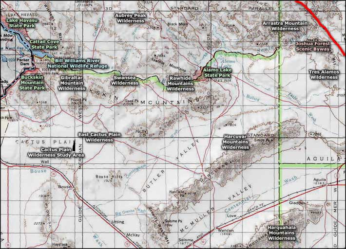
The 25,050-acre Harcuvar Mountains Wilderness is located about 82 miles northwest of Phoenix, north of US Highway 60, west of US Highway 93 and east of the road leading to Alamo Lake State Park.
There's about 10 miles of that eastern upper ridgeline of the Harcuvars contained within the designated wilderness area. Elevations vary from about 2,400' on the lower bajadas to more than 5,100' along that upper ridge. A lot of Harcuvar Mountains Wilderness is prime real estate for desert bighorn sheep, mountain lion, bobcat, mule deer, Gila monster and desert tortoise, but there's also a 3,500-acre island of cut-off interior chaparral habitat on the north side of that upper ridge. Reminiscent of the flora and fauna situations of the "sky island" habitats found in the mountain ranges of southeastern Arizona, that chaparral habitat allows several reptile species (Gilbert's skinks, desert night lizards, rosy boas) to exist there, far from any contact with their parent populations.
Most folks access the Harcuvar Mountains Wilderness using dirt jeep trails running north from US Highway 60 or south from the Alamo Dam Access Road (north of Wenden). The remoteness and ruggedness of the area coupled with the need for 4WD just to get to the foot of the hills makes this area a prime candidate for those folks seeking real solitude. The hunting is so-so, the climbing is good, the hiking, backpacking and camping are excellent. So are the views at the top.
Be careful of the private lands that abut the wilderness boundary. There are also a number of old mine sites on the property with broken down buildings, concrete foundations and rusty hardware slowly dissolving into the landscape.
The Harcuvar Mountains
Upper left photo courtesy of nowhereman
Other photos courtesy of TheArmchairExplorer, CCA-by-SA 3.0 License
Other photos courtesy of TheArmchairExplorer, CCA-by-SA 3.0 License
Related Pages
Alamo Lake State Park
Arrastra Mountain Wilderness
Aubrey Peak Wilderness
Bill Williams River National Wildlife Refuge
Buckskin Mountain State Park
Arrastra Mountain Wilderness
Aubrey Peak Wilderness
Bill Williams River National Wildlife Refuge
Buckskin Mountain State Park
Map courtesy of National Geographic Topo!