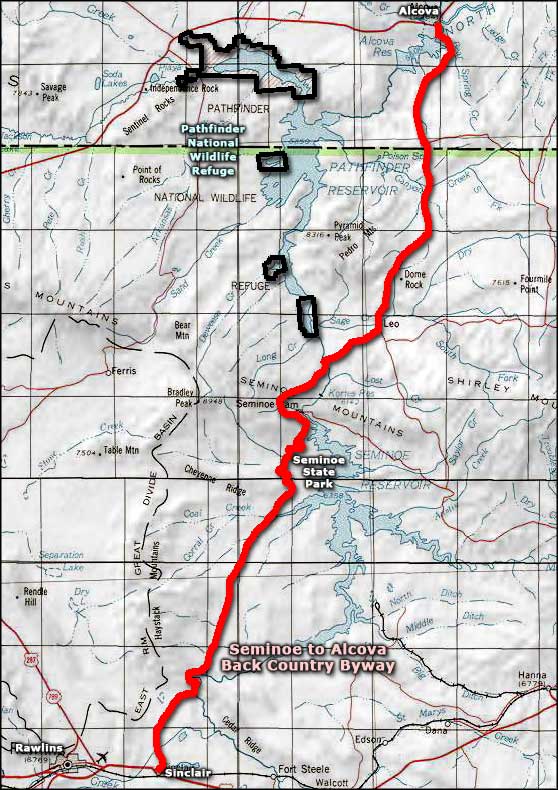
Seminoe to Alcova Backcountry Byway
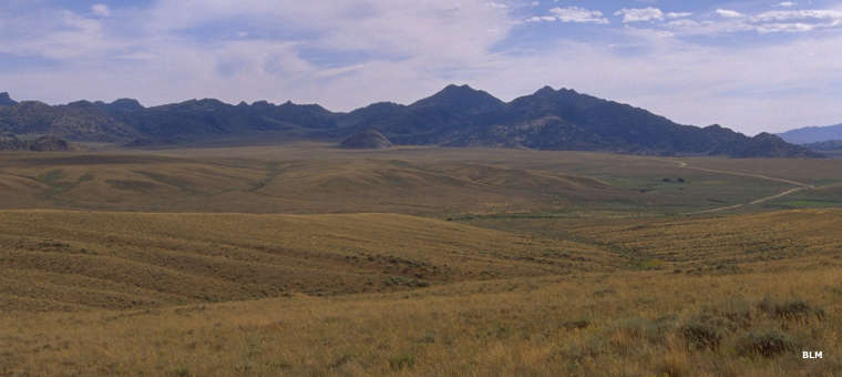
Along the Seminoe to Alcova Backcountry Byway
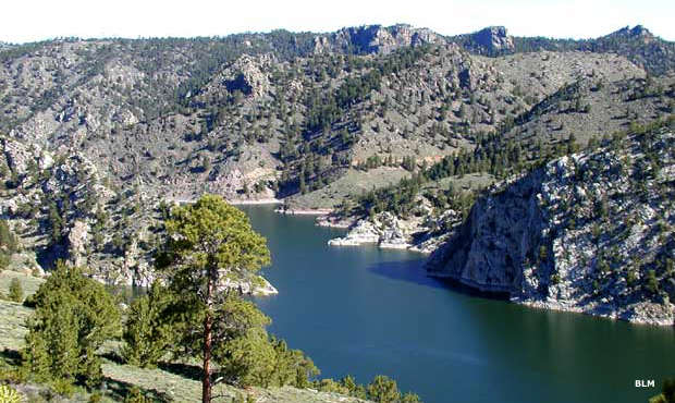
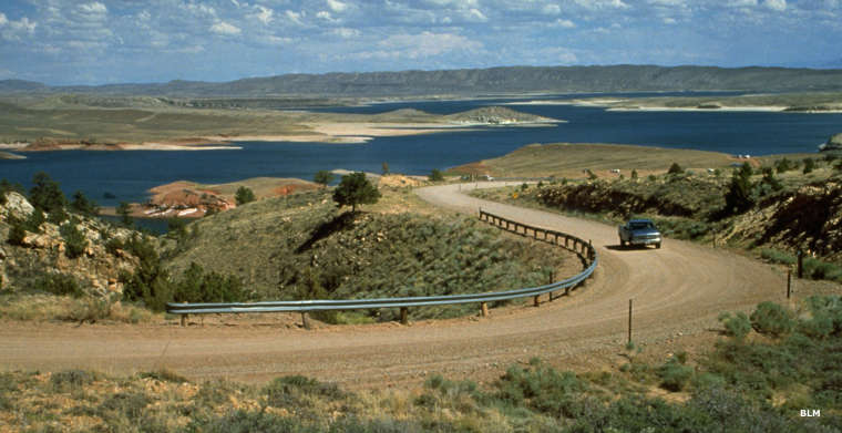
Seminoe Reservoir
The Seminoe to Alcova Backcountry Byway is a 64-mile route over mostly gravel roads that connects Sinclair (on Interstate 80) with Alcova. Most passenger cars can drive the road safely from May to November but north of Seminoe State Park and over the Seminoe Mountains to Miracle Mile (a seven-mile-long blue-ribbon trout fishery on the North Platte River) is a section of steep and often heavily washboarded gravel. It's not a place for RVs or vehicles pulling trailers. There are no services between Sinclair and Alcova so you'll want to be sure your gas tank is full and your spare tire is in good shape. You might also want to have extra food, clothing, camping gear and drinking water: the weather can change drastically in a matter of minutes in this landscape. There are developed campgrounds at the Dugway Recreation Area, Seminoe State Park and on the Miracle Mile section of road. You can also camp anywhere on publicly-administered land (as indicated by the BLM signage).
Gold was discovered in the Seminoe Mountains in 1868 but those first prospectors didn't live long enough to make a penny off their discovery. One of them went to town to register their claim but he was shot that same day "just for luck" said one newspaper reporter in his article about the occurrence. An Army lieutenant was sent to their camp to tell the others what happened but on his arrival he found them dead of Native American causes. Along the way, that lieutenant found some gold nuggets lying on the ground. He and some friends returned to the area in 1871 and started mining. By 1872 there were about 1,000 miners in the area. They were forced out by the Native Americans by 1874. That same year Buffalo Bill Cody lead an Army expedition through the area but they failed to end the "Indian problem." That wasn't solved until the general Indian Wars were over by 1878 or so.
Mining booms have come and gone since then with silver found in the Ferris Mountains, coal near Dugway, jade in the Seminoes, copper and iron near Rawlins and soda in the soda lakes to the northwest. More recently there's been a lot of drilling for oil and gas, the latest rush being for coalbed methane. There are still many active hardrock claims in the area.
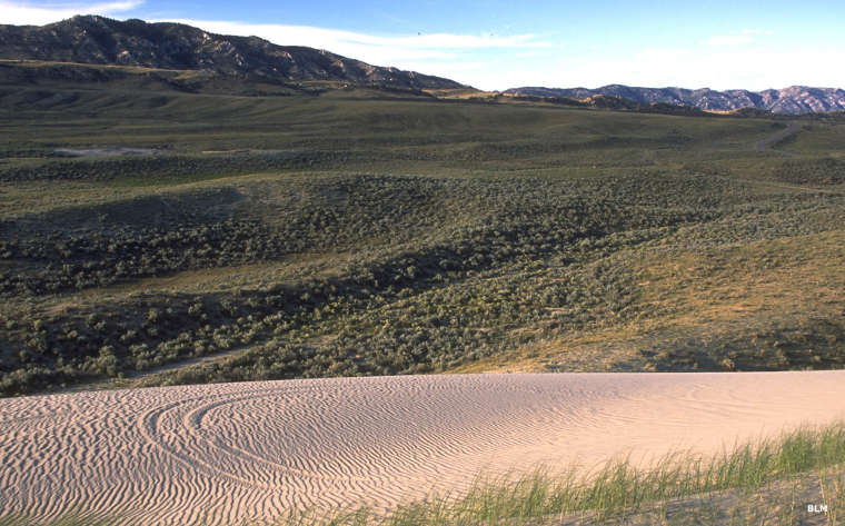
This area of Wyoming is a bit east of the Great Basin Desert but is still among the most arid countryside in the state. Since the Bureau of Reclamation started building dams on the larger rivers in the area, though, it has been transformed into one of the best water-recreation sites in Wyoming. Alcova Reservoir is a favorite among boaters, sailors and fishermen. There's even sandy beaches and an excellent restaurant at the marina. Nearby Pathfinder Reservoir is a favorite among the wind-surfing set. Miracle Mile is a stretch of the North Platte River between Alcova and Seminoe Reservoirs, and seems to be overflowing with brown and rainbow trout. Up the hill from Miracle Mile is the steep, gravel section of the back country byway. You'll also find a set of huge sand dunes up there, part of the Killpecker dune field that crosses Wyoming into western Nebraska.
Seminoe State Park offers campsites and boat ramps all along the shores of Seminoe Reservoir. The 20-mile road from there to Sinclair is an easy one for trailers and RVs, just don't try to push them up and over the Seminoe Mountains.
This is wide open countryside with a lot of sagebrush and not much else. There are junipers and some pines in the higher elevations. For wildlife there are plenty of jackrabbits, pronghorn antelope and coyotes. There are rock outcroppings everywhere but the largest are in the Seminoe and Pedro Mountains.
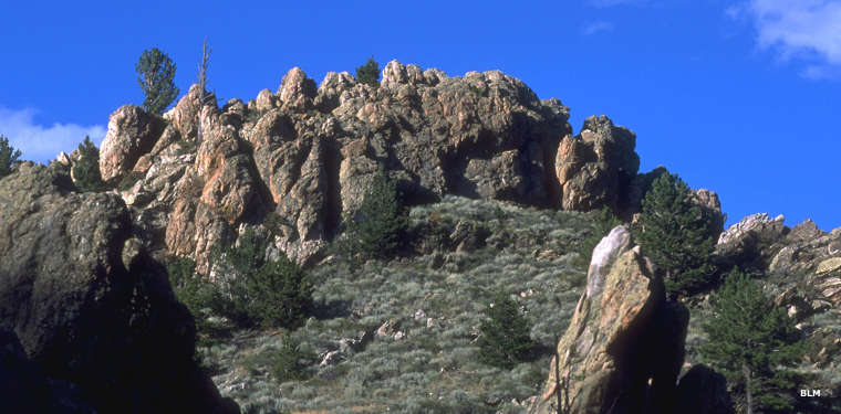
Rock outcroppings in the Seminoe Mountains
Near the Pedro Mountains
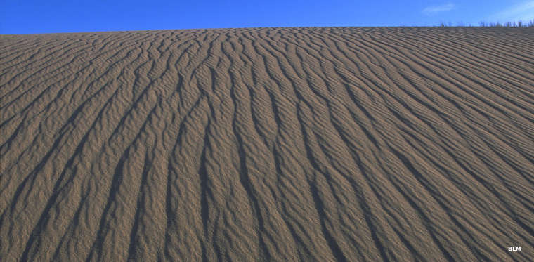
Sand dunes near the Pedro Mountains
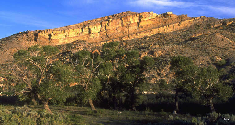
In the Seminoe Mountains
Above Seminoe Lake
Photos courtesy of the Bureau of Land Management
Related Pages
Map courtesy of National Geographic Topo!