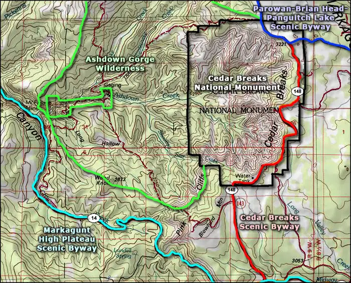
Ashdown Gorge Wilderness

A view into Ashdown Gorge Wilderness from Cedar Breaks National Monument
Ashdown Gorge Wilderness occupies about 7,043 acres on the northern and western sides of the Cedar Breaks National Monument southeast of Cedar City, Utah. This is an area of heavily eroded, multi-colored Wasatch limestone interspersed with meadows and forestland. In the northern end of the property is the Twisted Forest, a significant stand of bristlecone pines, many of which were alive during the time of Christ. Central to the wilderness is Ashdown Creek, the primary eroding watercourse in the area.
Elevations in the wilderness area range from about 8,000' to a high near 10,400'. This area can see significant snow in season (Brian Head Ski Resort is just over the other side of an 11,306' hill) and the creeks tend to flow all year round.
You'll find mule deer, chipmunks, voles, yellow-bellied marmots, mice and golden-mantled ground squirrels in the woods. That is, if you can get in the woods: there's less than 10 miles of trails in Ashdown Gorge Wilderness. The 5-mile-long Rattlesnake Trail follows Rattlesnake Creek along the northern boundary of Cedar Breaks National Monument before turning to run east-west across the wilderness to meet up with the Potato Hollow Trail. The Potato Hollow Trail then runs south for 2.5 miles to a fork: one side goes to the trail head at the edge of the wilderness, the other side to the Blowhard Trail, climbing Blowhard Mountain... and that's pretty much it for developed trails in Ashdown Gorge Wilderness.

Looking up at the Pink Cliffs
Photos courtesy of TheArmchairExplorer, CCA-by-SA 4.0 License
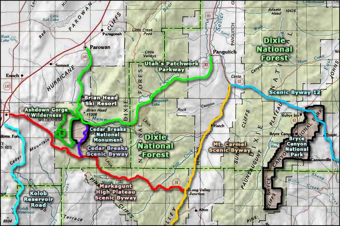
Map courtesy of National Geographic Topo!
Map courtesy of National Geographic Topo!
Related Pages
Map courtesy of National Geographic Topo!