Arches National Park


Balanced rocks, fins and spires
Arches National Park preserves over two thousand natural sandstone arches in addition to a variety of unique geological resources and formations such as balanced rocks, fins and pinnacles. The extraordinary features of the park are highlighted by a striking environment of contrasting colors, landforms and textures.
The forces of nature have acted together to create the landscape of Arches. Throughout the park, rock layers reveal millions of years of deposition, erosion and other geologic processes. These layers still continue to shape life in Arches as their erosion influences elemental features like soil chemistry and water flows. Arches is located in a "high desert," with elevations ranging from 4,085 to 5,653 feet above sea level. The climate is one of very hot summers and cold winters with very sparse precipitation. On a daily basis, temperatures may fluctuate as much as 50 degrees. The plants and animals in Arches have adapted in many ways that enable them to survive these conditions. The diversity of living things reflects the variety of available habitat, which includes lush riparian areas, ephemeral pools, dry arroyos, mixed grasslands and large expanses of bare rock.

Park Avenue, in Courthouse Wash

Through a red rock fin
To many, the most outstanding natural features of Arches are the park's geologic formations. Over 2,000 cataloged arches range in size from a three-foot opening (the minimum considered to be an arch), to Landscape Arch which measures 306 feet from base to base.
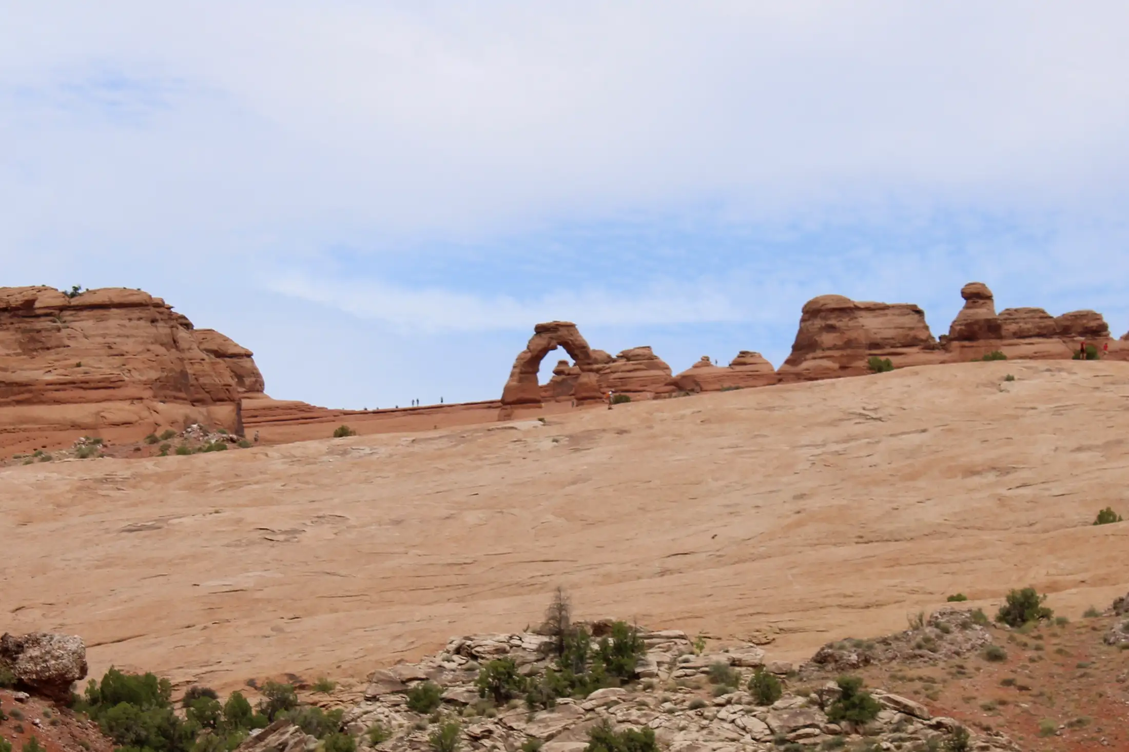
Delicate Arch

On the path to Devils Garden
Towering spires, fins and balanced rocks complement the arches, creating quite an assortment of formations in a relatively small area. Two unusual natural features common in Arches intrigue both scientists and visitors: cryptobiotic soil and potholes. Cryptobiotic soil is a living ground cover that forms the foundation of high desert plant life. Potholes are naturally occurring basins in sandstone that collect rainwater and wind-blown sediment. These potholes harbor organisms that are able to survive long periods of dehydration, and also serve as a breeding ground for many desert amphibians and insects. Both of these communities are easily impacted by human activities.

Arches National Park lies over an underground salt bed called the Paradox Formation which is responsible for the arches, spires, balanced rocks, fins and eroded monoliths scattered throughout the park. Thousands of feet thick in places, the Paradox Formation was deposited over 300 million years ago when the area was sea bottom. Over millions of years, the salt bed was covered with the residue of floods and winds as the seawaters returned and evaporated again and again. Much of this debris has been compressed into sandstone. At one time this overlying layer of rock may have been more than a mile thick. Salt under pressure is unstable and can flow under heavy weight. This movement in the salt caused the surface rock to buckle and shift, thrusting some sections upward into domes, dropping others into surrounding cavities, and causing vertical cracks which would later contribute to the development of the arches. As the subsurface movement shaped the surface, erosion stripped away the younger rock layers on top. Water seeped into cracks and joints, washing away loose debris and eroding the "cement" that held the sandstone together, leaving a series of free-standing fins. During colder periods, ice formed, its expansion putting pressure on the rock, breaking off bits and pieces, and sometimes creating openings. Many damaged fins collapsed. Others have survived as the formations of Arches National Park that we see today.

An arch in the distance, in the red rock of Devils Garden
Faults deep in the Earth also contributed to the movements on the surface. The result of one such 2,500-foot displacement is called the Moab Fault and is visible from the Arches Visitor Center. Another such displacement formed the Salt Valley. Except for isolated remnants, the major rock formations visible in the park today are the tan-colored Navajo Sandstone and the salmon-colored Entrada Sandstone of which most of the arches are composed.
Note: In 2023, Arches National Park implemented an appointment system for entry. The massive spike in traffic the last few years forced it. That said, I was last there a couple days before Labor Day, 2023, and made an appointment that allowed me in about 40 minutes later. Once in, take as long as you want.

The map is courtesy of National Park Service
Photos are courtesy of TheArmchairExplorer, CCA-by-SA 4.0 License
Photos are courtesy of TheArmchairExplorer, CCA-by-SA 4.0 License
Related Pages
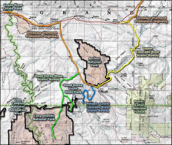
Map courtesy of National Geographic Topo!