Cimarron National Grassland
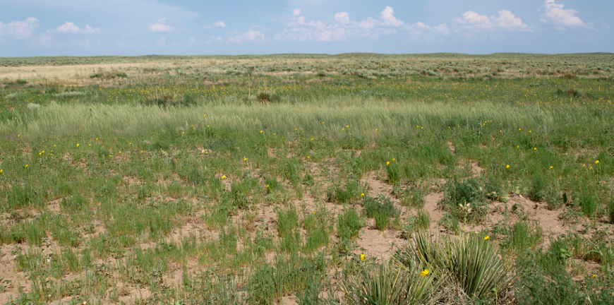
Typical view at Cimarron National Grassland
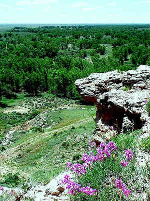
Point of Rocks
The largest piece of public land in Kansas, Cimarron National Grassland is a 108,175-acre property in the southwestern part of the state. Across the state line in Colorado is Comanche National Grassland. To the south is Rita Blanca National Grassland, to the southwest is Kiowa National Grassland. This part of the North American continent is that part hit most hard by the drought and devastation of the Dust Bowl period, from 1935 to 1938. The land had formerly been homesteaded but a combination of disastrous agricultural practices and drought caused much of the area to be abandoned. The National Grasslands were assembled from those abandoned farms. What had to happen first, though, was the Soil Conservation Service had to do their magic to restore the land. Then between 1956 and 1960 the land was transferred to the care of the US Forest Service and all these Grasslands came into being.
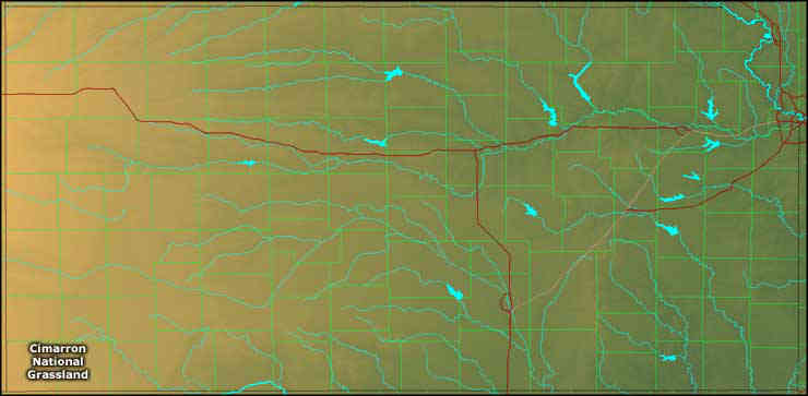
Elevations on the property range from a low around 3,150 feet to a high around 3,540 feet. The landscape is mostly flat with rolling hills and some rock bluffs above the Cimarron River. The vegetation is most grasses, yucca and sage but there are scattered stands of cottonwoods and strips of riparian vegetation along the wetter streambeds and the Cimarron River. The geology is a mix of shale, limestone, sand, gravel and sandstone.
Today, the property is managed for wildlife, water conservation, recreation, minerals production and livestock grazing. Elk were reintroduced in 1981 and a herd of about 50 individuals is maintained. Cimarron National Grassland also has a population of the rare lesser prairie chicken. There are two developed viewing areas for folks to watch the males strut their stuff from mid-March to early June.
About 23 miles of the Cimarron Cutoff of the Santa Fe National Historic Trail cross Cimarron National Grassland. There is also a 10-mile Turkey Trail that wanders through the riparian areas along the Cimarron River. The only other developed recreational resources on the Grassland are at the Cimarron Recreation Area (go 7 miles north of Elkhart, turn east on FSR 700.2 and go about 4 miles). The recreation area offers camping, group camping, fishing ponds, picnic areas and access to the Turkey Trail.
Like Comanche National Grassland, Cimarron National Grassland is administered as a Ranger District of Pike and San Isabel National Forests with a head office in Pueblo, Colorado.
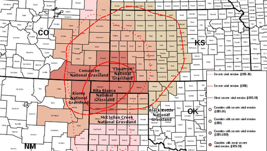
The center of the Dust Bowl
US Forest Service properties in Kansas
Upper photo is in the public domain
Upper left photo courtesy of the US Forest Service
Lower map courtesy of the USDA
Bottom map courtesy of Cartesia MapArt USTerrain
Upper left photo courtesy of the US Forest Service
Lower map courtesy of the USDA
Bottom map courtesy of Cartesia MapArt USTerrain