Ptarmigan Peak Wilderness
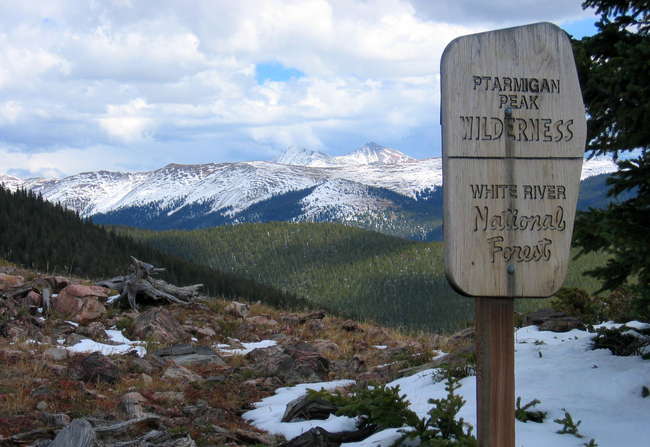
A view along the Ptarmigan Peak Trail
Ptarmigan Peak Wilderness is about 13,175 acres on the southern slopes of the Williams Fork Mountains in White River National Forest. Elevations vary from about 8,800' to 12,458' at the summit of Ptarmigan Peak. The Ptarmigan Peak Wilderness rises from below Ptarmigan Peak and ends at that ridge line. This is typical lodgepole pine forest rising to Engelmann spruce and subalpine fir, then to alpine tundra above treeline.
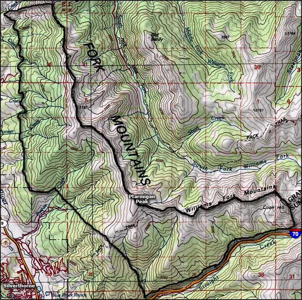
From the boundary along the top of the mountain ridge line, the terrain drops north into the wet and lush drainages of the South and Middle Forks of the Williams Fork River. These areas offer lush riparian meadows and many, many beaver dams making sure the resident brown, cutthroat, brook, and rainbow trout grow large and healthy...
There's not much in the way of hiking trails in this Wilderness. The Ptarmigan Peak Trail begins just outside Silverthorne and crosses Ptarmigan Pass before dropping into the drainages to the northeast, a 7-mile journey each way. The Ute Pass Trail follows the ridge line boundary from Ptarmigan Pass north to Ute Peak (12,303') and then on to Ute Pass, a distance of about 10 miles.
Fast Facts about Ptarmigan Peak Wilderness
- Size: 13,175 acres
- Designated: 1993
- Elevations: 8,800' to 12,458'
- Miles of Trails: 41
- Game Management Units: 37, 371
- Latitude: 40.35°N Longitude: 106.5°W
Upper photo courtesy of Jon Bradford via Summitpost.org
Map courtesy of National Geographic Topo!