Merritt Reservoir State Recreation Area
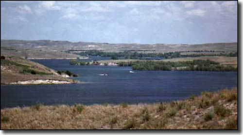
Merritt Reservoir State Recreation Area, from Merritt Trading Post Resort
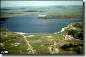
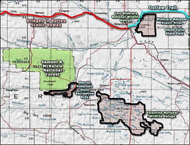
Merritt Dam was built by the US Bureau of Reclamation in a narrow valley along the Snake River. The dam was completed in May 1964 and the reservoir it created has been used primarily for irrigation purposes since. However, the Nebraska Game and Parks Commission administers the water surface and surrounding land for the benefit of wildlife and for recreational purposes. The property encompasses some 9,053 acres, 2,906 acres of which is usually water. The reservoir offers about 44 miles of shoreline. Almost bordering the recreation area to the northwest is the Samuel R. McKelvie National Forest with thousands of acres of grassy and treed sandhills and excellent grouse hunting.
The lake is deep, cold and offers excellent fishing. Anglers usually find plenty of crappie, white bass and walleye in the water, although there are rumors of good-sized catfish in the Snake River arm. There are public boat ramps at Main, Beed's Landing, Snake River and Powder Horn areas. The only established fish cleaning stations are at the Main and Beed's Landing sites.
You'll find 28 camping pads with 20/30 amp electrical service at Cedar Bay Campground. There are another 190 primitive sites scattered around the lake. Some areas have drinking water and vault toilets but most sites are essentially primitive with boat-in access. At the east end of the dam is the Merritt Trading Post Resort with concessions and fee-camping with water and electrical hook-ups. There are modern restrooms and an RV dump station nearby. The Trading Post has fuel and boat rentals available.
There are also about 200 picnic tables with cooking grills scattered around the lake. There are only eight picnic shelters.
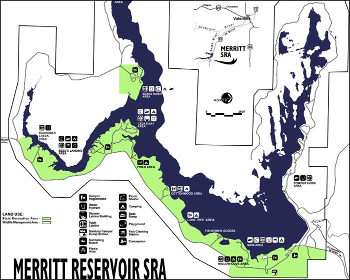
Merritt Reservoir State Recreation Area map
Upper photo courtesy of Merritt Trading Post Resort
Upper left photo courtesy of the US Bureau of Reclamation
Upper left photo courtesy of the US Bureau of Reclamation
Related Pages
Area map courtesy of National Geographic Topo!