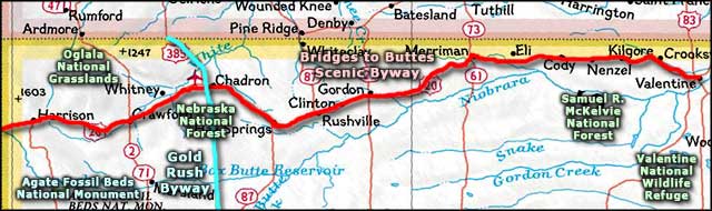
Bridges to Buttes Scenic Byway
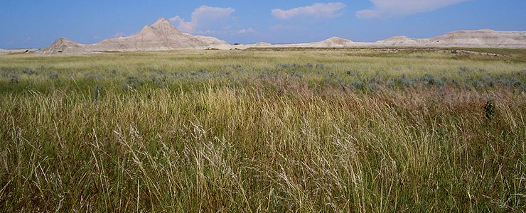
A typical view along the Bridges to Buttes Scenic Byway
The Bridges to Buttes Scenic Byway is a 200-mile route parallel to the northwestern boundary of Nebraska. The highway follows the path of the railroads, running from just east of Valentine to the Wyoming border. This is that area of Nebraska where the landscape finds its most diverse character: rolling sandhills, pine-covered Pine Ridge, high plateaus with views to the Black Hills, and some of the only forested areas in the state.
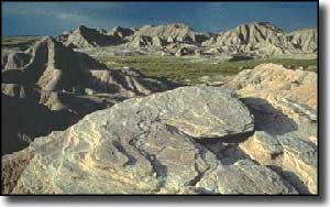
Traveling on the Bridges to Buttes Scenic Byway is like traveling on an old Western movie set: rolling prairie, cattle, pronghorns, cowboys and cowgirls... and a lot of Native American culture, history and tradition. In the western areas you'll also find buttes, mesas and fantastic geological formations, complete with prehistoric fossils. Also along the way are well-preserved frontier military posts, large working ranches and any number of outdoor recreational opportunities.
Along (or near) the Bridges to Buttes Scenic Byway
- Agate Fossil Beds National Monument
- Arthur Bowring Sandhills Ranch State Historical Park
- Box Butte State Recreation Area
- Chadron State Park
- Cowboy Trail
Upper photo courtesy of Brian Kell
Upper left photo © 2001 by Micheal Collins, via Byways.org
Area map courtesy of National Geographic Topo!
Upper left photo © 2001 by Micheal Collins, via Byways.org
Area map courtesy of National Geographic Topo!