BLM Sites in California
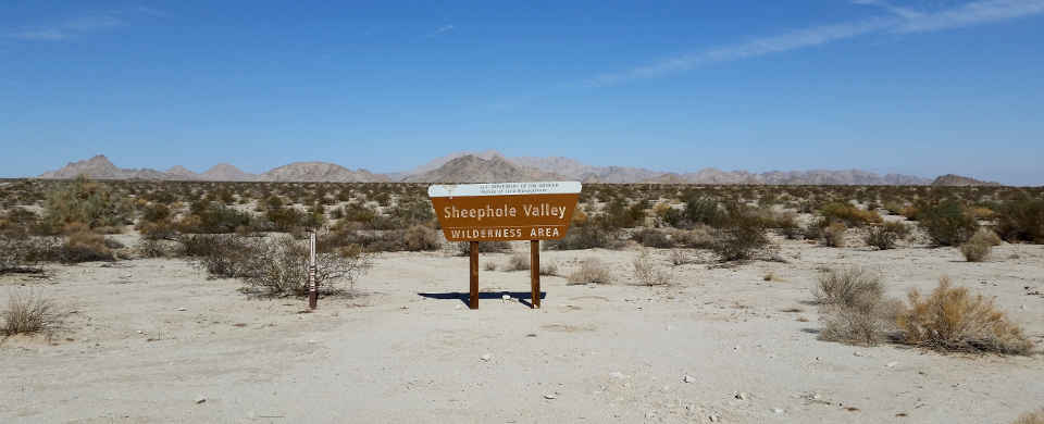
At Sheephole Valley Wilderness
BLM Sites in California
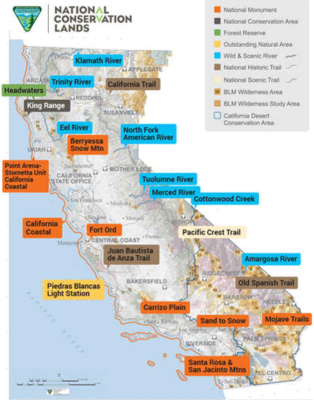
National Conservation Areas
- California Desert
- King Range
- McCain Valley
National Monuments
- Berryessa Snow Mountain
- California Coastal
- Carrizo Plain
- Fort Ord
- Mojave Trails
- Santa Rosa & San Jacinto Mountains
- Sand to Snow
Wilderness Areas
- Agua Tibia
- Argus Range
- Beauty Mountain
- Big Maria Mountains
- Bigelow Cholla Garden
- Bighorn Mountain
- Black Mountain
- Bright Star
- Bristol Mountains
- Cache Creek
- Cadiz Dunes
- Carrizo Gorge
- Cedar Roughs
- Chemehuevi Mountains
- Chimney Peak
- Chuckwalla Mountains
- Cleghorn Lakes
- Clipper Mountain
- Coso Range
- Coyote Mountains
- Darwin Falls
- Dead Mountains
- Domeland
- El Paso Mountains
- Fish Creek Mountains
- Funeral Mountains
- Golden Valley
- Granite Mountain
- Grass Valley
- Hollow Hills
- Ibex
- Indian Pass
- Inyo Mountains
- Ishi
- Jacumba
- Kelso Dunes
- Kiavah
- King Range
- Kingston Range
- Little Chuckwalla Mountains
- Little Picacho
- Machesna Mountain
- Malpais Mesa
- Manly Peak
- Mecca Hills
- Mesquite
- Newberry Mountains
- Nopah Range
- North Algodones Dunes
- North Mesquite Mountains
- Old Woman Mountains
- Orocopia Mountains
- Otay Mountain
- Owens Peak
- Pahrump Valley
- Palen/McCoy
- Palo Verde Mountains
- Picacho Peak
- Pinto Mountains
- Piper Mountain
- Piute Mountains
- Resting Spring Range
- Rice Valley
- Riverside Mountains
- Rocks and Islands
- Rodman Mountains
- Sacatar Trail
- Saddle Peak Hills
- San Gorgonio
- Santa Lucia
- Santa Rosa
- Sawtooth Mountains
- Sheephole Valley
- South Fork Eel River
- South Nopah Range
- Stateline
- Stepladder Mountains
- Surprise Canyon
- Sylvania Mountains
- Trilobite
- Turtle Mountains
- Ventana
- Whipple Mountains
- White Mountains
- Yolla Bolly-Middle Eel
- Yuki
Backcountry Byways
- Bradshaw Trail
- Buckhorn Backcountry Byway
- Chimney Peak Backcountry Byway
Recreation Areas
- Chappie-Shasta OHV Area
- Cow Mountain
- Dry Valley OHV Area
- Dumont Dunes OHV Area
- El Mirage OHV Area
- Fort Sage OHV Area
- Imperial Sand Dunes
- Indian Valley/Walker Ridge
- Johnson Valley OHV Area
- Keyesville
- Knoxville
- North Cow Mountain
- North Fork
- Poleta OHV Area
- Rasor OHV Area
- Rice Canyon OHV area
- Samoa Dunes
- San Joaquin River Gorge
- South Cow Mountain OHV Area
- Stoddard Valley OHV Area
Areas of Critical Environmental Concern
- Alkali Sinks
- Big Morongo Canyon Preserve
- Blue Ridge
- California Rocks & Islands
- Case Mountain
- Chico Martinez
- Clear Creek - Serpentine
- Coachella Valley Preserve
- Cypress Mountain
- Fish Slough
- Goose Lake
- Horse Canyon
- Ione Manzanita
- Ione Tertiary Oxisol Soil
- Joaquin Rocks
- Kettleman Hills
- Limestone Salamander
- Lokern
- Panoche - Coalinga
- Piute Cypress
- Point Sal
- Red Hills
- Salinas River
- Tierra Redonda
National Natural Landmarks
- Amboy Crater
- Trona Pinnacles
Natural Areas
- Afton Canyon
- Amargosa River
- Cache Creek
- Piedras Blancas Light Station
- Sacramento River Bend
Other BLM Sites
- Headwaters Forest Reserve
- Little Darby Environmental Education Area
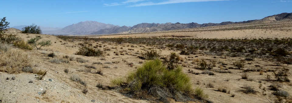
In the California Desert Conservation Area
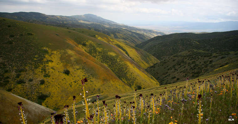
Carrizo Plain National Monument
Upper and lower photos courtesy of TheArmchairExplorer, CCA-by-SA 4.0 License
Bottom photo courtesy of the Bureau of Land Management, CCA 2.0 License