Chiricahua Wilderness
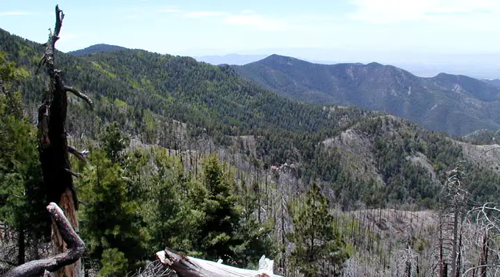
A mountain view in Chiricahua Wilderness
Chiricahua Wilderness is an 87,700-acre property in Coronado National Forest containing the inner canyons and upper slopes of the Chiricahua Mountains, some of the highest "sky-island" peaks in the forest. This is an area where sharp ridges and high peaks rise directly above deep canyons. Being in that zone where the Rocky Mountains meet the Sierra Madres and where the Sonoran Desert overlaps the Chihuahuan Desert, there is an incredible diversity of wildlife and vegetation. Elevations vary from a low around 5,200 feet to a high of 9,797 feet on the summit of Chiricahua Peak.
For many years, the Chihuahua Mountains (and the Dos Cabezas to the north) were the homeland of the Chiricahua Apaches. Then came the ranchers and gold prospectors who caused serious problems with the Chiricahuas and war raged around these mountains for almost twenty years. Finally, after Geronimo and his people surrendered in 1886, they were transported east to Alabama and Florida and the mountains opened up to cattle ranching, logging and prospecting. Today, you might find a few cattle still wandering around but most of the mining takes place in tourists' pockets...
There is a well-developed network of hiking trails in Chiricahua Wilderness but due to the ruggedness of the countryside, there are also large trail-less areas. The primary trails are well-marked, the primitive trails aren't, and the primitive trails aren't maintained either. Significant portions of Chiricahua Wilderness have burned over the last forty years so some areas are filled with still-standing dead trees while other areas are already showing evidence of aspen-and-oak renewal. Along the upper ridges be prepared for expansive views across southern Arizona into northern Mexico with mountain ranges stretching off far into the distance...
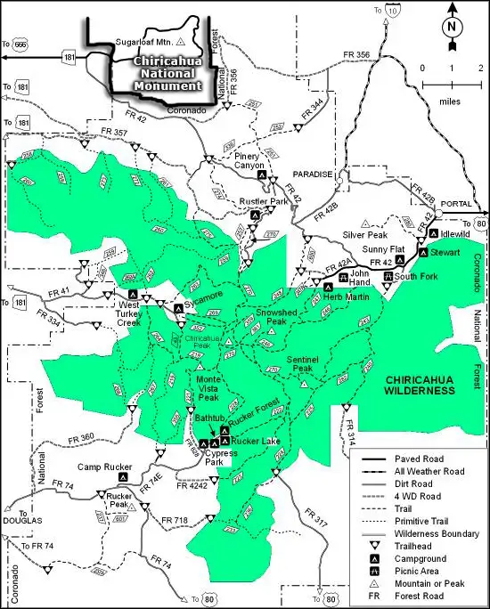
There are 13 established trails in the Chiricahua Wilderness and because of the dense timber and undergrowth, vertical canyon walls and steep hillsides, most folks stick to the trails. There is usually water in some of the canyons and at springs along the crest year-round but in some years the water supply in this area is undependable. Be prepared and carry lots of your own. Easy access to Chiricahua Wilderness is available at trailheads in Turkey Creek, Cave Creek and Rucker Canyon. The Morse Canyon Trail also rewards hikers with great views over what is probably the roughest terrain in southeastern Arizona. Another favorite is the Crest Trail which follows the highest ridges across the Wilderness.
To get there: Chiricahua Wilderness is in the heart of the Chiricahua Mountains halfway between Douglas and Willcox, about 100 miles east of Tucson. The trail map below shows road access to various of the trailheads.
A fire in May and June of 2011 burned virtually all of Chiricahua Wilderness. The area is open to the public but hikers need to be aware of the dangers of falling trees, flash floods and burned out stumps in the ground. I would imagine many of the trail routes have suffered, too, as there is virtually no maintenance done by the National Forest Service these days. This is also a region where Federal authorities warn folks to be extremely cautious of the nefarious activities of Mexican drug cartels that sometimes intrude on the wilderness area.
USGS Quad Maps: Chiricahua Peak, Rustler Park, Stanford Canyon, Portal, Fife Peak, Portal Peak, Swede Peak
Upper photo courtesy of Deirdre St. Louis, via Wilderness.net
Trail map courtesy of the US Forest Service
Related Pages
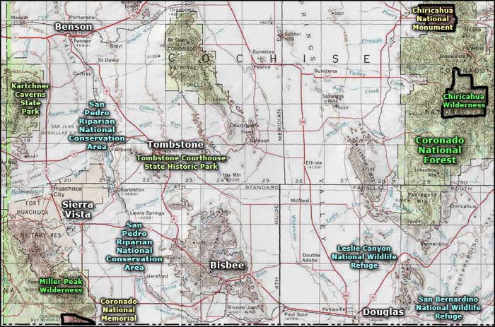
Map courtesy of National Geographic Topo!