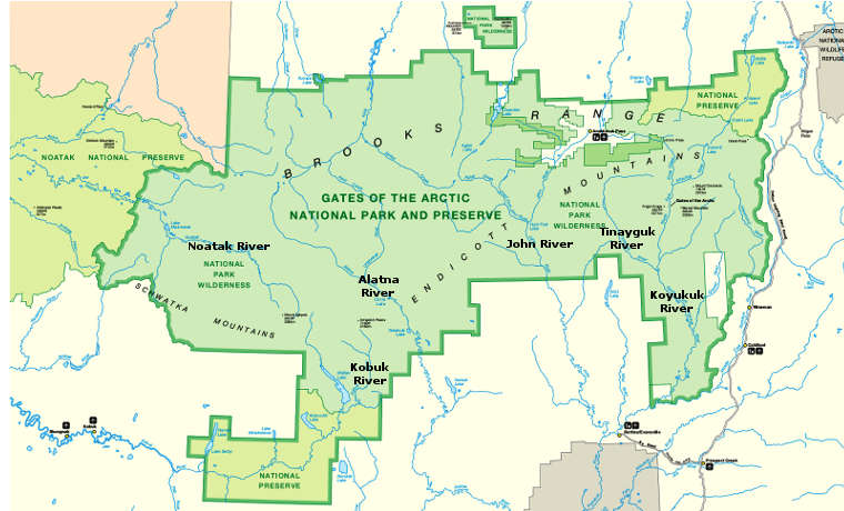
Tinayguk National Wild & Scenic River

Along the Tinayguk Wild & Scenic River

A Ranger about to embark on a float
44 miles long, the Tinayguk River is the largest tributary of the North Fork of the Koyukuk River. The entire watershed is in a glacier-carved valley in the Endicott Mountains, within the bounds of Gates of the Arctic National Park.
The river does attract a few die hard whitewater enthusiasts but getting to the river is too difficult for anyone less (than die hard, that is). The river drops an average 80 feet per mile through its first 12 miles before easing off to about 25 feet per mile for the remaining 32 miles of its course.
Upper photo courtesy of alaska.org
Upper left photo and map courtesy of the National Park Service
Upper left photo and map courtesy of the National Park Service