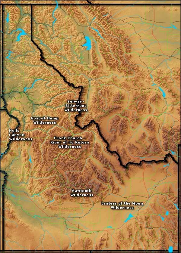
National Wilderness Areas in Idaho
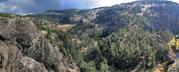
North Fork Owyhee Wilderness
About 2/3 of the human population in Idaho lives in the southern part of the state, spread out along the Snake River Valley. That leaves some pretty large chunks of forested, mountainous terrain with almost no people. Borah Peak, at 12,662', is the highest point in Idaho but for now is inside a Wilderness Study Area. It won't become a true designated Wilderness Area until Congress takes positive action. The designated wildernesses tend to be further down the hill where there tends to be more flowing water, more tree cover and more wildlife.
The 2,366,757-acre Frank Church-River of No Return Wilderness is the 2nd largest wilderness in the 48 contiguous states, the Death Valley Wilderness in California being the only wilderness in the lower 48 that's bigger. The Frank Church-River of No Return Wilderness is separated from the Selway-Bitterroot Wilderness to the north only by the 600-foot wide Magruder Corridor: a dirt road that follows the Nez Perce Trail across Idaho and over Nez Perce Pass into Montana. This is a countryside of rugged, glaciated peaks rising above huge forests with abundant wildlife and great opportunities for solitude and a true wilderness adventure. The Selway-Bitterroot Wilderness is the third largest wilderness area in the lower 48 states.
The Selway-Bitterroot, Frank Church-River of No Return, Gospel-Hump and Sawtooth Wildernesses are all located on or above the Idaho Batholith, a huge Precambrian igneous intrusion of gray-green granite that underlies virtually all of central Idaho. The Sawtooth Wilderness is also located on the Sawtooth Batholith, another, perhaps more recent, batholith deposited on top of the Idaho Batholith.
Craters of the Moon Wilderness sits atop the Great Rift: a 62-mile-long, 2-mile-wide crack in the Earth's surface that seems to want to erupt and deposit more lava on the Earth's surface about every 2,000 years... and it's about that time again.
In 2015 Congress unanimously voted to add 3 new wildernesses to Idaho's inventory: Jim-McClure-Jerry Peak Wilderness, White Clouds Wilderness and Hemingway-Boulders Wilderness. All three are in the mountainous areas east of Stanley with Hemingway-Boulders completely within Sawtooth National Forest while White Clouds is split between Sawtooth National Forest and BLM land and Jim McClure-Jerry Peak split between Salmon-Challis National Forest and more BLM land. White Clouds and Hemingway-Boulders are also included in the Sawtooth National Recreation Area. As the three properties are newly designated, management plans for them are still being worked out.
National Wilderness Areas in Idaho
National Forest Wildernesses
National Park Service/BLM Wildernesses
Bureau of Land Management Wildernesses
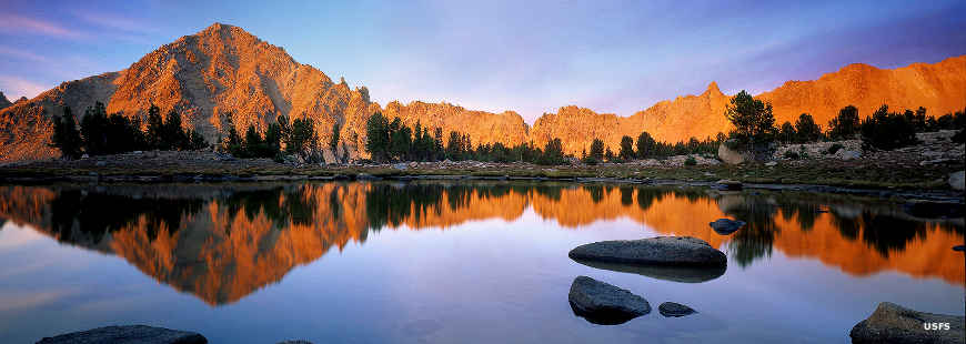
White Clouds Wilderness
Upper photo courtesy of the Bureau of Land Management
Map courtesy of Cartesia MapArt US Terrain
Lower photo courtesy of the US Forest Service